MyTopo
Concordia Missouri US Topo Map
Couldn't load pickup availability
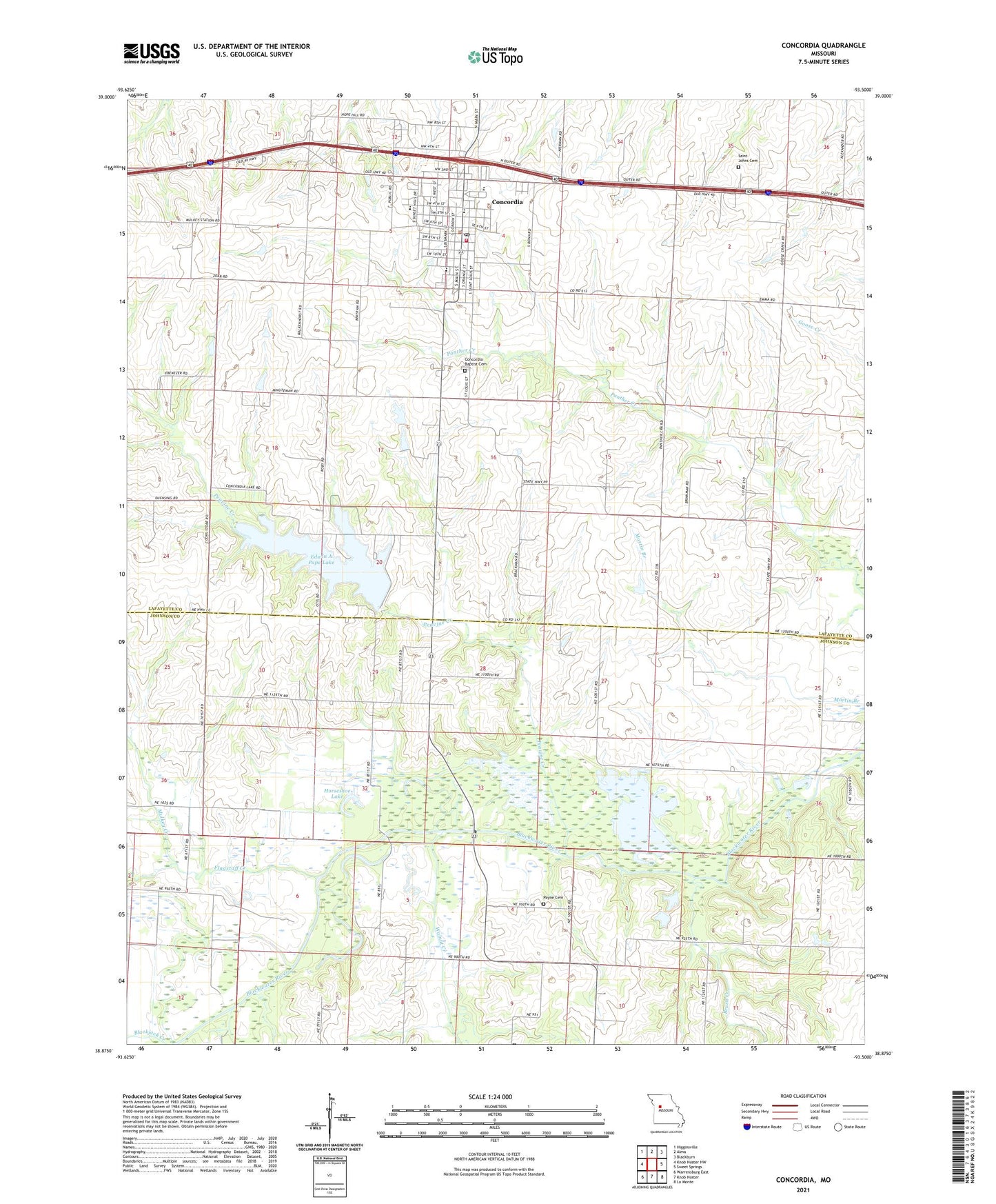
2021 topographic map quadrangle Concordia in the state of Missouri. Scale: 1:24000. Based on the newly updated USGS 7.5' US Topo map series, this map is in the following counties: Lafayette, Johnson. The map contains contour data, water features, and other items you are used to seeing on USGS maps, but also has updated roads and other features. This is the next generation of topographic maps. Printed on high-quality waterproof paper with UV fade-resistant inks.
Quads adjacent to this one:
West: Knob Noster NW
Northwest: Higginsville
North: Alma
Northeast: Blackburn
East: Sweet Springs
Southeast: La Monte
South: Knob Noster
Southwest: Warrensburg East
Contains the following named places: Blackjack Creek, Brush Creek, City of Concordia, Concordia, Concordia Baptist Cemetery, Concordia Elementary School, Concordia Fire Protection District Main Station, Concordia High School, Concordia Police Department, Concordia Post Office, County Line School, Edwin A Pape Lake, Edwin A Pape Lake Dam, Eureka School, Flagstaff Creek, Heimsoth Lake Dam, Horseshoe Lake, Lowland School, Mulkey Creek, Oak Ridge School, Opfer Lake Dam, Payne Cemetery, Peavine Creek, Ralph and Martha Perry Memorial State Wildlife Area, Saint Johns Cemetery, Saint Johns Evangelical Church, Saint Paul Lutheran High School, Saint Pauls College, Saint Paul's Lutheran School, Sunny Side School, Township of Freedom, Walkenhorst School, Walnut Creek, Werths Lake Dam, ZIP Code: 64020