MyTopo
Dudley Missouri US Topo Map
Couldn't load pickup availability
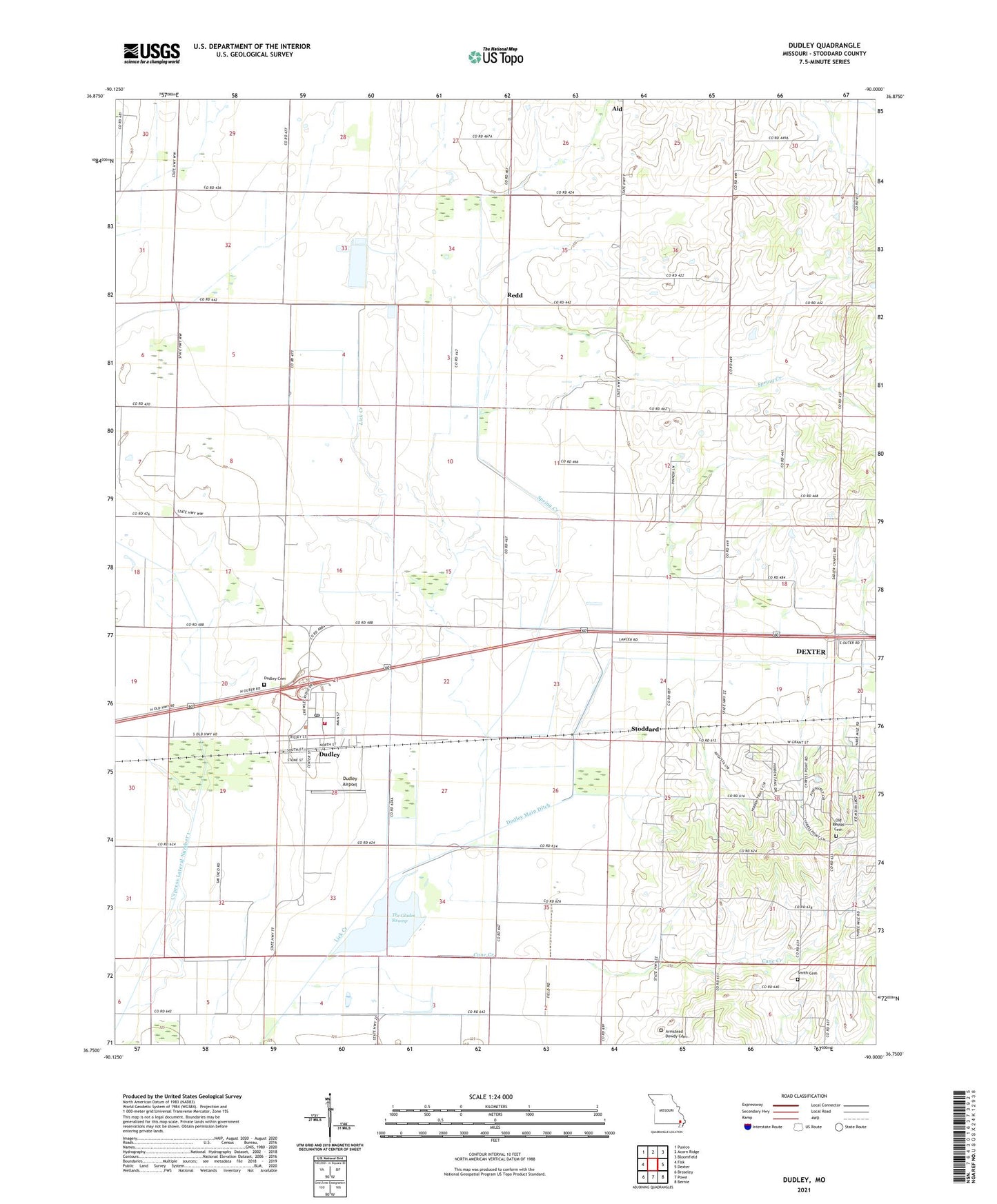
2021 topographic map quadrangle Dudley in the state of Missouri. Scale: 1:24000. Based on the newly updated USGS 7.5' US Topo map series, this map is in the following counties: Stoddard. The map contains contour data, water features, and other items you are used to seeing on USGS maps, but also has updated roads and other features. This is the next generation of topographic maps. Printed on high-quality waterproof paper with UV fade-resistant inks.
Quads adjacent to this one:
West: Fisk
Northwest: Puxico
North: Acorn Ridge
Northeast: Bloomfield
East: Dexter
Southeast: Bernie
South: Powe
Southwest: Broseley
Contains the following named places: Ajax, Armstead Dowdy Cemetery, Avis Fishing Lake Dam, Cane Creek, Cane Creek Church, City of Dudley, Cypress Lateral Number 1, Cypress School, Dowdy School, Dudley, Dudley Airport, Dudley Cemetery, Dudley Main Ditch, Dudley Post Office, Dudley Volunteer Fire Department, Garner School, Greenwood School, Howell School, Lovins Lake Dam, Melton School, Mule Ditch, Old Bethel Cemetery, Orchard Lake, Redd, Sadlers Chapel, Sherry School, Smith Cemetery, Spring Creek, Stoddard, The Glades Swamp, Walter Avis Lake, Wilkerson School