MyTopo
Glennonville Missouri US Topo Map
Couldn't load pickup availability
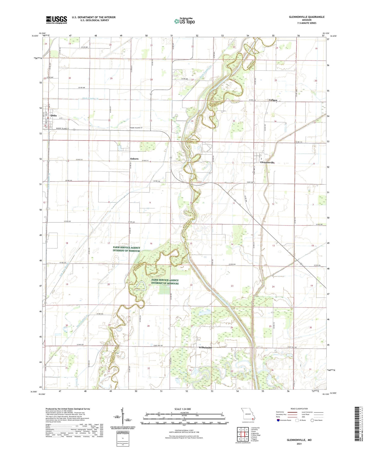
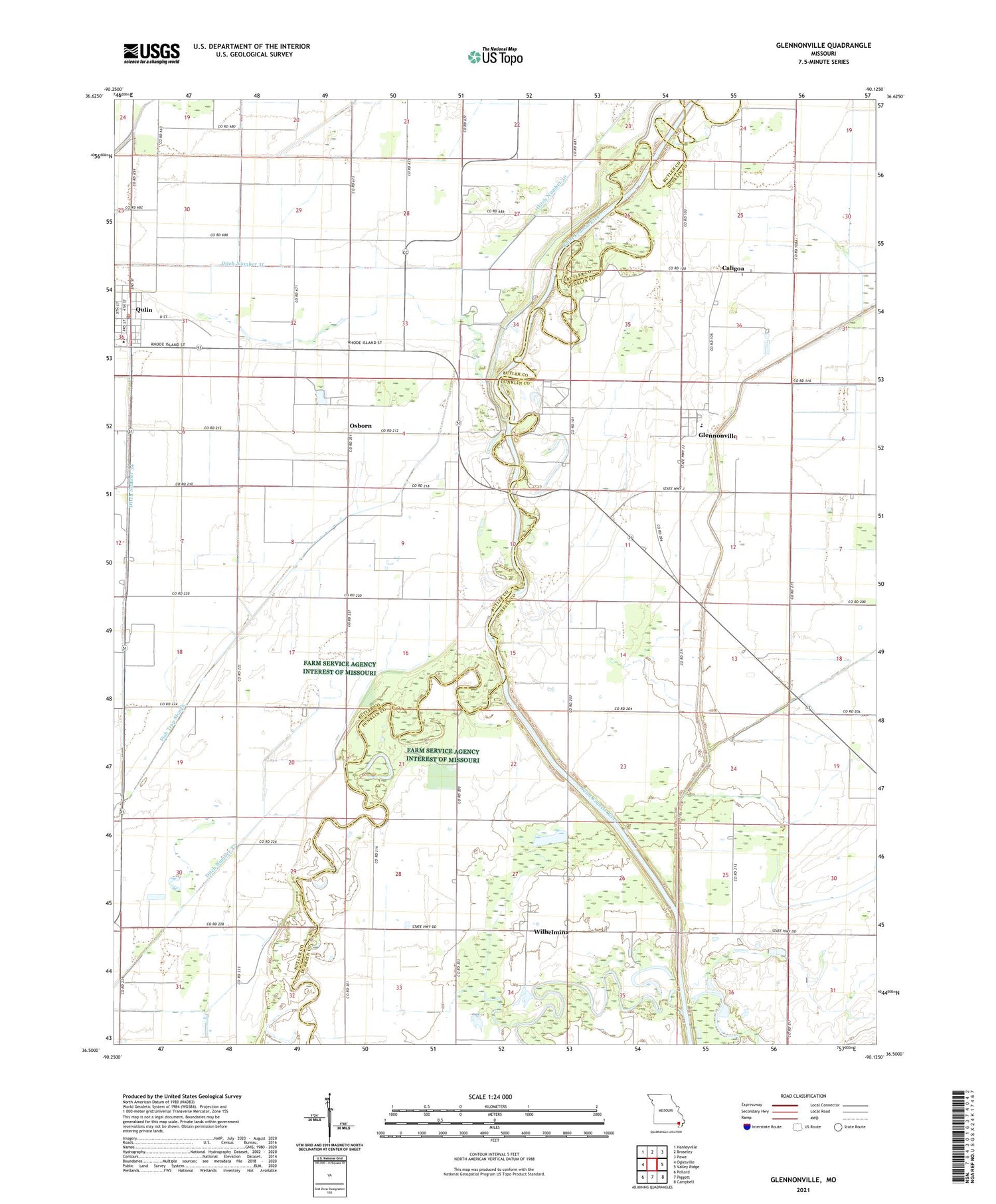
2021 topographic map quadrangle Glennonville in the state of Missouri. Scale: 1:24000. Based on the newly updated USGS 7.5' US Topo map series, this map is in the following counties: Dunklin, Butler. The map contains contour data, water features, and other items you are used to seeing on USGS maps, but also has updated roads and other features. This is the next generation of topographic maps. Printed on high-quality waterproof paper with UV fade-resistant inks.
Quads adjacent to this one:
West: Oglesville
Northwest: Hanleyville
North: Broseley
Northeast: Powe
East: Valley Ridge
Southeast: Campbell
South: Piggott
Southwest: Pollard
Contains the following named places: Caligoa, Celtis, Cora Davis School, Davis School, Dekyns Ferry, Dekyns Gage, Ditch Number 30, Ditch Number 31, Ditch Number 34, Ditch Number 37, Gentzen School, Glennonville, Holmes Place, Lateral Number 1, Little Lake, Lone Prairie Church, Main Ditch, McElyea Place, Osborn, Paragon, Qulin, Side Ditch, Webb School, Wilhelmina, Wilhelmina Cutoff, Wilhelmina Fagus Ferry, Wilhelmina School, Wilhelmina State Forest