MyTopo
Graniteville Missouri US Topo Map
Couldn't load pickup availability
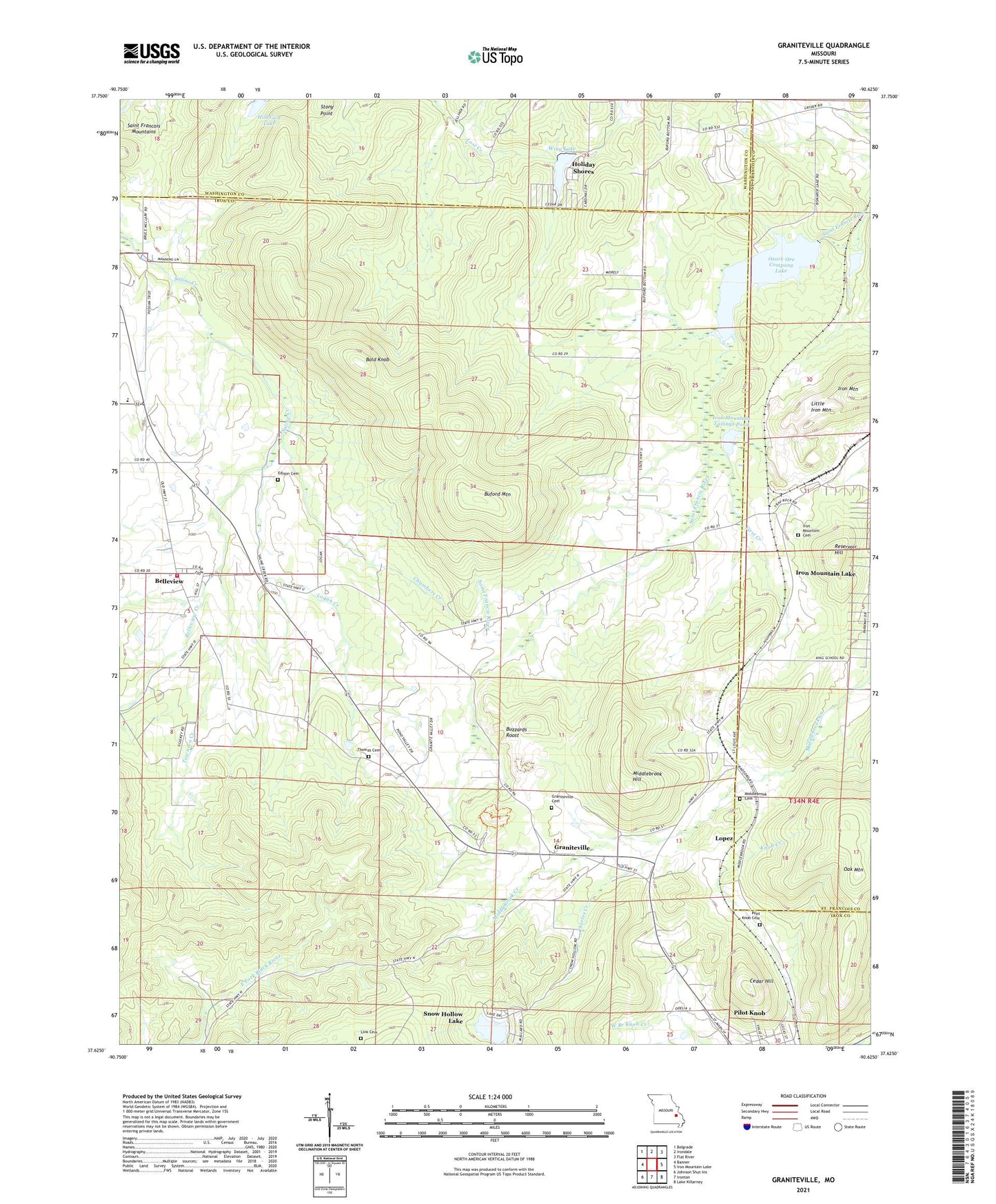
2021 topographic map quadrangle Graniteville in the state of Missouri. Scale: 1:24000. Based on the newly updated USGS 7.5' US Topo map series, this map is in the following counties: Iron, St. Francois, Washington. The map contains contour data, water features, and other items you are used to seeing on USGS maps, but also has updated roads and other features. This is the next generation of topographic maps. Printed on high-quality waterproof paper with UV fade-resistant inks.
Quads adjacent to this one:
West: Banner
Northwest: Belgrade
North: Irondale
Northeast: Flat River
East: Iron Mountain Lake
Southeast: Lake Killarney
South: Ironton
Southwest: Johnson Shut-Ins
Contains the following named places: Bald Knob, Belleview, Belleview Creek, Belleview School, Black Lower Lake Dam, Black Upper Lake Dam, Buford Mountain, Buzzards Roost, Cedar Hill, Cedar Hill Iron Mine, Chambers Creek, Charles Creek, Edison Cemetery, Elephant Rocks State Park, Elm Grove School, First Creek, Ghermanville, Graniteville, Hematite Lake Dam, Hill View Lake, Holiday Shores, Iron Mountain, Iron Mountain Cemetery, Iron Mountain Reservoir, Iron Mountain School, Iron Mountain Tailings Pond, Iron Mountain Tailings Pond Dam, Link Cemetery, Little Iron Mountain, Logan Creek, Lopez, Middlebrook, Middlebrook Hill, Oak Mountain, Ozark Ore Company Lake, Phil Schneider Granite Quarries, Pilot Knob Cemetery, Pilot Knob Fire Protection District Station 2 Belleview, Pilot Knob Granite Quarry, Pin Hook, Reservoir Hill, Schneider Companys Quarry, Sheahan Brothers Granite Quarry, Sky Ranch II Airport, Snow Hollow Dam, Snow Hollow Lake, Stony Point, Syenite Granite Companys Quarry, Thomas Cemetery, Thorn Grove School, Townsen Creek, Township of Iron, Wing Lake, Wing Lake Dam