MyTopo
Gravois Mills Missouri US Topo Map
Couldn't load pickup availability
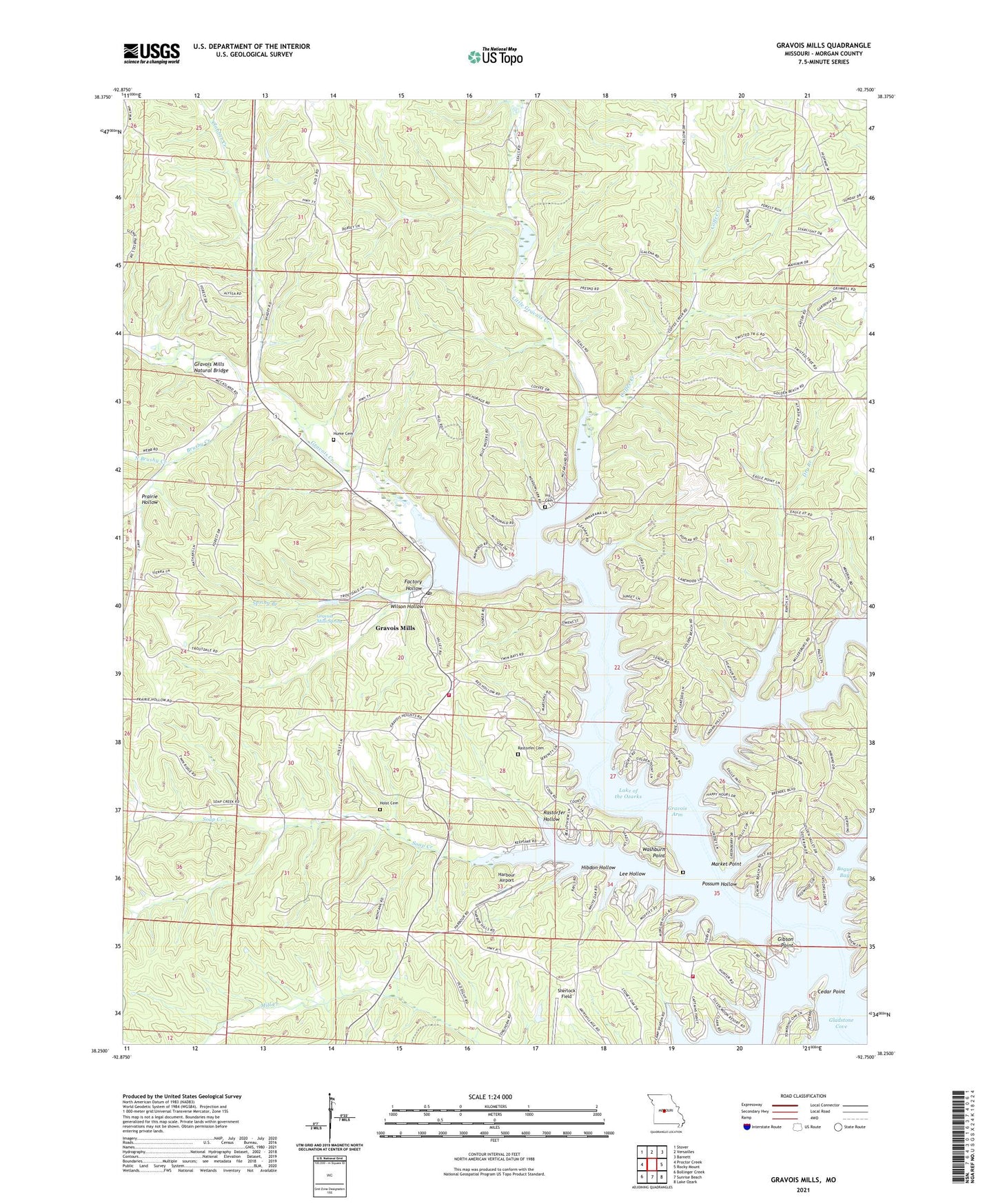
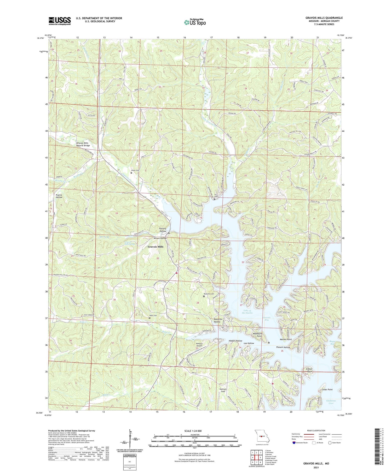
2021 topographic map quadrangle Gravois Mills in the state of Missouri. Scale: 1:24000. Based on the newly updated USGS 7.5' US Topo map series, this map is in the following counties: Morgan. The map contains contour data, water features, and other items you are used to seeing on USGS maps, but also has updated roads and other features. This is the next generation of topographic maps. Printed on high-quality waterproof paper with UV fade-resistant inks.
Quads adjacent to this one:
West: Proctor Creek
Northwest: Stover
North: Versailles
Northeast: Barnett
East: Rocky Mount
Southeast: Lake Ozark
South: Sunrise Beach
Southwest: Bollinger Creek
Contains the following named places: Bogue Bay, Brushy Creek, Camp Santa Fe, Camp Sharon, Cedar Point, Clabber Creek, Coffee Creek, Coffee School, Community Chapel, Dry Branch, Factory Hollow, Fair View School, Forcade Hollow, Gibson Point, Gladstone, Gladstone Cove, Gravois Arm, Gravois Creek, Gravois Fire Protection District Station 1, Gravois Fire Protection District Station 2, Gravois Mills, Gravois Mills Natural Bridge, Gravois Mills Post Office, Gravois Mills Spring, Harbour Airport, Hibdon Hollow, Holst Cemetery, Holst School, Hubbard School, Hume Cemetery, Ivy Cemetery, Lafayette Lake Dam, Lee Hollow, Little Gravois Creek, Market Point, Mitchell Mine, North Brushy Creek, Number 841 Reservoir, Possum Hollow, Prairie Hollow, Rastorfer Cemetery, Rastorfer Hollow, Saint Patricks Church, Sherlock Field, Sidebottom Cemetery, Soap Creek, South School, Spring Branch, Town of Gravois Mills, Township of Osage, Washburn Point, Wilson Hollow, Yarger Lake Dam