MyTopo
Huggins Missouri US Topo Map
Couldn't load pickup availability
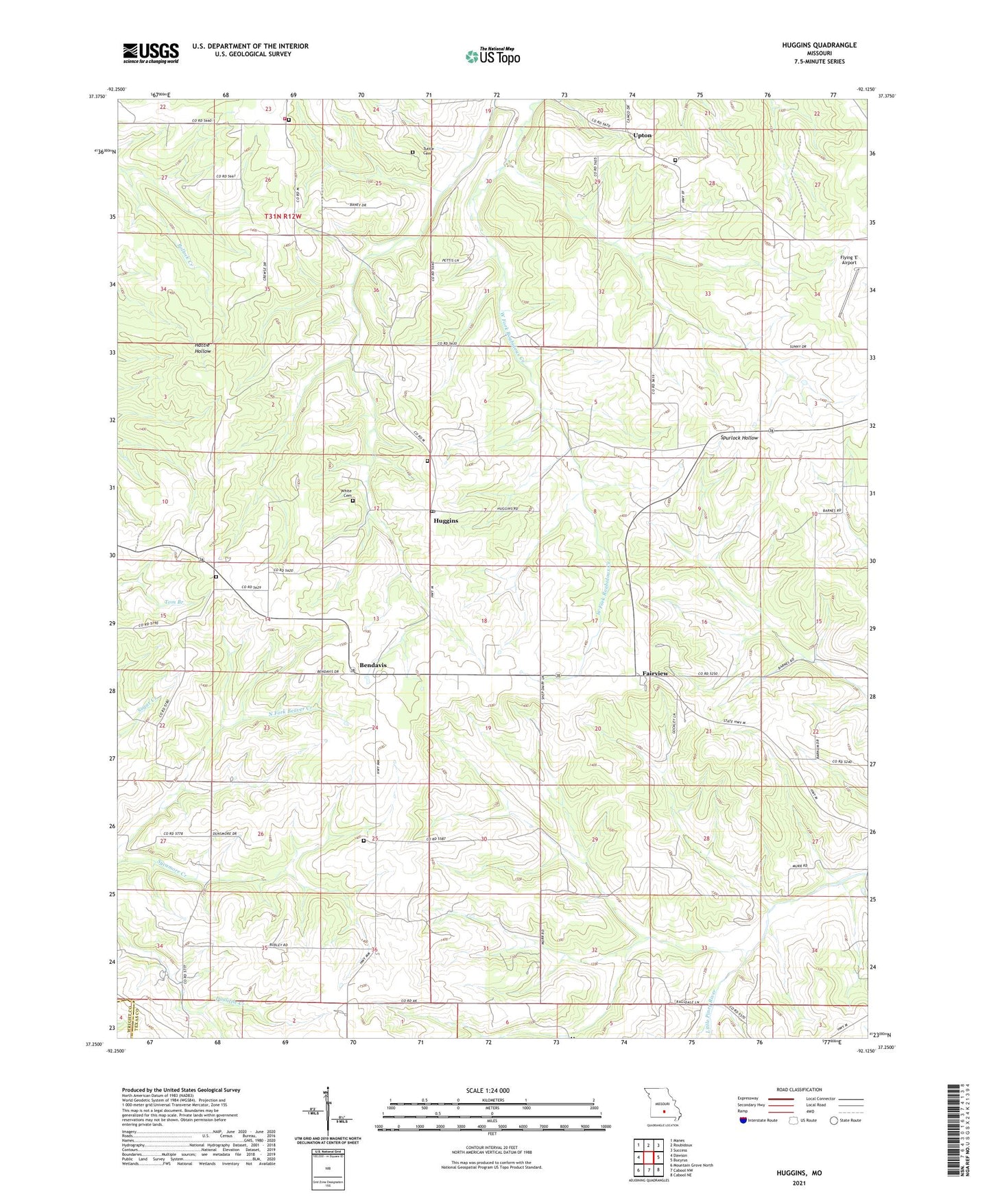
2021 topographic map quadrangle Huggins in the state of Missouri. Scale: 1:24000. Based on the newly updated USGS 7.5' US Topo map series, this map is in the following counties: Texas, Wright. The map contains contour data, water features, and other items you are used to seeing on USGS maps, but also has updated roads and other features. This is the next generation of topographic maps. Printed on high-quality waterproof paper with UV fade-resistant inks.
Quads adjacent to this one:
West: Dawson
Northwest: Manes
North: Roubidoux
Northeast: Success
East: Bucyrus
Southeast: Cabool NE
South: Cabool NW
Southwest: Mountain Grove North
Contains the following named places: Alice, Alice School, Ballard Church, Ballard School, Bendavis, Cedar Valley Church, Cedar Valley School, Dunsmore School, Fairview, Fairview Church, Flying 'E' Airport, Hickory Ridge Church, Huggins, Huggins Post Office, Huggins Volunteer Fire Department Station 1, Logan School, Lone Star School, Murr School, Oak Grove School, Pairlee Freeman Barnes State Wildlife Area, Pleasant Ridge, Pleasant Ridge School, Racket Ridge School, Rock Springs Church, Sycamore Creek, Township of Morris, Tuttle Cemetery, Upton, Watts Cemetery, ZIP Code: 65484