MyTopo
Jamestown Missouri US Topo Map
Couldn't load pickup availability
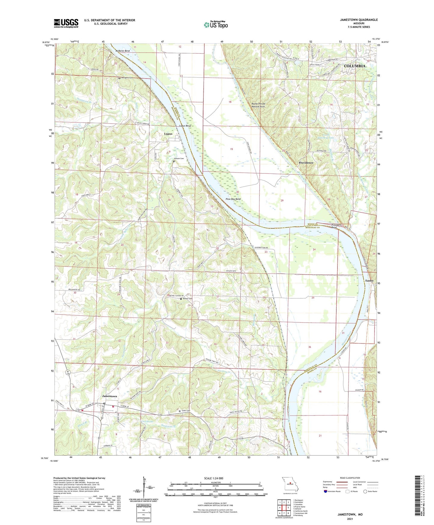
2021 topographic map quadrangle Jamestown in the state of Missouri. Scale: 1:24000. Based on the newly updated USGS 7.5' US Topo map series, this map is in the following counties: Moniteau, Boone. The map contains contour data, water features, and other items you are used to seeing on USGS maps, but also has updated roads and other features. This is the next generation of topographic maps. Printed on high-quality waterproof paper with UV fade-resistant inks.
Quads adjacent to this one:
West: Prairie Home
Northwest: Rocheport
North: Huntsdale
Northeast: Columbia
East: Ashland
Southeast: Hartsburg
South: Centertown NW
Southwest: California North
Contains the following named places: Acton School, Bethel Cemetery, Bethel School, Cave Springs, Cofer Cemetery, Cunningham School, Easley, Factory Creek, Hickam Cemetery, Jamestown, Jamestown C-1 Elementary School, Jamestown C-1 High School, Jamestown Post Office, Jamestown Rural Fire Protection District Station 1, Jamestown Rural Fire Protection District Station 2, Little Bonne Femme Creek, Little Splice Creek, Lupus, Lupus Bend, Maupin Branch, Mayhan Branch, Mount Zion Church, Nashville, Oakland School, Perche Creek, Pettigrew Cemetery, Plow Boy Bend, Providence, Providence Bend, Roche Percee Natural Arch, Smackout, Smith Hatchery Lake, Smith Hatchery Lake Dam, Splice Creek, Thompson Branch, Town of Jamestown, Town of Lupus, Township of Linn, Township of Rock Bridge, Warren School, Woodbine Lake Dam, ZIP Code: 65046