MyTopo
Jefferson City NW Missouri US Topo Map
Couldn't load pickup availability
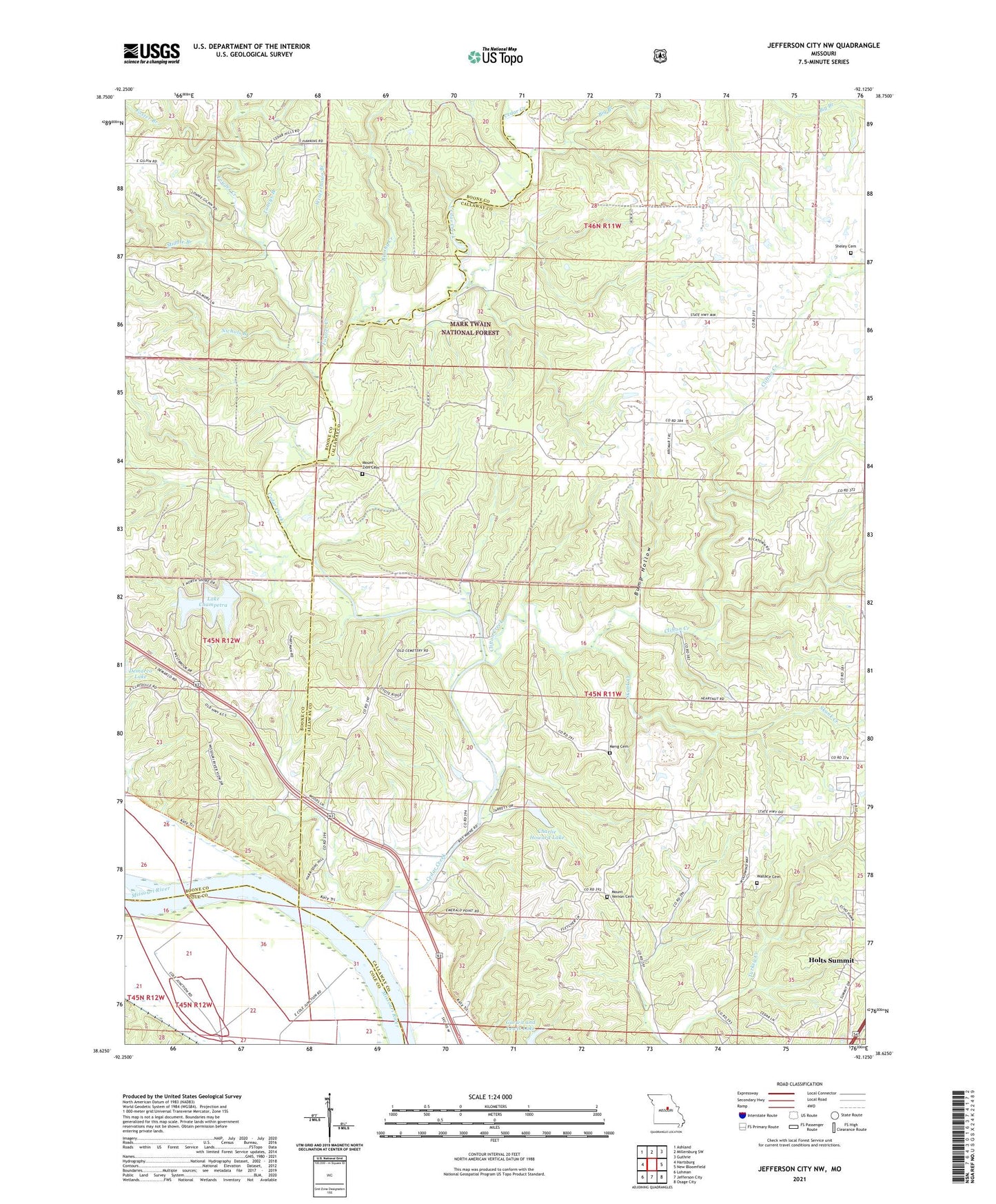
2021 topographic map quadrangle Jefferson City NW in the state of Missouri. Scale: 1:24000. Based on the newly updated USGS 7.5' US Topo map series, this map is in the following counties: Callaway, Boone, Cole. The map contains contour data, water features, and other items you are used to seeing on USGS maps, but also has updated roads and other features. This is the next generation of topographic maps. Printed on high-quality waterproof paper with UV fade-resistant inks.
Quads adjacent to this one:
West: Hartsburg
Northwest: Ashland
North: Millersburg SW
Northeast: Guthrie
East: New Bloomfield
Southeast: Osage City
South: Jefferson City
Southwest: Lohman
Contains the following named places: Audrain Prairies, Big Branch, Brushy Creek, Bump Hollow, Burnett School, Cedar Creek, Charlie Howard Lake, Claysville School, Clifton Creek, Conner Creek, Demarco Lake, Folsom, Foster Branch, Fowler Creek, Gravel School, Hall School, Hopewell Church, Howard Lake Dam, Lake Champetra, Lake Champetra Dam, Meng Cemetery, Middle Branch, Mount Vernon Cemetery, Mount Vernon Church, Mount Zion Cemetery, Nichols Branch, Nichols Creek, Oak Grove School, Sheley Cemetery, Skunk Creek, Sycamore School, Toneys Branch, Wallace Cemetery, West Sheely School, Winterbows Branch