MyTopo
Kennett North Missouri US Topo Map
Couldn't load pickup availability
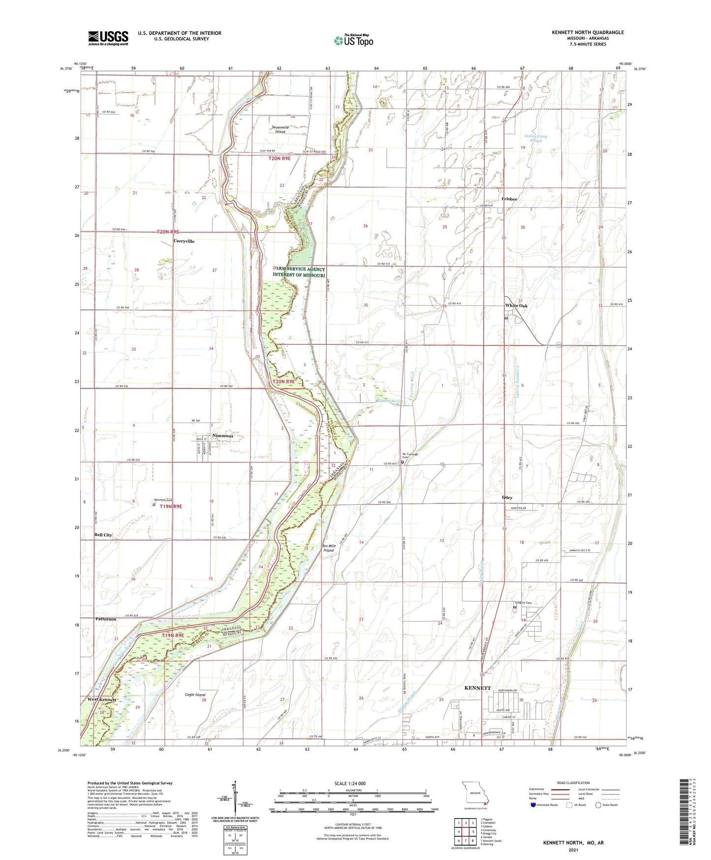
2021 topographic map quadrangle Kennett North in the states of Missouri, Arkansas. Scale: 1:24000. Based on the newly updated USGS 7.5' US Topo map series, this map is in the following counties: Dunklin, Clay. The map contains contour data, water features, and other items you are used to seeing on USGS maps, but also has updated roads and other features. This is the next generation of topographic maps. Printed on high-quality waterproof paper with UV fade-resistant inks.
Quads adjacent to this one:
West: Greenway
Northwest: Piggott
North: Campbell
Northeast: Gideon
East: Bragg City
Southeast: Deering
South: Kennett South
Southwest: Senath
Contains the following named places: Arkansas Ditch, Bark Camp, Bell City, Bomar School, Cagle Island, Carryville, Church Camp, Elm Grove School, Ely School, Friendship Church, Frisbee, Frisbee Census Designated Place, Gregory Cemetery, Gregory School, Indian Camp Slough, Ipley, KNNT-AM (Kennett), KTEI-FM (Piggott), Lateral Number 1, Lateral Number 2, Main Ditch District Number 2, Maple Grove Church, Mc Cullough Cemetery, Nimmons, Nimmons Cemetery, Old River, Owens, Patterson, Pleasant Valley Church, Pool Church, Pool School, Raft Slough, Seven Mile, Sevenmile Island, Shipley Slough, South East School, Taylor School, Ten Mile Island, Town of Nimmons, Township of Payne, Township of Payne-Swain, Township of Swain, Varney River, Varney River Church, Varney River Ditch, Walnut Grove Church, Walnut Grove School, West Ditch, West Kennett, White Oak, White Oak Census Designated Place, Whiteoak Post Office, ZIP Codes: 63852, 63880