MyTopo
Knob Noster Missouri US Topo Map
Couldn't load pickup availability
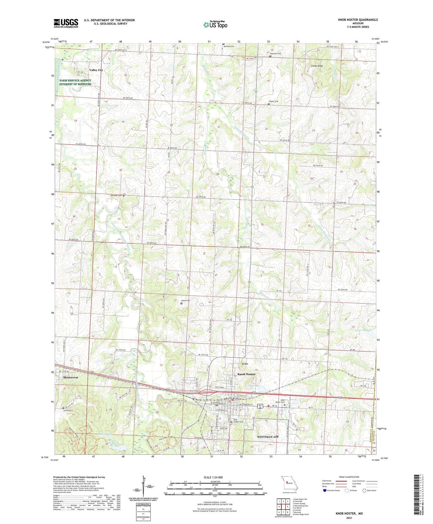
2021 topographic map quadrangle Knob Noster in the state of Missouri. Scale: 1:24000. Based on the newly updated USGS 7.5' US Topo map series, this map is in the following counties: Johnson, Pettis. The map contains contour data, water features, and other items you are used to seeing on USGS maps, but also has updated roads and other features. This is the next generation of topographic maps. Printed on high-quality waterproof paper with UV fade-resistant inks.
Quads adjacent to this one:
West: Warrensburg East
Northwest: Knob Noster NW
North: Concordia
Northeast: Sweet Springs
East: La Monte
Southeast: Green Ridge North
South: Burtville
Southwest: Cornelia
Contains the following named places: Boyd Pond, Brush Hill School, Brushville School, Camp Shawnee, Campbell Lake, Campbell Lake Dam, Cana School, Carbon Hill, City of Knob Noster, Clear Fork Blackwater River, Clear Fork Lake, Clear Fork Lake Dam, Cooks Knob, Dunkard Church, Foffel Lake, Foffel Lake Dam, Hepsidam School, Hocker Cemetery, Immanuel Church, Jaeger Lake, Jaeger Lake Dam, Johnson County Fire Protection District Station 4, Knaus Cemetery, Knob Noster, Knob Noster Elementary School, Knob Noster High School, Knob Noster Middle School, Knob Noster Police Department, Knob Noster Post Office, Knob Noster Volunteer Fire Department, Knobs, Lee Cemetery, Little Walnut Creek, Maple Grove School, Marshall Cemetery, Montserrat, Morel Lake, Oak Grove School, Pleasant Prairie School, Redbud Lake, Rothwell Cemetery, Saint Joseph Cemetery, Shumate Lake, Shumate Lake Dam, Sullivan Lake, Township of Grover, Valley City, Wampler Cemetery, Woodland School, ZIP Code: 65336