MyTopo
Koshkonong Missouri US Topo Map
Couldn't load pickup availability
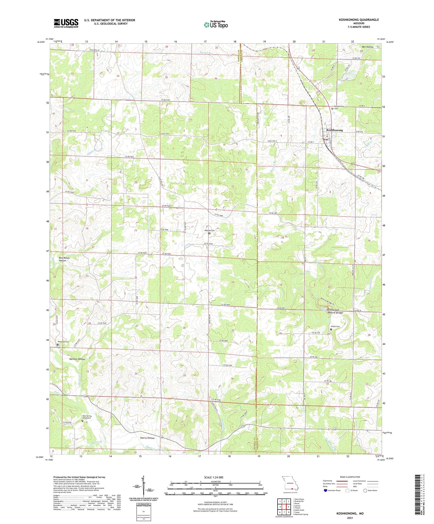
2021 topographic map quadrangle Koshkonong in the state of Missouri. Scale: 1:24000. Based on the newly updated USGS 7.5' US Topo map series, this map is in the following counties: Howell, Oregon. The map contains contour data, water features, and other items you are used to seeing on USGS maps, but also has updated roads and other features. This is the next generation of topographic maps. Printed on high-quality waterproof paper with UV fade-resistant inks.
Quads adjacent to this one:
West: Lanton
Northwest: West Plains
North: Brandsville
Northeast: Rover
East: Thayer
Southeast: Mammoth Spring
South: Camp
Southwest: Salem Knob
Contains the following named places: Alexander School, Anthony Branch, Batman School, Black Jack School, Brussell Branch, Bussell Branch, Christy, Christy Church, Christy Post Office, Christy School, Clifton Branch, Grand Gulf, Grand Gulf Natural Bridge, Grand Gulf State Park, Harmon Hollow, Hatfield Church, Koshkonong, Koshkonong Cemetery, Koshkonong Post Office, Koshkonong Volunteer Fire Department, Merideth Church, Mint Spring Graveyard, Nail Creek, Red Ranch Hollow, Red Ranch School, Saint Elmo, Sherry Hollow, Shiloh Church, Town of Koshkonong, Township of Myatt, Wet Hollow