MyTopo
Lancaster Missouri US Topo Map
Couldn't load pickup availability
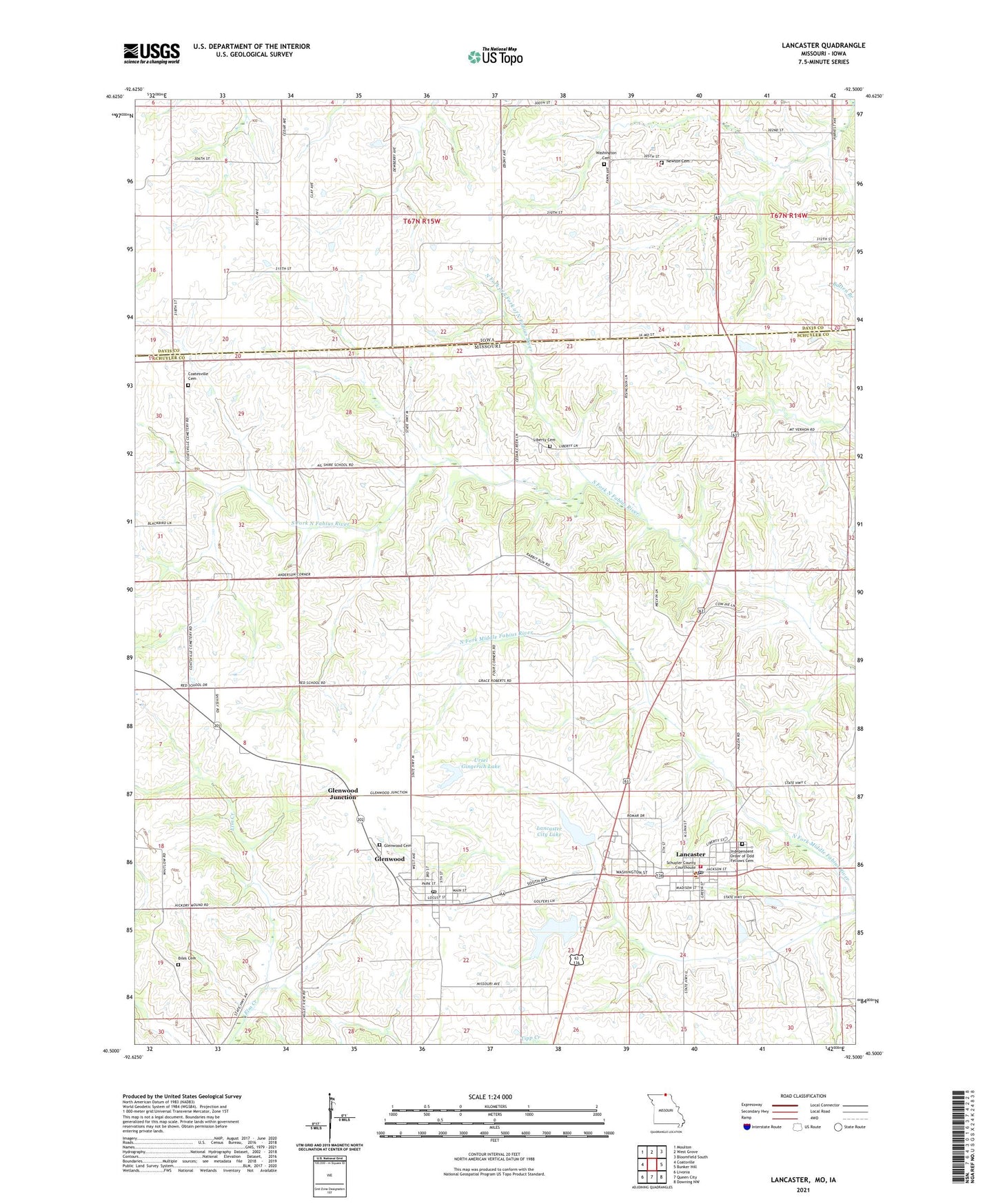
2021 topographic map quadrangle Lancaster in the states of Missouri, Iowa. Scale: 1:24000. Based on the newly updated USGS 7.5' US Topo map series, this map is in the following counties: Schuyler, Davis. The map contains contour data, water features, and other items you are used to seeing on USGS maps, but also has updated roads and other features. This is the next generation of topographic maps. Printed on high-quality waterproof paper with UV fade-resistant inks.
Quads adjacent to this one:
West: Coatsville
Northwest: Moulton
North: West Grove
Northeast: Bloomfield South
East: Bunker Hill
Southeast: Downing NW
South: Queen City
Southwest: Livonia
Contains the following named places: Ailshire School, Biles Cemetery, City of Lancaster, Coatesville Cemetery, Glenwood, Glenwood Cemetery, Glenwood Junction, Glenwood Post Office, Helmick Lake Dam, Hickory Mound School, Independent Order of Odd Fellows Cemetery, Lancaster, Lancaster City Dam, Lancaster City Lake, Lancaster Fire Rescue, Lancaster Lake Dam, Lancaster Post Office, Liberty Cemetery, Liberty School, Melvin School, Mount Tabor School, Mount Vernon School, Newton Cemetery, North Fork of South Fork of North Fabius River, Number 39 Dam, Schuyler County Sheriff's Office, Siding, Township of Glenwood, Township of Liberty, Ursel Gingerich Dam, Ursel Gingerich Lake, Valley View Church, Village of Glenwood, Washington Cemetery