MyTopo
Lawson Missouri US Topo Map
Couldn't load pickup availability
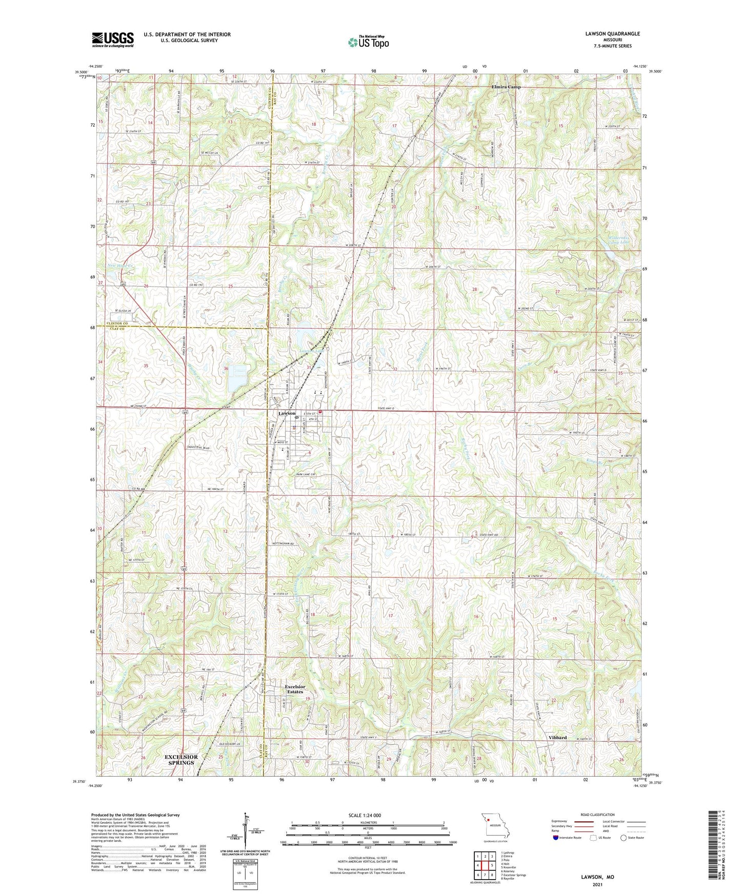
2021 topographic map quadrangle Lawson in the state of Missouri. Scale: 1:24000. Based on the newly updated USGS 7.5' US Topo map series, this map is in the following counties: Ray, Clay, Clinton. The map contains contour data, water features, and other items you are used to seeing on USGS maps, but also has updated roads and other features. This is the next generation of topographic maps. Printed on high-quality waterproof paper with UV fade-resistant inks.
Quads adjacent to this one:
West: Holt
Northwest: Lathrop
North: Elmira
Northeast: Polo
East: Knoxville
Southeast: Rayville
South: Excelsior Springs
Southwest: Kearney
Contains the following named places: Barnesville School, Bennet School, Bisbee School, Butler School, Canaan Hill Church, City of Lawson, Claysville, Elmira Camp, Excelsior Estates, Franklin School, Graham School, Jackson School, Lawson, Lawson City Reservoir Dam, Lawson Fire and Rescue Protection District, Lawson High School, Lawson Lake, Lawson Middle School, Lawson Police Department, Lawson Post Office, Lawson School, Riggs School, Salem Church, Shelton Lake Dam, Southwest Elementary School, Township of Polk, Union School, Vibbard, Vibbard Census Designated Place, Village of Excelsior Estates, Washington School, Watkins, Wilderness Camp Dam, Wilderness Camp Lake, ZIP Code: 64062