MyTopo
Lincoln SE Missouri US Topo Map
Couldn't load pickup availability
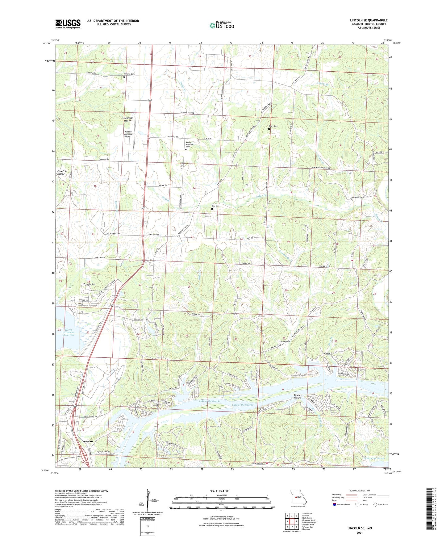
2021 topographic map quadrangle Lincoln SE in the state of Missouri. Scale: 1:24000. Based on the newly updated USGS 7.5' US Topo map series, this map is in the following counties: Benton. The map contains contour data, water features, and other items you are used to seeing on USGS maps, but also has updated roads and other features. This is the next generation of topographic maps. Printed on high-quality waterproof paper with UV fade-resistant inks.
Quads adjacent to this one:
West: Shawnee Bend
Northwest: Lincoln NW
North: Lincoln
Northeast: Cole Camp
East: Lakeview Heights
Southeast: Edwards
South: Warsaw East
Southwest: Warsaw West
Contains the following named places: Allen School, Benton County, Bird Branch, Bird Cemetery, Black Oak Cemetery, Black Oak Church, Dillon School, Drake Cemetery, Feaster Branch, Feaster Cemetery, Feaster School, Fredonia Church, Fredonia School, Horn Branch, KAYQ-FM (Warsaw), Lemon Branch, Lincoln Lookout Tower, Little Valley Hollow, McCalls Branch, McFarland School, Mount Pleasant Cemetery, Mount Pleasant Church, Negro Creek, Osage Valley Fire Protection District Station 2, Poplar, Poplar School, Schuyler, Short Cemetery, Sterett Creek, Sterett Creek Dike, Sterett Creek Public Use Area, Townes Hollow, Township of South Lindsey, Victory in God Chapel, Vincent Cemetery, Warsaw Fire and Rescue Station 3, Warsaw Municipal Airport, ZIP Code: 65338