MyTopo
Macon Missouri US Topo Map
Couldn't load pickup availability
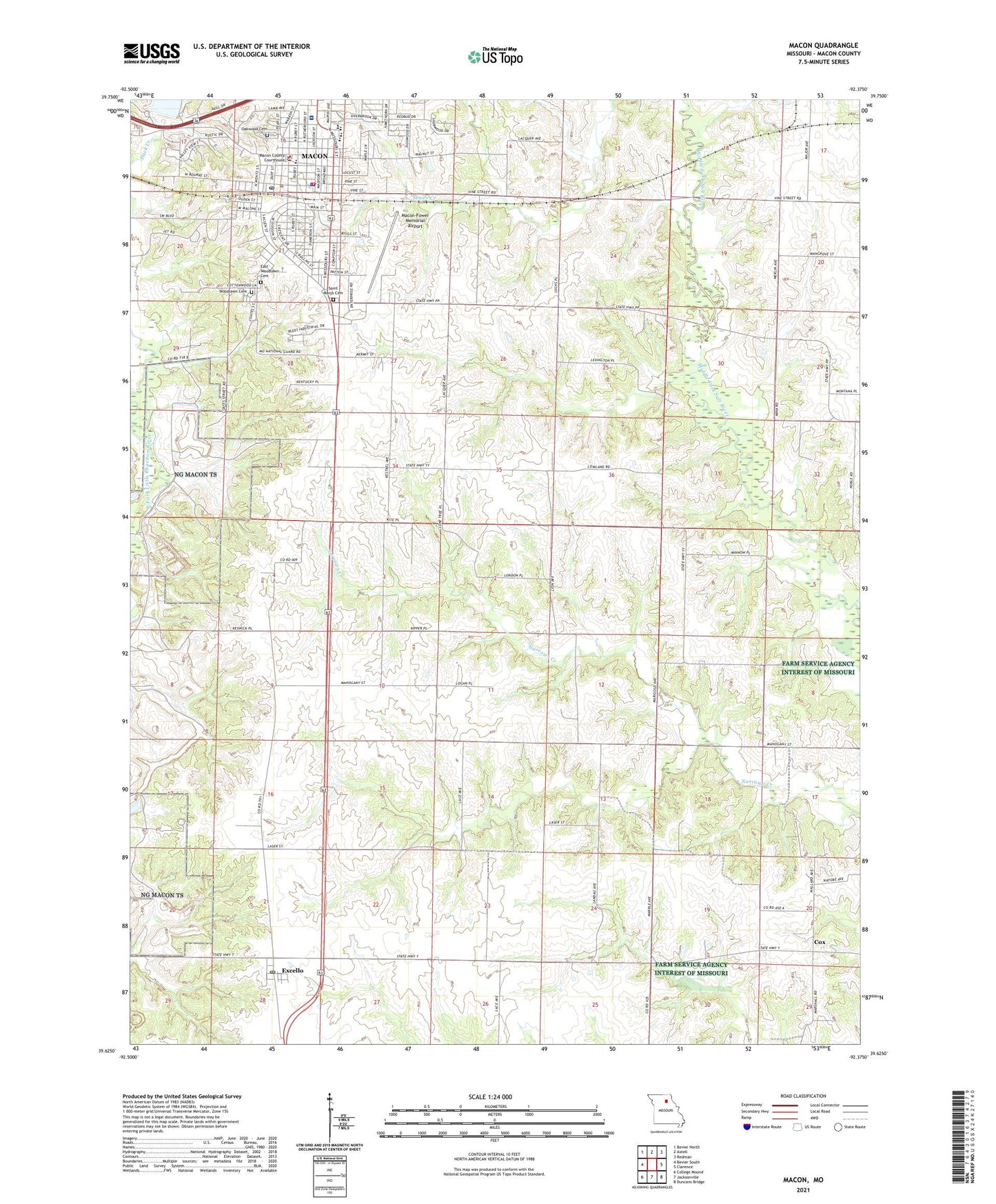
2021 topographic map quadrangle Macon in the state of Missouri. Scale: 1:24000. Based on the newly updated USGS 7.5' US Topo map series, this map is in the following counties: Macon. The map contains contour data, water features, and other items you are used to seeing on USGS maps, but also has updated roads and other features. This is the next generation of topographic maps. Printed on high-quality waterproof paper with UV fade-resistant inks.
Quads adjacent to this one:
West: Bevier South
Northwest: Bevier North
North: Axtell
Northeast: Redman
East: Clarence
Southeast: Duncans Bridge
South: Jacksonville
Southwest: College Mound
Contains the following named places: Bear Thicket School, Brock School, Chapel Hill Church, City of Macon, Cox, East Woodlawn Cemetery, Excello, Excello Census Designated Place, Excello Post Office, Fort Blees, Fox School, Friendship Church, KLTI-AM (Macon), KZOX-FM (Macon), Macon, Macon County Sheriff's Office, Macon Fire Department, Macon Lake Dam, Macon Police Department, Macon Post Office, Macon-Fower Memorial Airport, Narrows Creek, Narrows Creek Post Office, Oak Ridge School, Oakwood Cemetery, Saint Marys Cemetery, Samaritan Hospital, Shilling School, Stephens Park, Still Hildreth Lake, Still Hildreth Sanitorium Dam, Township of Hudson, Township of Narrows, Union Hall, Walker School, Waller School, Woodlawn Cemetery, ZIP Code: 65247