MyTopo
Medill Missouri US Topo Map
Couldn't load pickup availability
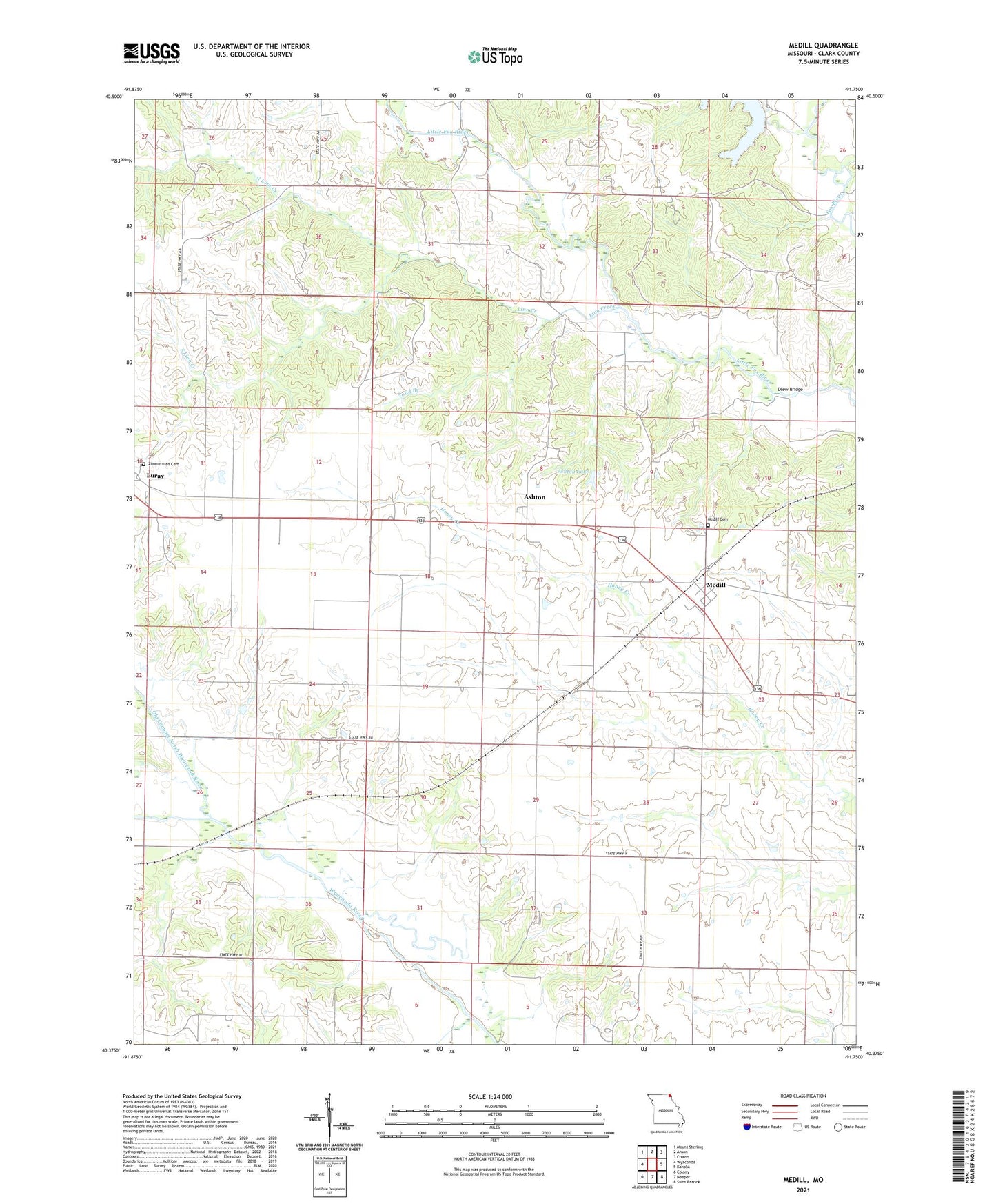
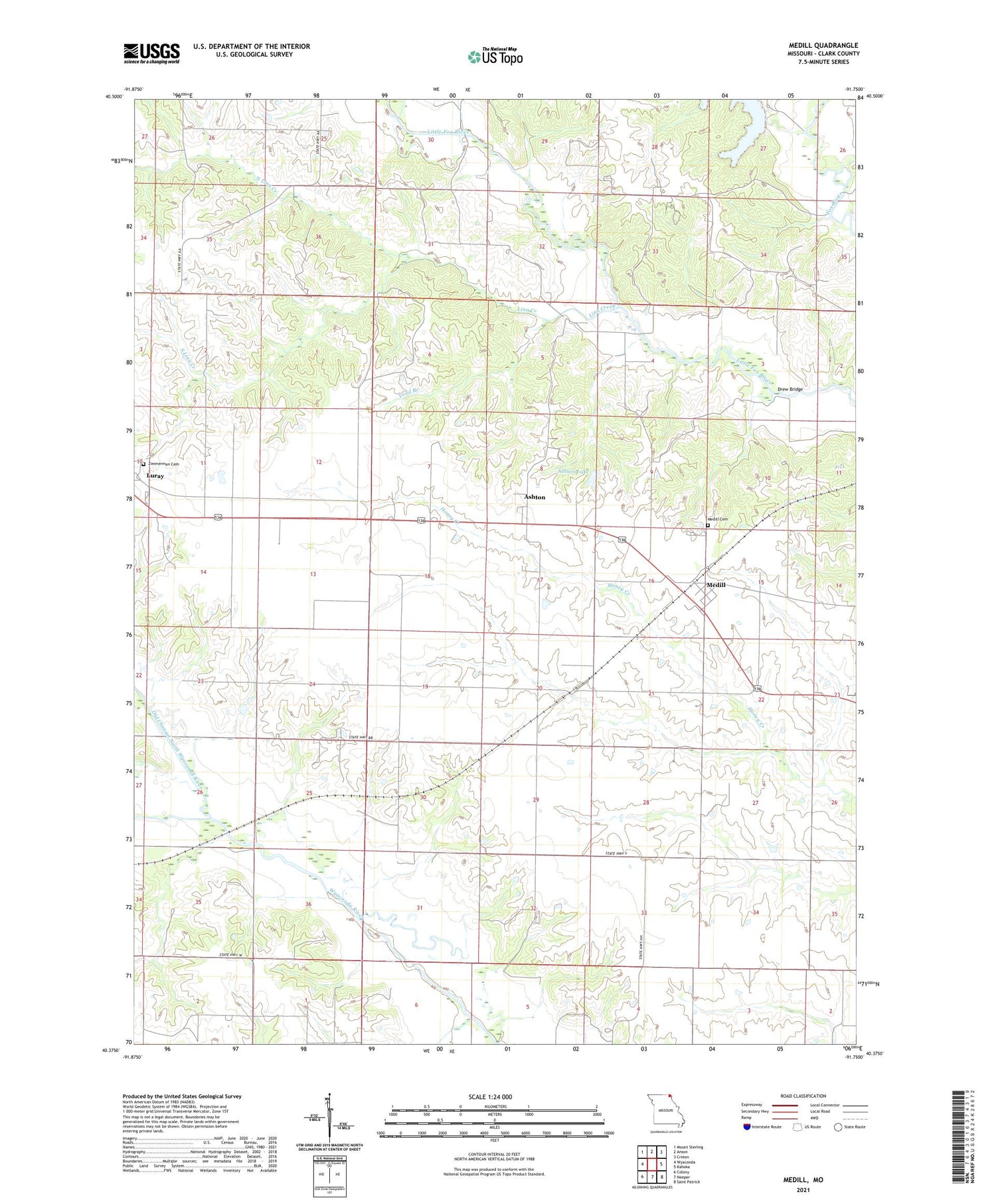
2021 topographic map quadrangle Medill in the state of Missouri. Scale: 1:24000. Based on the newly updated USGS 7.5' US Topo map series, this map is in the following counties: Clark. The map contains contour data, water features, and other items you are used to seeing on USGS maps, but also has updated roads and other features. This is the next generation of topographic maps. Printed on high-quality waterproof paper with UV fade-resistant inks.
Quads adjacent to this one:
West: Wyaconda
Northwest: Mount Sterling
North: Anson
Northeast: Croton
East: Kahoka
Southeast: Saint Patrick
South: Neeper
Southwest: Colony
Contains the following named places: Ashton, Ashton Church, Ashton Lake, Beard School, Boston School, Brotherton Lake Dam, Cama, Carmel Church, Cemetery Chapel, Center Chapel, Drew Bridge, Eureka School, Happy Hill School, Hays School, Lebanon School, Linn Creek, Medill, Medill Cemetery, Medill Census Designated Place, Medill Presbyterian Church, North Linn Creek, North Wyaconda River, Seyb Lake Dam, South Linn Creek, South Wyaconda River, Thompson School, Todd Branch, Toops School, Township of Lincoln, Woodville Baptist Church, Woodville Church, Zimmerman Cemetery