MyTopo
Meta Missouri US Topo Map
Couldn't load pickup availability
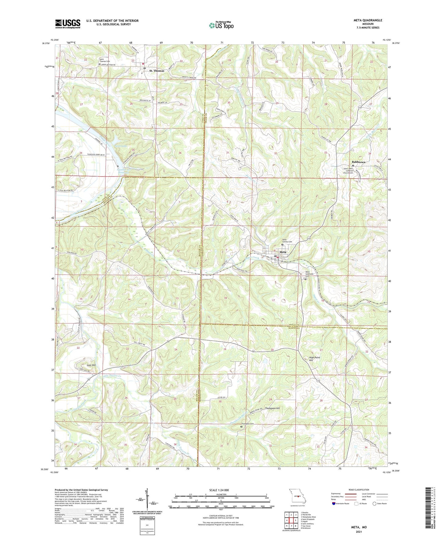
2021 topographic map quadrangle Meta in the state of Missouri. Scale: 1:24000. Based on the newly updated USGS 7.5' US Topo map series, this map is in the following counties: Osage, Miller, Maries, Cole. The map contains contour data, water features, and other items you are used to seeing on USGS maps, but also has updated roads and other features. This is the next generation of topographic maps. Printed on high-quality waterproof paper with UV fade-resistant inks.
Quads adjacent to this one:
West: Saint Elizabeth
Northwest: Brazito
North: Wardsville
Northeast: Westphalia West
East: Argyle
Southeast: Brinktown
South: Van Cleve
Southwest: Saint Anthony
Contains the following named places: Babbtown, City of Meta, Cla-Lor Lake Dam, Cole County Fire Protection District Station 3, Cross Lake, Fry Branch, High Point Hill, Kern School, Little Tavern Creek, Lost Hill, Meta, Meta Fire and Rescue Protection, Meta Post Office, Meta Southside Cemetery, Meta Tower Site, Number 137 Reservoir, Number 138 Dam, Number 98 Lake, Ortmeyer Lake Dam, Saint Cecilia Cemetery, Saint Cecilias Catholic Church, Saint John's Lutheran Church Cemetery, Saint Thomas, Saint Thomas Cemetery, Saint Thomas Post Office, Scott Lake, Shansmeyer School, Sugar Creek, Teal, Thompson Cemetery, Thompson High School, Thompson Hill, Thompson Hill Creek, Thompson Hill School, Town of Saint Thomas, Turpin Lake Dam