MyTopo
Novinger Missouri US Topo Map
Couldn't load pickup availability
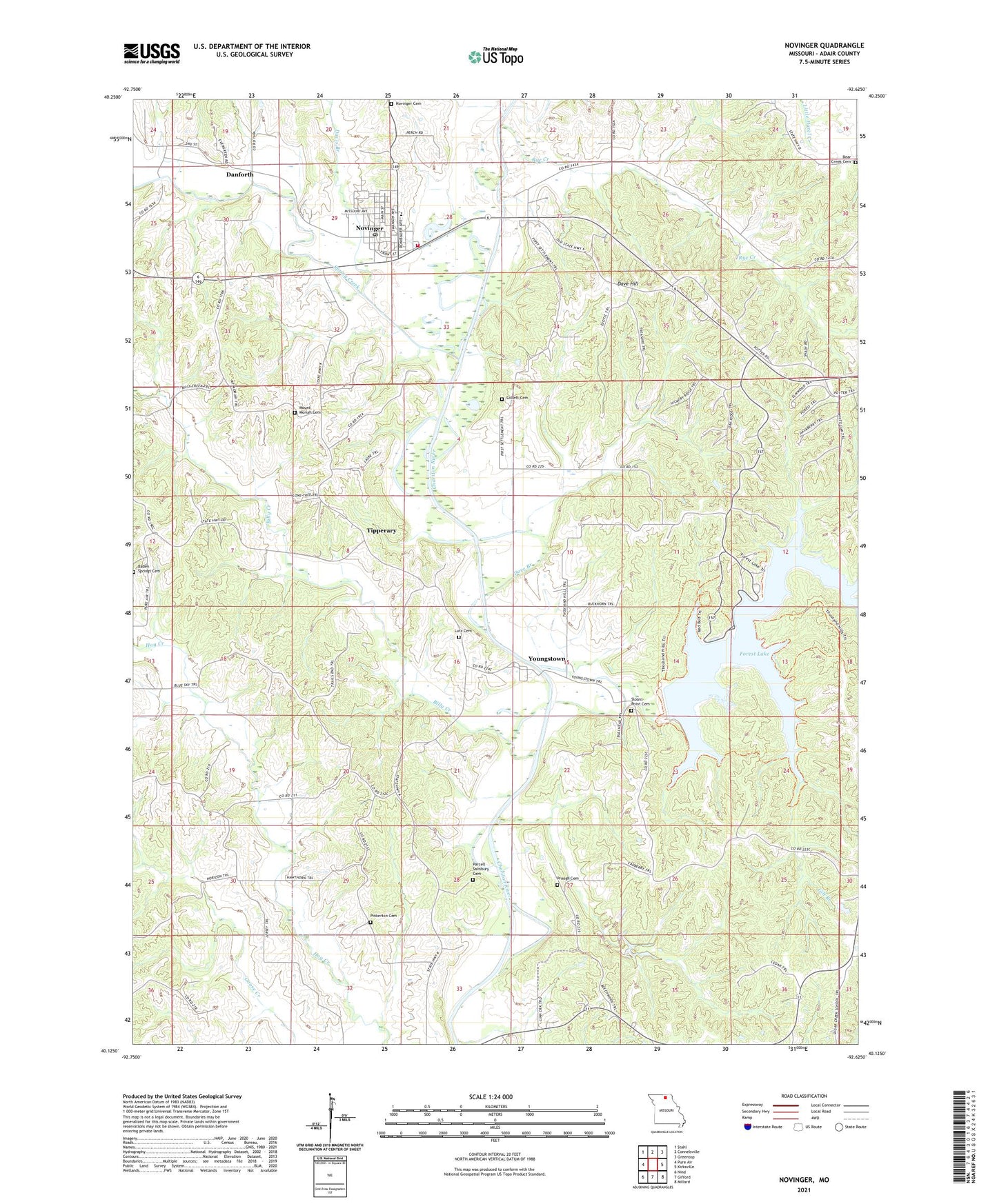
2021 topographic map quadrangle Novinger in the state of Missouri. Scale: 1:24000. Based on the newly updated USGS 7.5' US Topo map series, this map is in the following counties: Adair. The map contains contour data, water features, and other items you are used to seeing on USGS maps, but also has updated roads and other features. This is the next generation of topographic maps. Printed on high-quality waterproof paper with UV fade-resistant inks.
Quads adjacent to this one:
West: Pure Air
Northwest: Stahl
North: Connelsville
Northeast: Greentop
East: Kirksville
Southeast: Millard
South: Gifford
Southwest: Nind
Contains the following named places: Baden Springs Cemetery, Bear Creek Cemetery, Bear Creek Church, Billy Creek, Bunker Hill School, Camp Pioneer Ridge, City of Novinger, Collett Cemetery, Danforth, Danforth School, Dave Branch, Dave Hill, Davis Branch, Evanston Siding, Forest Lake, Forest Lake Dam, Gill Branch, Jayne Lake Dam, Kirksville Pumping Station, Lutz Cemetery, Mine Number 1, Mount Moriah Cemetery, Mount Moriah Church, Nefy, Novinger, Novinger Cemetery, Novinger Community Volunteer Fire Department, Novinger Post Office, Pinkerton Cemetery, Prough Cemetery, Prough School, Rye Creek, Rye Creek School, Salisbury - Parcels Cemetery, Salisbury School, Sloans Point, Sloans Point Cemetery, Sloans Point School, Spring Creek, Stinson School, Thousand Hills State Park, Tipperary, Watson Siding, West Center School, Williams School, Youngstown