MyTopo
Paris West Missouri US Topo Map
Couldn't load pickup availability
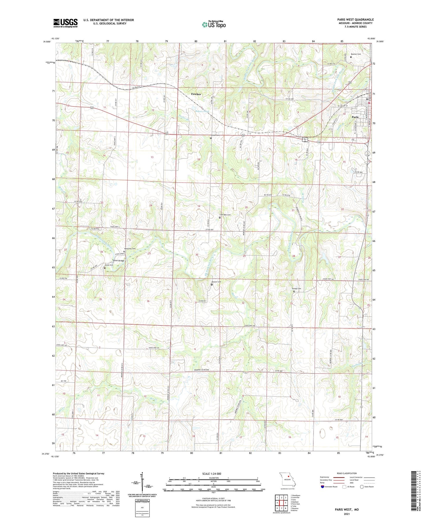
2021 topographic map quadrangle Paris West in the state of Missouri. Scale: 1:24000. Based on the newly updated USGS 7.5' US Topo map series, this map is in the following counties: Monroe. The map contains contour data, water features, and other items you are used to seeing on USGS maps, but also has updated roads and other features. This is the next generation of topographic maps. Printed on high-quality waterproof paper with UV fade-resistant inks.
Quads adjacent to this one:
West: Madison
Northwest: Woodlawn
North: Granville
Northeast: Goss
East: Paris East
Southeast: Molino
South: Rowena
Southwest: Tulip
Contains the following named places: Bakers Pond, Bee Creek, Boomer Cemetery, Brazeale Farm Airport, Briar Creek, Cecil, Cedar Bluff School, Central Stone County Lake Dam, City of Paris, Cross Hollow School, Curtright Cemetery, Deaver Cemetery, Foreman School, Fowkes, Lake Village Airport, McKinney Cemetery, Monroe County, Mount Airy Church, Mount Zion Church, Paris, Paris Elementary School, Paris Fire Department, Paris High School, Paris Post Office, Paris Rural Fire Protection District, Pooles Branch, Saint Francis Cabrini Church, Sanford School, Shiloh Cemetery, Snell School, Township of Jackson, Union Bridge, Union Cemetery, Union School, Welch, Youngs Cemetery