MyTopo
Pine Crest Missouri US Topo Map
Couldn't load pickup availability
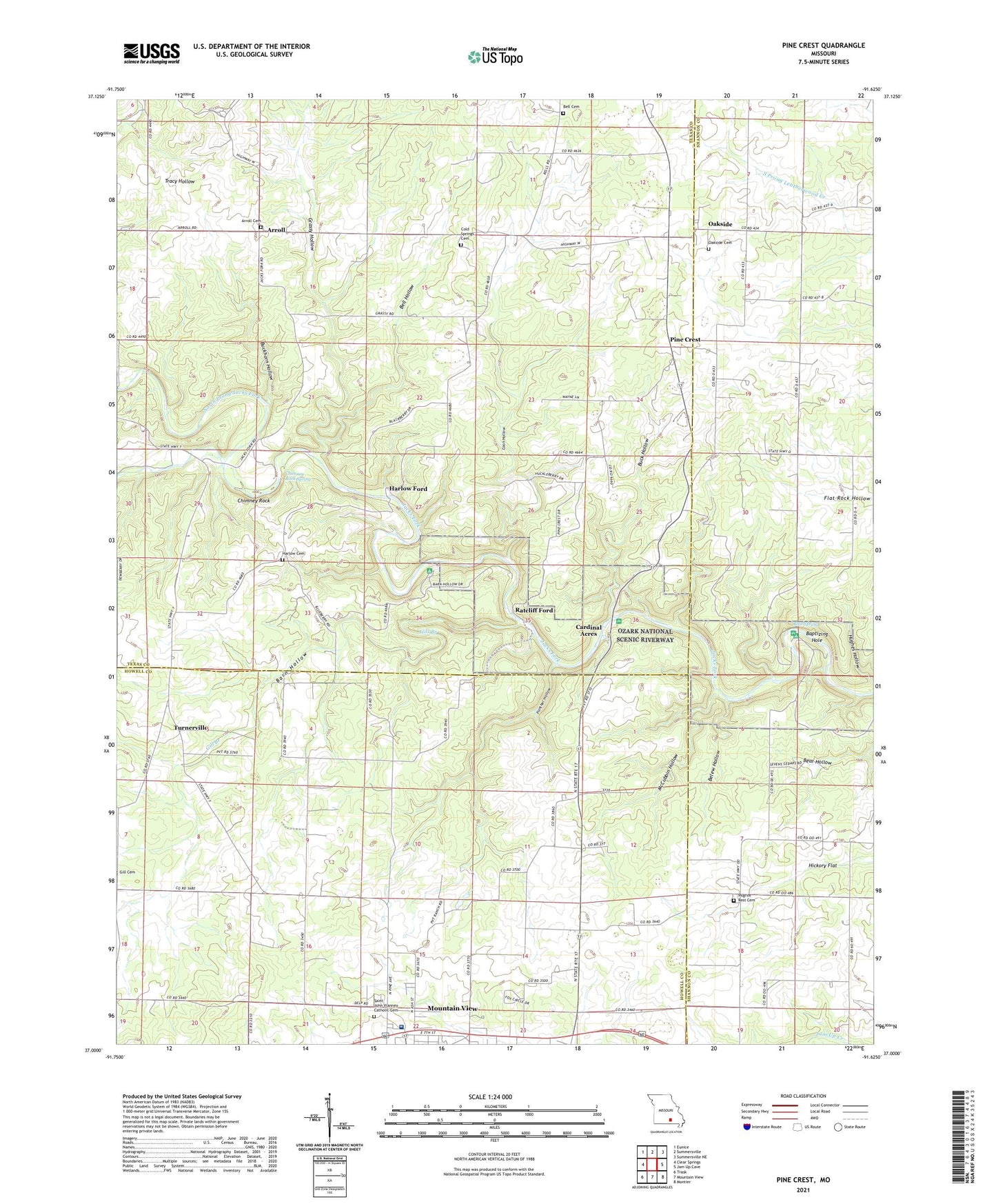
2021 topographic map quadrangle Pine Crest in the state of Missouri. Scale: 1:24000. Based on the newly updated USGS 7.5' US Topo map series, this map is in the following counties: Texas, Howell, Shannon. The map contains contour data, water features, and other items you are used to seeing on USGS maps, but also has updated roads and other features. This is the next generation of topographic maps. Printed on high-quality waterproof paper with UV fade-resistant inks.
Quads adjacent to this one:
West: Clear Springs
Northwest: Eunice
North: Summersville
Northeast: Summersville NE
East: Jam Up Cave
Southeast: Montier
South: Mountain View
Southwest: Trask
Contains the following named places: Arroll, Arroll School, Baptizing Hole, Barn Hollow, Barn Hollow Natural Area, Belew Hollow, Bell Cemetery, Bell Hollow, Bell School, Blue Spring, Blue Spring Campsite, Blue Spring River Access, Blue Springs, Bluff View River Access, Buck Hollow, Buck Hollow River Access, Buckhorn Hollow, Cardinal Acres, Chimney Rock, Chimney Rock Spring, Cold Springs Cemetery, Columbia School, Coon Hollow, Ferndale Church, Gill Branch, Grassy Hollow, Harlow Cemetery, Harlow Ford, Harlow School, Heelstring School, Hickory Flat, Hines School, Inwood School, McCubbin Hollow, Mercy Saint Francis Hospital, North Prong Jacks Fork, Oakside, Oakside Cemetery, Oakside Community Church, Oakside School, Panther Hollow, Pilgrim Rest Church, Pine Crest, Ratcliff Ford, South Prong Jacks Fork, Stallman School, Township of Date, Township of Goldsberry, Turnerville, VFW Campground, ZIP Code: 65548