MyTopo
Point Pleasant Missouri US Topo Map
Couldn't load pickup availability
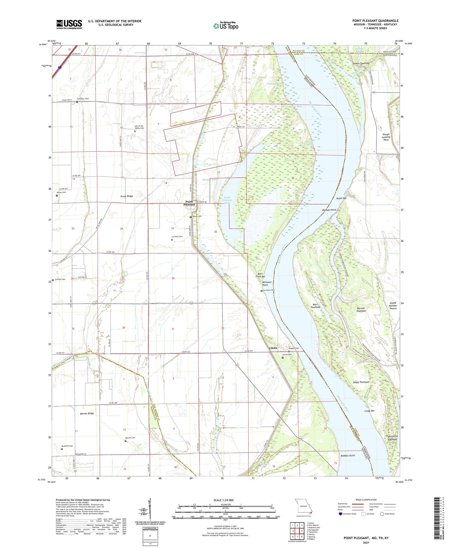
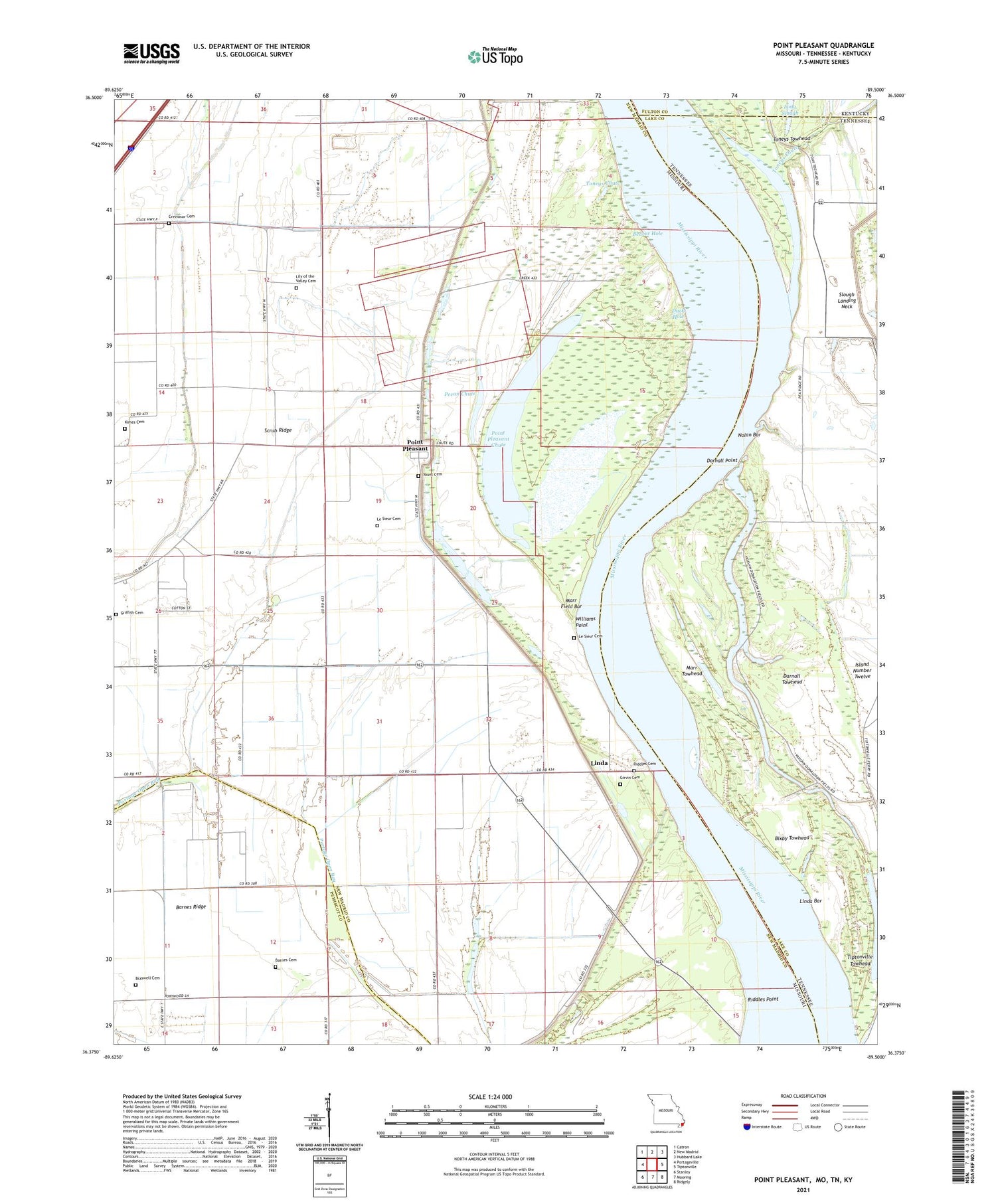
2021 topographic map quadrangle Point Pleasant in the states of Missouri, Tennessee, Kentucky. Scale: 1:24000. Based on the newly updated USGS 7.5' US Topo map series, this map is in the following counties: New Madrid, Lake, Pemiscot, Fulton. The map contains contour data, water features, and other items you are used to seeing on USGS maps, but also has updated roads and other features. This is the next generation of topographic maps. Printed on high-quality waterproof paper with UV fade-resistant inks.
Quads adjacent to this one:
West: Portageville
Northwest: Catron
North: New Madrid
Northeast: Hubbard Lake
East: Tiptonville
Southeast: Ridgely
South: Mooring
Southwest: Stanley
Contains the following named places: Barnes Cemetery, Barnes Ridge, Batesell Landing, Beaver Hole, Below Toneys Towhead Revetment, Bixby Towhead, Braswell Cemetery, Compromise Landing, Creviosur Cemetery, Cushion Lake, Darnall Landing, Darnall Point, Darnall Towhead, Duck Hole, Girvin Cemetery, Griffith Cemetery, Island Number 11, Kimes Cemetery, Le Sieur Cemetery, Lily of the Valley Church, Linda, Linda Bar, Linda School, Long Slough, Macedonia Church, Marr Field Bar, Marr Towhead, Newman School, Newmann School, Nolan Bar, Pecan Chute, Point Pleasant, Point Pleasant Chute, Riddles Cemetery, Riddles Point, Riddles Point School, Scrub Ridge, Slough Landing Neck, Tiptonville Chute, Tiptonville Towhead, Toneys Chute, Toneys Towhead, Township of Le Sieur, Ward School, Watsons Landing, Williams Point, Yount Cemetery