MyTopo
Powell Missouri US Topo Map
Couldn't load pickup availability
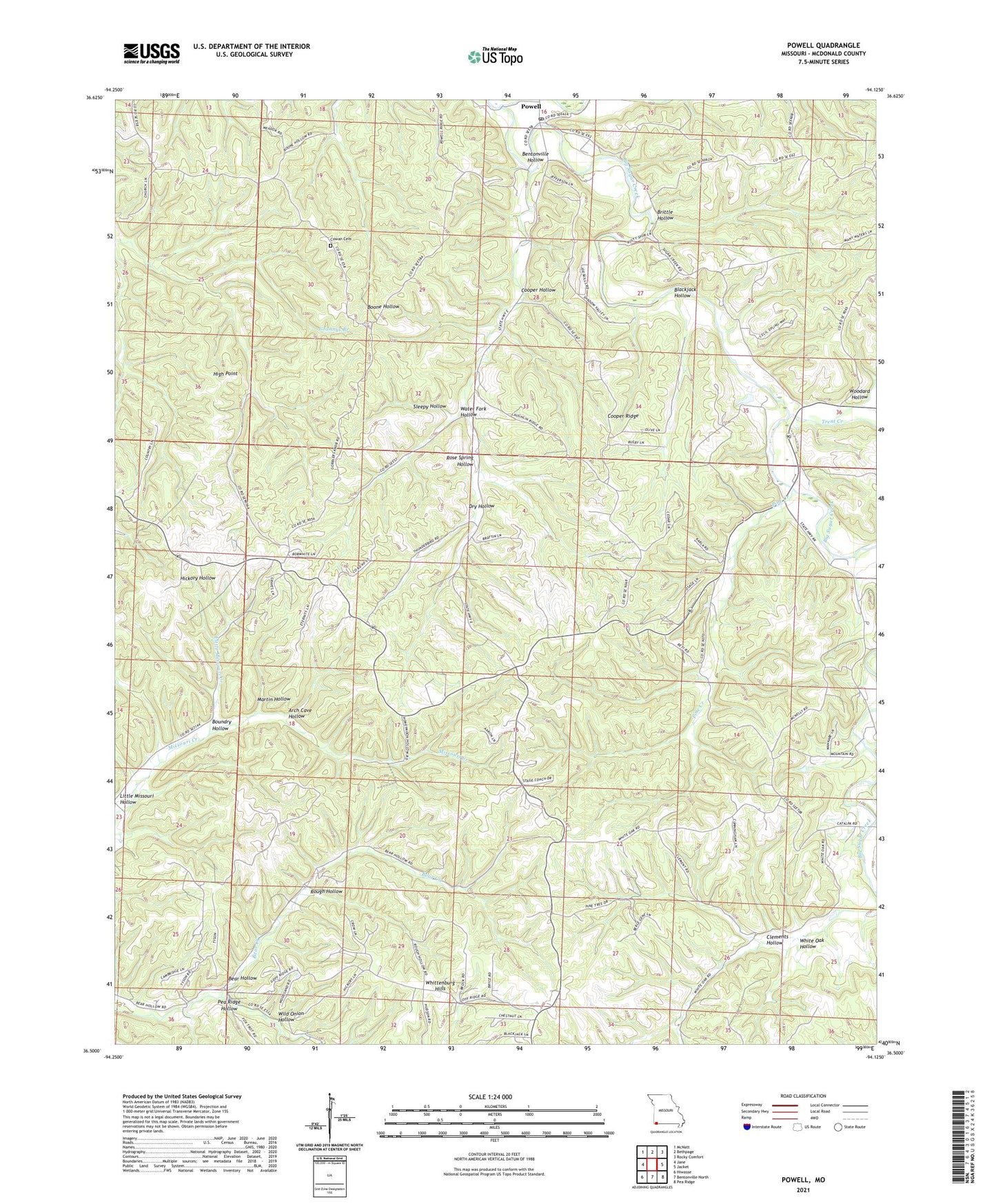
2021 topographic map quadrangle Powell in the state of Missouri. Scale: 1:24000. Based on the newly updated USGS 7.5' US Topo map series, this map is in the following counties: McDonald. The map contains contour data, water features, and other items you are used to seeing on USGS maps, but also has updated roads and other features. This is the next generation of topographic maps. Printed on high-quality waterproof paper with UV fade-resistant inks.
Quads adjacent to this one:
West: Jane
Northwest: McNatt
North: Bethpage
Northeast: Rocky Comfort
East: Jacket
Southeast: Pea Ridge
South: Bentonville North
Southwest: Hiwasse
Contains the following named places: Antioch School, Arch Cave Hollow, Arnett, Bear Hollow, Bear Hollow School, Bentonville Hollow, Blackjack Hollow, Boundry Hollow, Brittle Hollow, Brush Creek, Clements Hollow, Cooper Hollow, Cooper Ridge, Cowan Cemetery, Dry Hollow, Enterprise School, High Point, Little Missouri Creek, Little Missouri Hollow, Martin Hollow, Mikes Creek, Mountain, Oak Hill School, Pea Ridge Hollow, Pine Creek, Poplar Hill School, Powell, Powell Post Office, Powell Tower Site State Public Hunting Grounds, Roller School, Rose Spring Hollow, Rough Hollow, Sleepy Hollow, Township of Center, Township of Mountain, Trent Creek, Water Fork Hollow, West Point School, Whittenburg Hills, Wild Onion Hollow, Woodard Hollow, ZIP Code: 65730