MyTopo
Pure Air Missouri US Topo Map
Couldn't load pickup availability
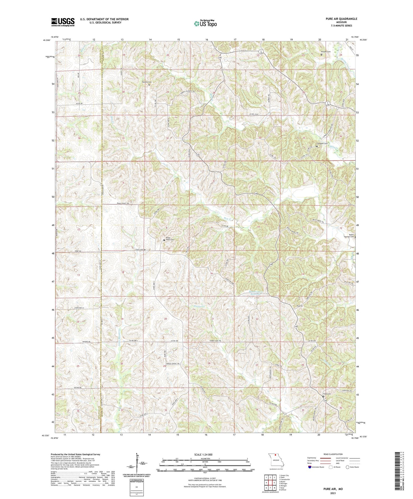
2021 topographic map quadrangle Pure Air in the state of Missouri. Scale: 1:24000. Based on the newly updated USGS 7.5' US Topo map series, this map is in the following counties: Adair, Sullivan. The map contains contour data, water features, and other items you are used to seeing on USGS maps, but also has updated roads and other features. This is the next generation of topographic maps. Printed on high-quality waterproof paper with UV fade-resistant inks.
Quads adjacent to this one:
West: Mystic
Northwest: Green City
North: Stahl
Northeast: Connelsville
East: Novinger
Southeast: Gifford
South: Nind
Southwest: Winigan
Contains the following named places: Bald Knob Church, Bald Knob School, Broyles Cemetery, Campbell Cemetery, Daniels Cemetery, Eschman Lake Dam, Golden Rule School, Hook School, Maple Grove School, Mines, Mononame 9 Reservoir, Pratt Cemetery, Pure Air, Ringo Point, Ringo Point Cemetery, Ringo Point School, Township of Liberty, Union Church, West Elm Grove School, Zig, Zig Post Office, ZIP Codes: 63544, 63559