MyTopo
Queen City Missouri US Topo Map
Couldn't load pickup availability
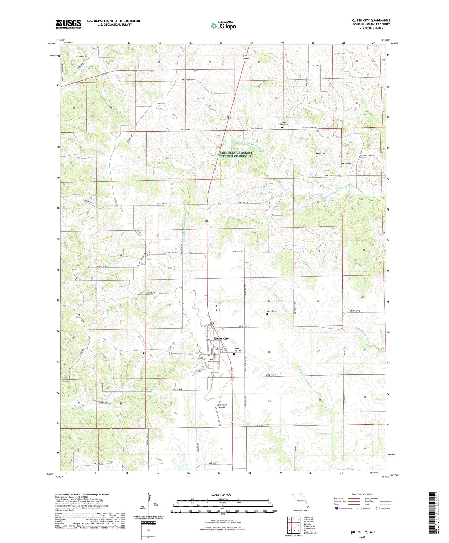
2021 topographic map quadrangle Queen City in the state of Missouri. Scale: 1:24000. Based on the newly updated USGS 7.5' US Topo map series, this map is in the following counties: Schuyler. The map contains contour data, water features, and other items you are used to seeing on USGS maps, but also has updated roads and other features. This is the next generation of topographic maps. Printed on high-quality waterproof paper with UV fade-resistant inks.
Quads adjacent to this one:
West: Livonia
Northwest: Coatsville
North: Lancaster
Northeast: Bunker Hill
East: Downing NW
Southeast: Willmathsville
South: Greentop
Southwest: Connelsville
Contains the following named places: Applegate Airport, Barnes Cemetery, Barr School, Bethel Church, Blacks School, City of Queen City, Green Valley School, Independence School, Julesburg, Liberty Hall School, Lucas School, Mount Zion Cemetery, Myers Cemetery, New Hope Church, New Hope School, Patterson School, Public Water Supply District 1 L Reservoir, Queen City, Queen City Cemetery, Queen City Community Fire Department, Queen City Post Office, Roberts School, School Number Thirty-four, Schuyler County, Tarr Cemetery, Thomas Cemetery, Tipton School, Township of Prairie, ZIP Code: 63561