MyTopo
Richland Missouri US Topo Map
Couldn't load pickup availability
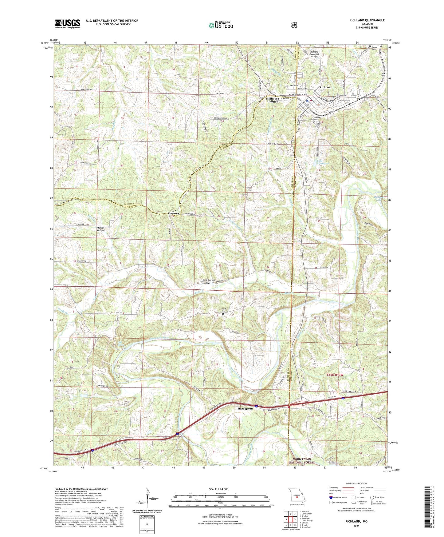
2021 topographic map quadrangle Richland in the state of Missouri. Scale: 1:24000. Based on the newly updated USGS 7.5' US Topo map series, this map is in the following counties: Laclede, Pulaski, Camden. The map contains contour data, water features, and other items you are used to seeing on USGS maps, but also has updated roads and other features. This is the next generation of topographic maps. Printed on high-quality waterproof paper with UV fade-resistant inks.
Quads adjacent to this one:
West: Stoutland
Northwest: Montreal
North: Conns Creek
Northeast: Crocker
East: Ozark Springs
Southeast: Brownfield
South: Drynob
Southwest: Oakland
Contains the following named places: Armistead Dam, Barlow Creek, Bear Creek, Cave Spring Hollow, Cedar Grove School, City of Richland, Cliff Spring, Colenso, Colenso Post Office, Cottonwood Branch, Cottonwood Creek, Davis Creek, Davis School, Dowty Cemetery, Duck Creek, Eaton School, Eden Roadside Park, Eureka Church, Garnsey, Gascozark, Gascozark Hereford Ranch, Gascozark Hills Resort, Gillming Lake Dam, Hazelgreen, Hazelgreen Fire Protection District Station 1 Headquarters, Hazelgreen Fire Protection District Station 2, Hazelgreen Fire Protection District Station 3, Hillhouse Addition, Independence Church, Independence School, Laclede County Camp, Lake Armistead, Manes Cemetery, Moore Lake Dam, Mount Satchel School, Oak Lawn Cemetery, Osage Fork Gasconade River, Pleasant Knoll School, Rainey Lake Dam, Richland, Richland Police Department, Richland Post Office, Riverside Lodge, Sandy Creek, Township of May/Smith, Township of Mayfield, Township of Smith, Tri - County Fire and Rescue Association Station 1, Tri - County Fire Protection District, Vancak Lake Dam, Wair Chapel, Wair School, Wildwood Resort, Wilson Hollow, ZIP Code: 65556