MyTopo
Steelville Missouri US Topo Map
Couldn't load pickup availability
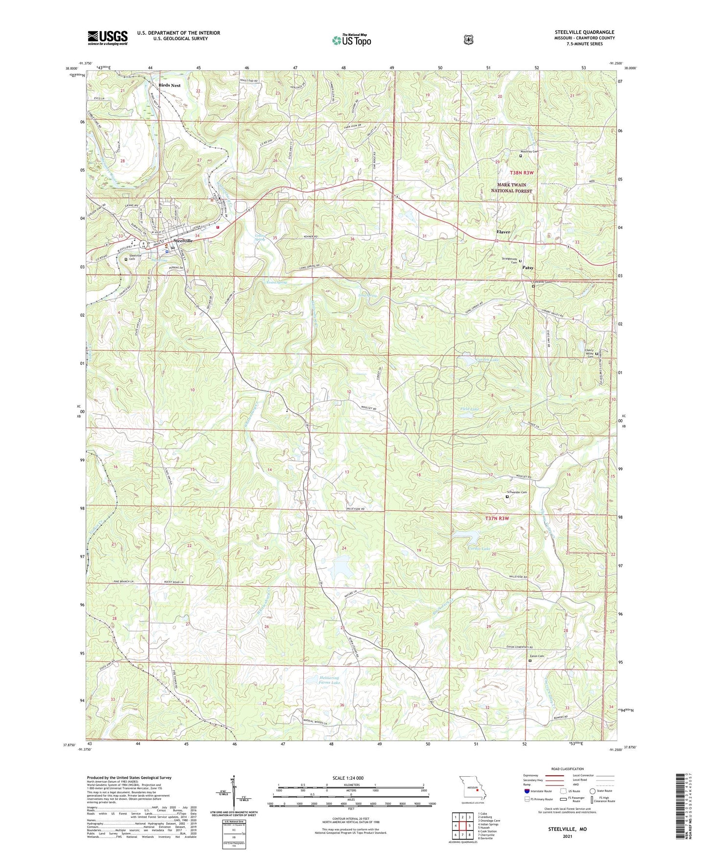
2021 topographic map quadrangle Steelville in the state of Missouri. Scale: 1:24000. Based on the newly updated USGS 7.5' US Topo map series, this map is in the following counties: Crawford. The map contains contour data, water features, and other items you are used to seeing on USGS maps, but also has updated roads and other features. This is the next generation of topographic maps. Printed on high-quality waterproof paper with UV fade-resistant inks.
Quads adjacent to this one:
West: Indian Springs
Northwest: Cuba
North: Leasburg
Northeast: Onondaga Cave
East: Huzzah
Southeast: Davisville
South: Cherryville
Southwest: Cook Station
Contains the following named places: Big Spring, Birds Nest, Birds Nest Beach Park, Black Jack Creek, Black Jack School, Carden Lake, Carden Lake Dam, Cardin Lake, Cardin Lake Dam, Center Point Church, Center Point School, Cherry Valley, Cherry Valley Cemetery, Cherry Valley Number One Iron Bank, Cherry Valley Number Two Iron Bank, Cherry Valley School, City of Steelville, Clark Iron Mine, Coffee Church, Coffee School, Collins Spring, Crawford County, Crawford County Sheriff's Office, Eaton Cemetery, Edwards Cemetery, Elaver, Evans Spring, Ferguson Iron Bank, Field Lake, Field Lake Dam, Halbert Lead Digging, Helmering Farms Dam, Helmering Farms Lake, Keysville Lookout Tower, Long Spring, Midland, Midland Church, Midland Mine, Midland School, Mononame 133 Dam, Mononame 852 Dam, Moultray Cemetery, N.G. Clark Number One Iron Bank, Patsy, Peetz Iron Bank, Pleasant View School, Roswell, Sankey, Schweider Cemetery, Steelville, Steelville Cemetery, Steelville Fire Protection District Station 1, Steelville Marshal's Office, Steelville Post Office, Steelville R-3 High School, Straightway Church, United Church, Valley Side School, Whittenburg Creek, Wildwoods, Woolsey School