MyTopo
Stet Missouri US Topo Map
Couldn't load pickup availability
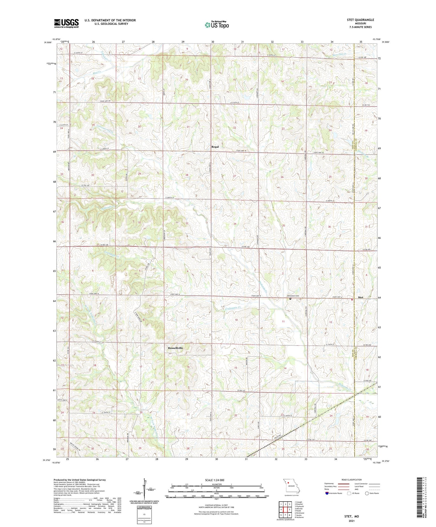
2021 topographic map quadrangle Stet in the state of Missouri. Scale: 1:24000. Based on the newly updated USGS 7.5' US Topo map series, this map is in the following counties: Ray, Carroll. The map contains contour data, water features, and other items you are used to seeing on USGS maps, but also has updated roads and other features. This is the next generation of topographic maps. Printed on high-quality waterproof paper with UV fade-resistant inks.
Quads adjacent to this one:
West: Millville
Northwest: Cowgill
North: Braymer
Northeast: Plymouth
East: Roads
Southeast: Norborne
South: Hardin
Southwest: Richmond
Contains the following named places: Bethany Church, Cottonwood Creek, Crabapple Creek, Klatt Lake Dam, Little Union Church, Log Cabin Station, New Hope Church, New Hope School, Penniston Cemetery, Pleasant Hill School, Regal, Russellville, South Mud Creek, Stet, Stet Elementary School, Stet High School, Stet Rural Fire Protection District, Township of Grape Grove, Wesley Chapel