
MyTopo
Willard Missouri US Topo Map
Couldn't load pickup availability
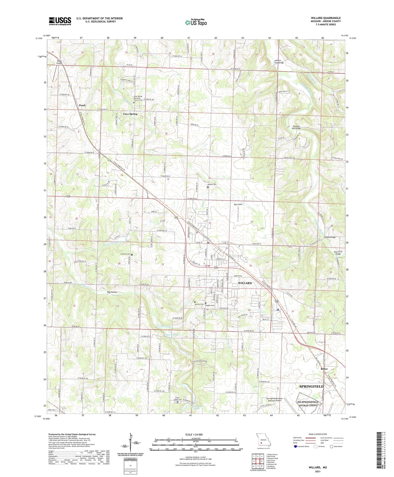
2021 topographic map quadrangle Willard in the state of Missouri. Scale: 1:24000. Based on the newly updated USGS 7.5' US Topo map series, this map is in the following counties: Greene. The map contains contour data, water features, and other items you are used to seeing on USGS maps, but also has updated roads and other features. This is the next generation of topographic maps. Printed on high-quality waterproof paper with UV fade-resistant inks.
Quads adjacent to this one:
West: Ash Grove
Northwest: Walnut Grove
North: Morrisville
Northeast: Pleasant Hope
East: Ebenezer
Southeast: Springfield
South: Brookline
Southwest: Halltown NE
Contains the following named places: Big Hollow, Bird Field, Brower Spring, Cave Spring, Cave Spring Memorial Church, Cave Spring Memorial Church Cemetery, City of Willard, Clear Creek Cemetery, Clear Creek Park, Clear Creek School, Clear Creek Spring, Colored School, Edgewood School, Flat Rock School, Flint Hill Branch, Friendship Church, Hackney, Hackney Mill Bridge, Johnson Ford Bridge, Knox Ford Bridge, Mount Pleasant Branch, Mount Pleasant Church, Murray Cemetery, Pearl, Rainer Branch, Ritter, Sneeds Bridge, Star School, Tatum Chapel, Textor Airport, Township of Murray, Wesley Cemetery, Willard, Willard Fire Protection District Station 1, Willard Police Department, Willard Post Office, Willey School, Yocum School, ZIP Code: 65781


