MyTopo
Willmathsville Missouri US Topo Map
Couldn't load pickup availability
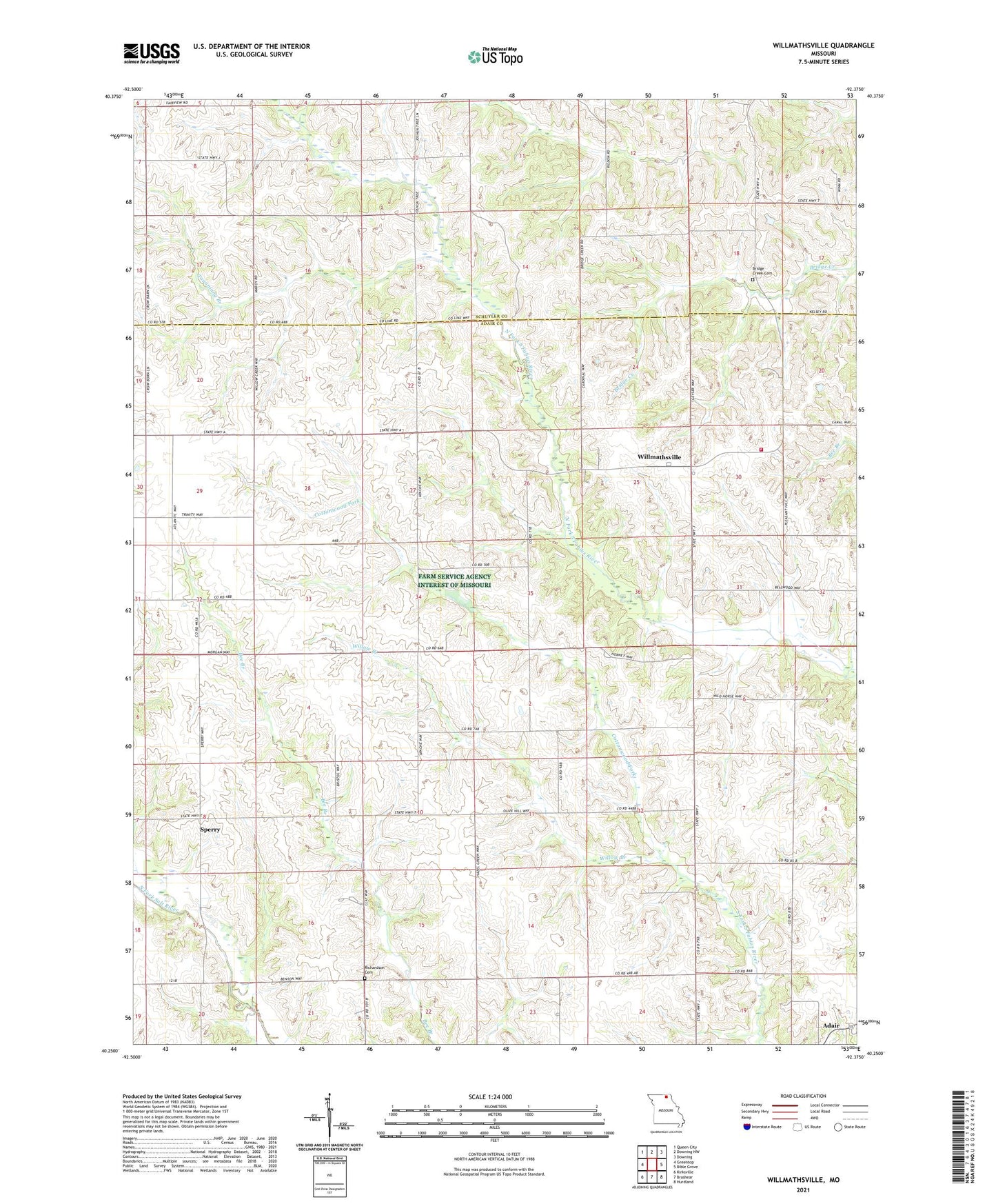
2021 topographic map quadrangle Willmathsville in the state of Missouri. Scale: 1:24000. Based on the newly updated USGS 7.5' US Topo map series, this map is in the following counties: Adair, Schuyler. The map contains contour data, water features, and other items you are used to seeing on USGS maps, but also has updated roads and other features. This is the next generation of topographic maps. Printed on high-quality waterproof paper with UV fade-resistant inks.
Quads adjacent to this one:
West: Greentop
Northwest: Queen City
North: Downing NW
Northeast: Downing
East: Bible Grove
Southeast: Hurdland
South: Brashear
Southwest: Kirksville
Contains the following named places: Adair, Bethel Church, Bridge Creek Cemetery, Cottonwood Fork, Energy School, Floyds Creek Post Office, Garden Grove School, Greentop Fire Association Willmathsville Station, Olive Hill School, Pickens Lake Dam, Pleasant Hill School, Pleasant View School, Richardson Cemetery, Sperry, Sperry School, Tauaninny Branch, Township of Clay, Trinity, Trinity Church, Trinity School, Union School, Willmathsville, Willow Branch