MyTopo
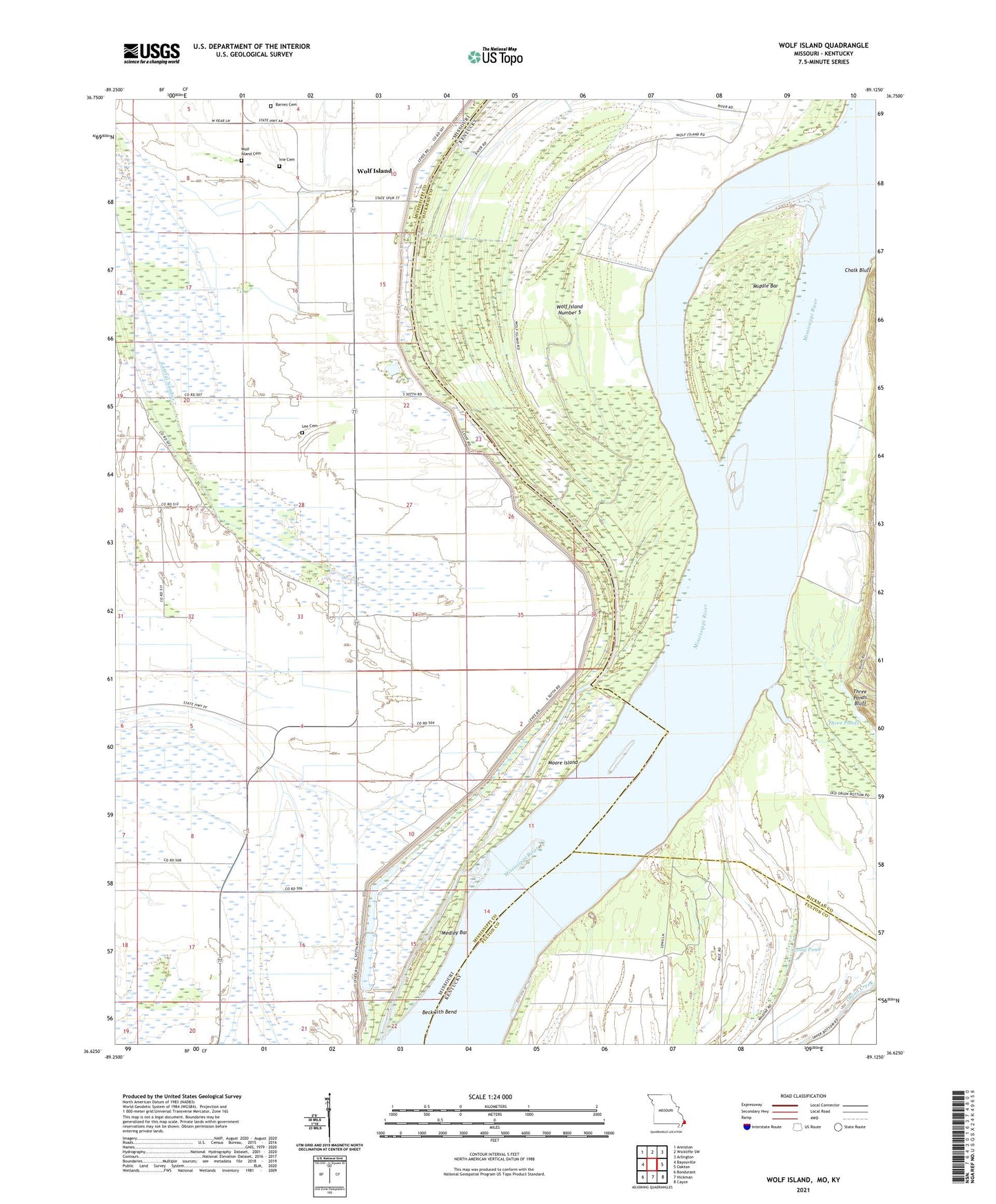
Wolf Island Missouri US Topo Map
Couldn't load pickup availability
2021 topographic map quadrangle Wolf Island in the states of Missouri, Kentucky. Scale: 1:24000. Based on the newly updated USGS 7.5' US Topo map series, this map is in the following counties: Mississippi, Hickman, Fulton. The map contains contour data, water features, and other items you are used to seeing on USGS maps, but also has updated roads and other features. This is the next generation of topographic maps. Printed on high-quality waterproof paper with UV fade-resistant inks.
Quads adjacent to this one:
West: Bayouville
Northwest: Anniston
North: Wickliffe SW
Northeast: Arlington
East: Oakton
Southeast: Cayce
South: Hickman
Southwest: Bondurant
Contains the following named places: Barnes Cemetery, Beckwith Bend, Chalk Bluff, Grey School, Ivie Cemetery, Lateral Number 7, Lee Cemetery, Little Eagle Pond, Long Pond, Macedonia Church, Medley Bar, Medley Landing, Medley School, Middle Bar, Moore Island, Mount Zion Church, Muscovalley Landing, Muscovalley Post Light, Pinhook School, Samuels Landing, Sassafras Ridge Church, Sassafras Ridge School, Three Ponds, Three Ponds Bluff, Towosahgy State Park, Walnut Grove, Williams Landing, Wolf Island, Wolf Island Cemetery, Wolf Island Church, Wolf Island Number 5, Wolf Island School