MyTopo
Girard Montana US Topo Map
Couldn't load pickup availability
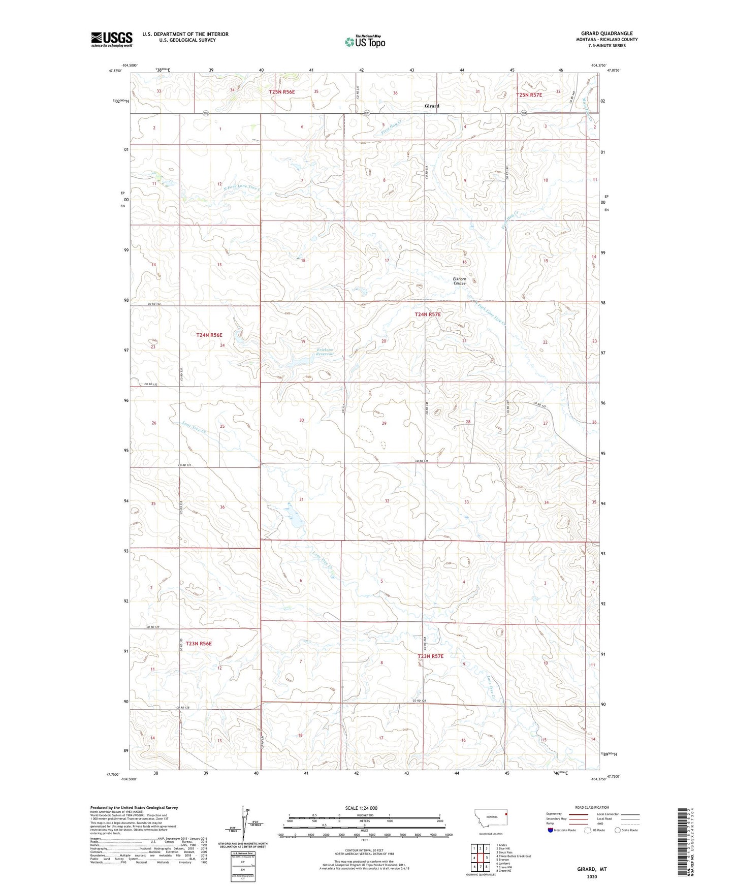
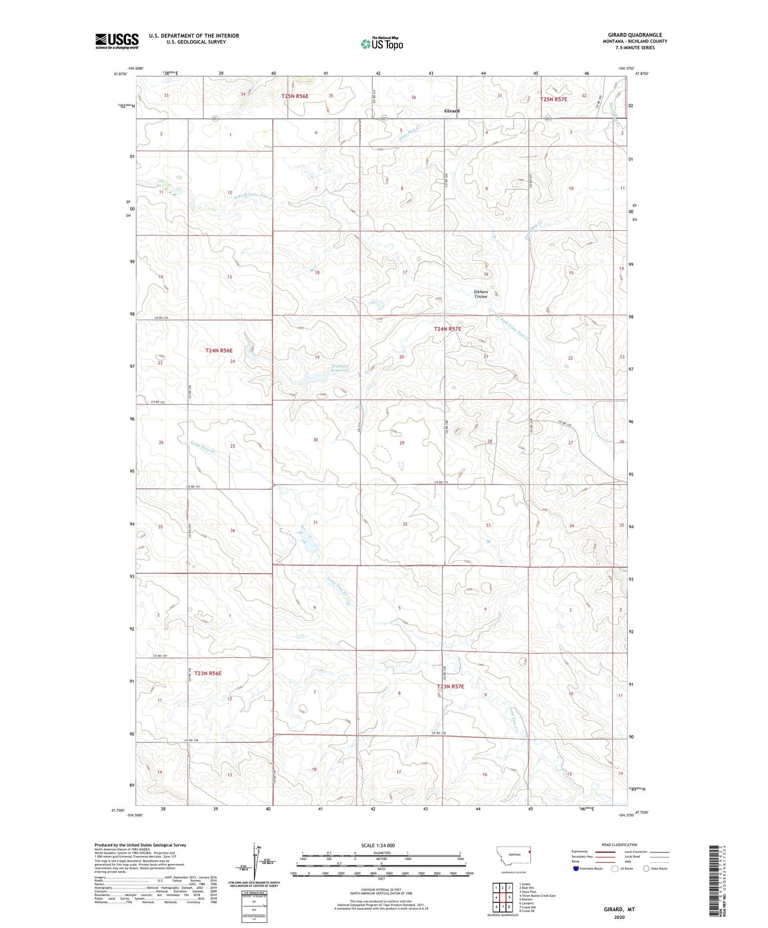
2020 topographic map quadrangle Girard in the state of Montana. Scale: 1:24000. Based on the newly updated USGS 7.5' US Topo map series, this map is in the following counties: Richland. The map contains contour data, water features, and other items you are used to seeing on USGS maps, but also has updated roads and other features. This is the next generation of topographic maps. Printed on high-quality waterproof paper with UV fade-resistant inks.
Quads adjacent to this one:
West: Three Buttes Creek East
Northwest: Andes
North: Blue Hill
Northeast: Sioux Pass
East: Brorson
Southeast: Crane NE
South: Crane NW
Southwest: Lambert
Contains the following named places: 21N57E31DDCD01 Well, 24N56E25DDAC01 Well, 24N57E21DD__01 Well, 24N57E21DDAA01 Well, 24N57E32CBBB01 Well, Elkhorn Coulee, Erickson Dam, Erickson Reservoir, Girard, Girard Post Office, Girard School, Gladowski Dam, JJJJ Ross Dam