MyTopo
Lake McDonald East Montana US Topo Map
Couldn't load pickup availability
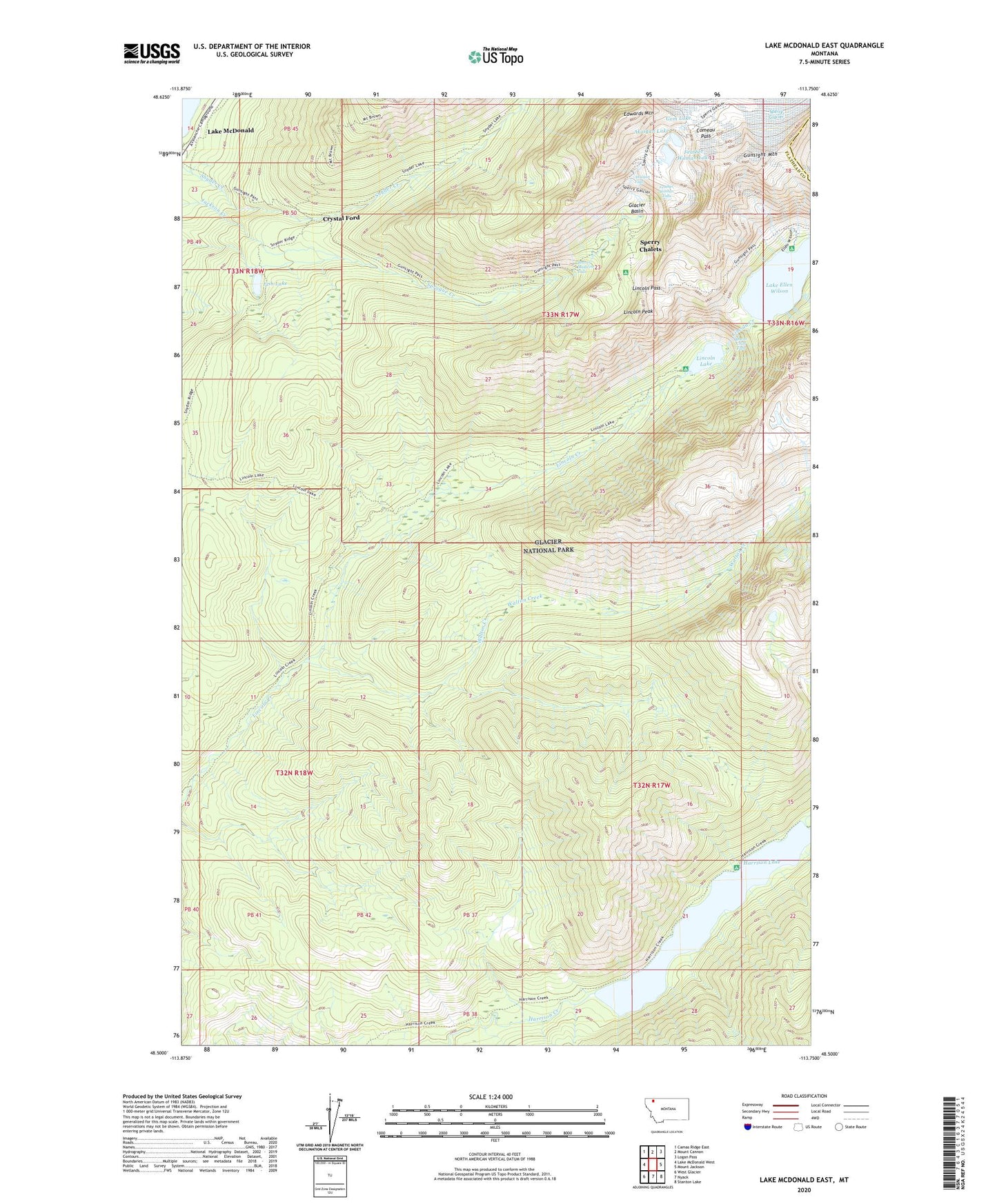
2020 topographic map quadrangle Lake McDonald East in the state of Montana. Scale: 1:24000. Based on the newly updated USGS 7.5' US Topo map series, this map is in the following counties: Flathead, Glacier. The map contains contour data, water features, and other items you are used to seeing on USGS maps, but also has updated roads and other features. This is the next generation of topographic maps. Printed on high-quality waterproof paper with UV fade-resistant inks.
Quads adjacent to this one:
West: Lake McDonald West
Northwest: Camas Ridge East
North: Mount Cannon
Northeast: Logan Pass
East: Mount Jackson
Southeast: Stanton Lake
South: Nyack
Southwest: West Glacier
Contains the following named places: Akaiyan Falls, Akaiyan Lake, Beaver Chief Falls, Beaver Medicine Falls, Comeau Pass, Crystal Ford, Edwards Mountain, Feather Woman Falls, Feather Woman Lake, Fish Lake, Gem Lake, Glacier Basin, Gunsight Mountain, Gunsight Pass Trail, Harrison Lake, Lake Ellen Wilson, Lake McDonald, Lake McDonald Post Office, Lincoln Lake, Lincoln Lake Trail, Lincoln Pass, Lincoln Peak, Midget Creek, Mount Brown Lookout Trail, Snyder Lake Trail, Snyder Ridge Trail, Sperry Chalets, Sperry Glacier, Walton Creek