MyTopo
Nevada Mountain Montana US Topo Map
Couldn't load pickup availability
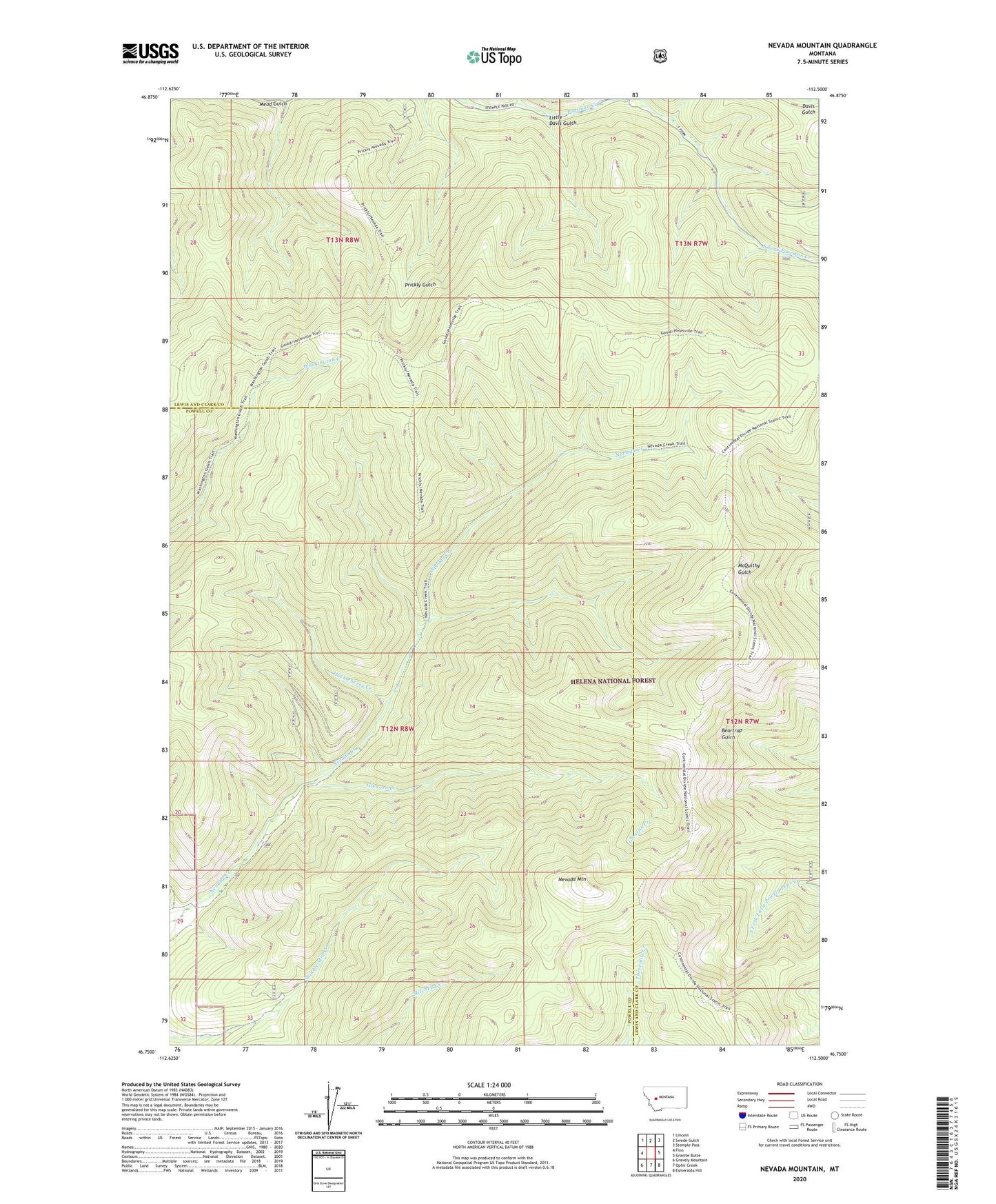
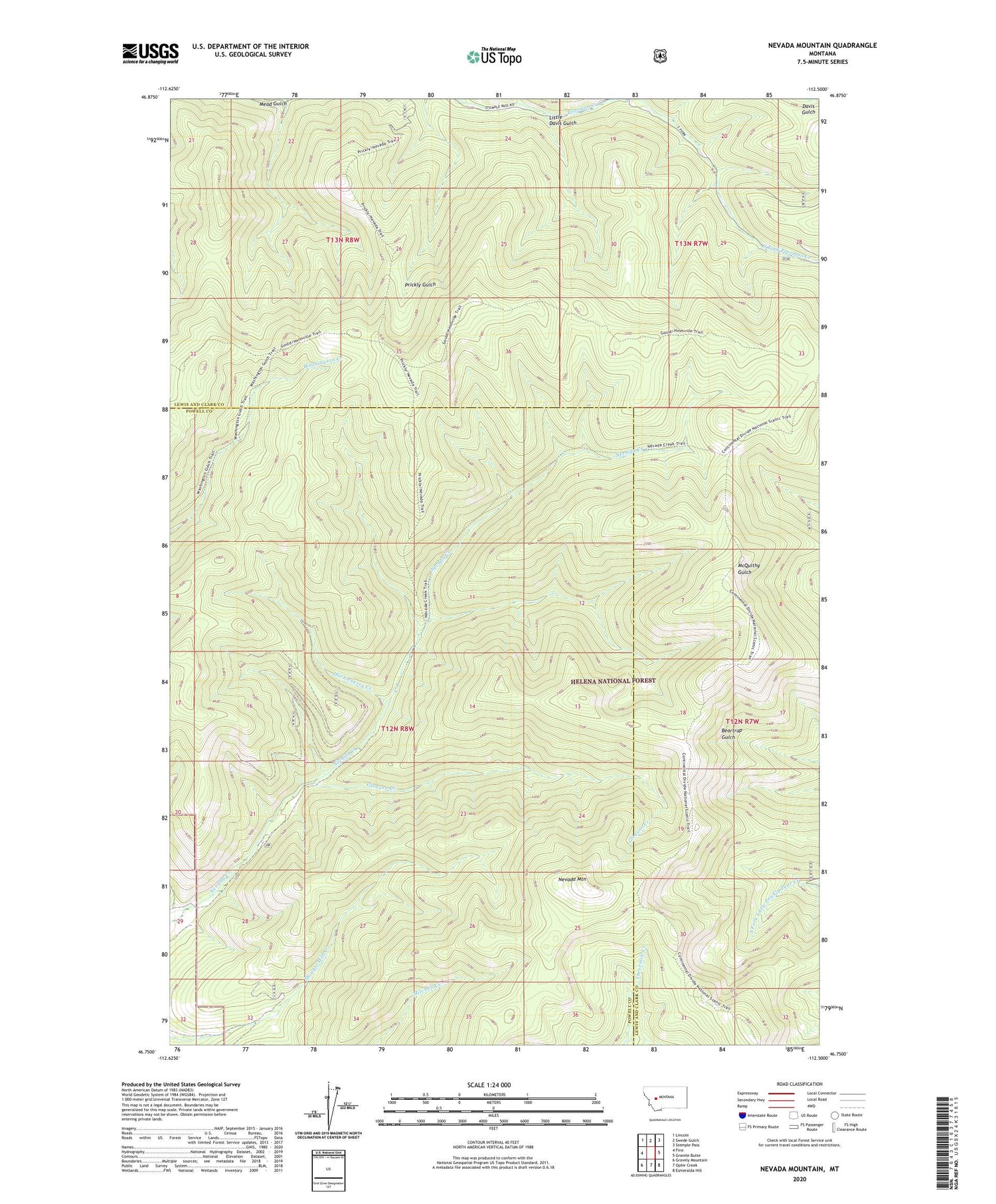
2020 topographic map quadrangle Nevada Mountain in the state of Montana. Scale: 1:24000. Based on the newly updated USGS 7.5' US Topo map series, this map is in the following counties: Lewis and Clark, Powell. The map contains contour data, water features, and other items you are used to seeing on USGS maps, but also has updated roads and other features. This is the next generation of topographic maps. Printed on high-quality waterproof paper with UV fade-resistant inks.
Quads adjacent to this one:
West: Finn
Northwest: Lincoln
North: Swede Gulch
Northeast: Stemple Pass
East: Granite Butte
Southeast: Esmeralda Hill
South: Ophir Creek
Southwest: Gravely Mountain
Contains the following named places: Cyclone Mine, Fish Creek/Electrum Mine, Gleason Creek, Gould Helmville Trail, Helena National Forest, Highland Mine, Huckleberry Creek, Little Davis Gulch, Mead Gulch, Middle Fork Millsite, NE NW Section 32 Mine, Nevada Mountain, NW NE Section 32 Mine, South Fork Poorman Creek, SW NW Section 28 Mine