MyTopo
Plentywood SW Montana US Topo Map
Couldn't load pickup availability
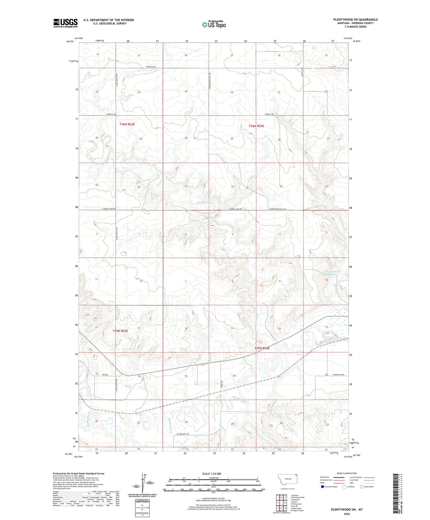
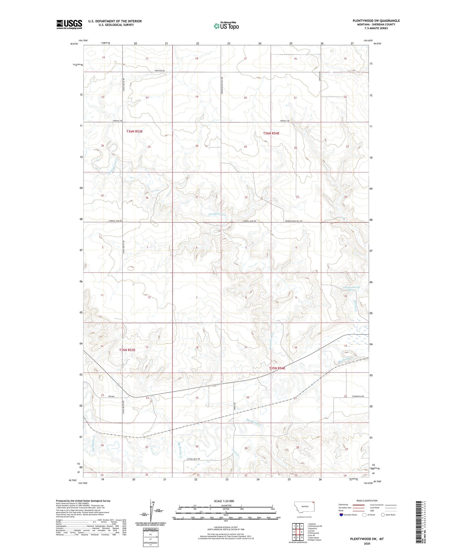
2020 topographic map quadrangle Plentywood SW in the state of Montana. Scale: 1:24000. Based on the newly updated USGS 7.5' US Topo map series, this map is in the following counties: Sheridan. The map contains contour data, water features, and other items you are used to seeing on USGS maps, but also has updated roads and other features. This is the next generation of topographic maps. Printed on high-quality waterproof paper with UV fade-resistant inks.
Quads adjacent to this one:
West: Archer
Northwest: Outlook
North: Plentywood NW
Northeast: Raymond
East: Plentywood
Southeast: Shippe Canyon
South: Kisler Butte
Southwest: Soo NE
Contains the following named places: 35N53E01AD__01 Well, 35N53E01ADCC01 Well, 35N53E25DDCC01 Well, 35N54E05ABDB01 Well, 35N54E10ACAB01 Well, 35N54E10ACCA01 Spring, 35N54E20CCAA01 Well, 36N54E34CDDD01 Well, 59254, Ford Creek, Hamley School, Midby, Midby Post Office, Nickerson School, Olson School, Plentywood Bench Lutheran Church, Plentywood Creek, Plentywood Division, Sloneker School