MyTopo
Porcupine Creek Montana US Topo Map
Couldn't load pickup availability
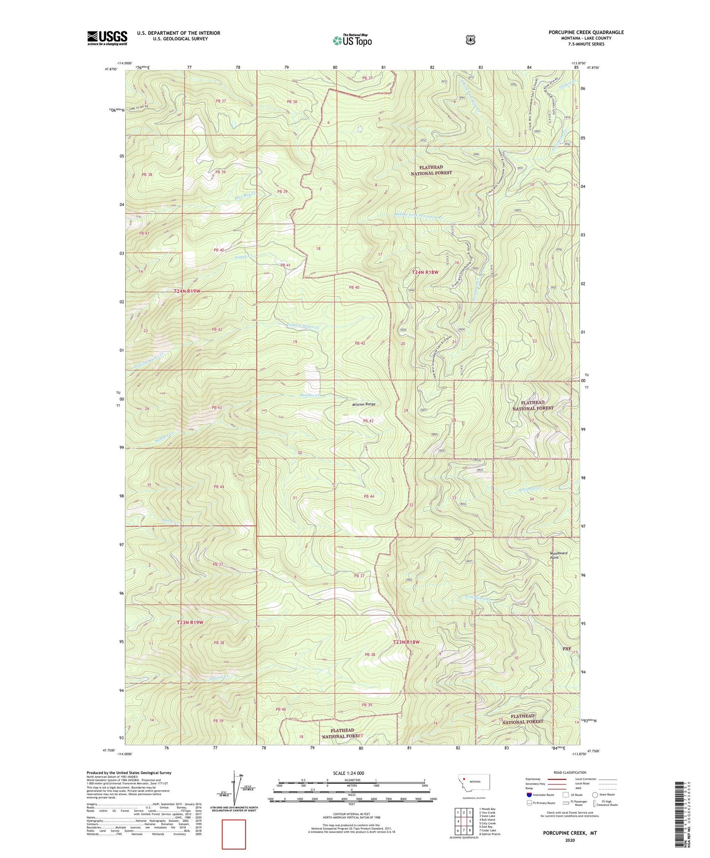
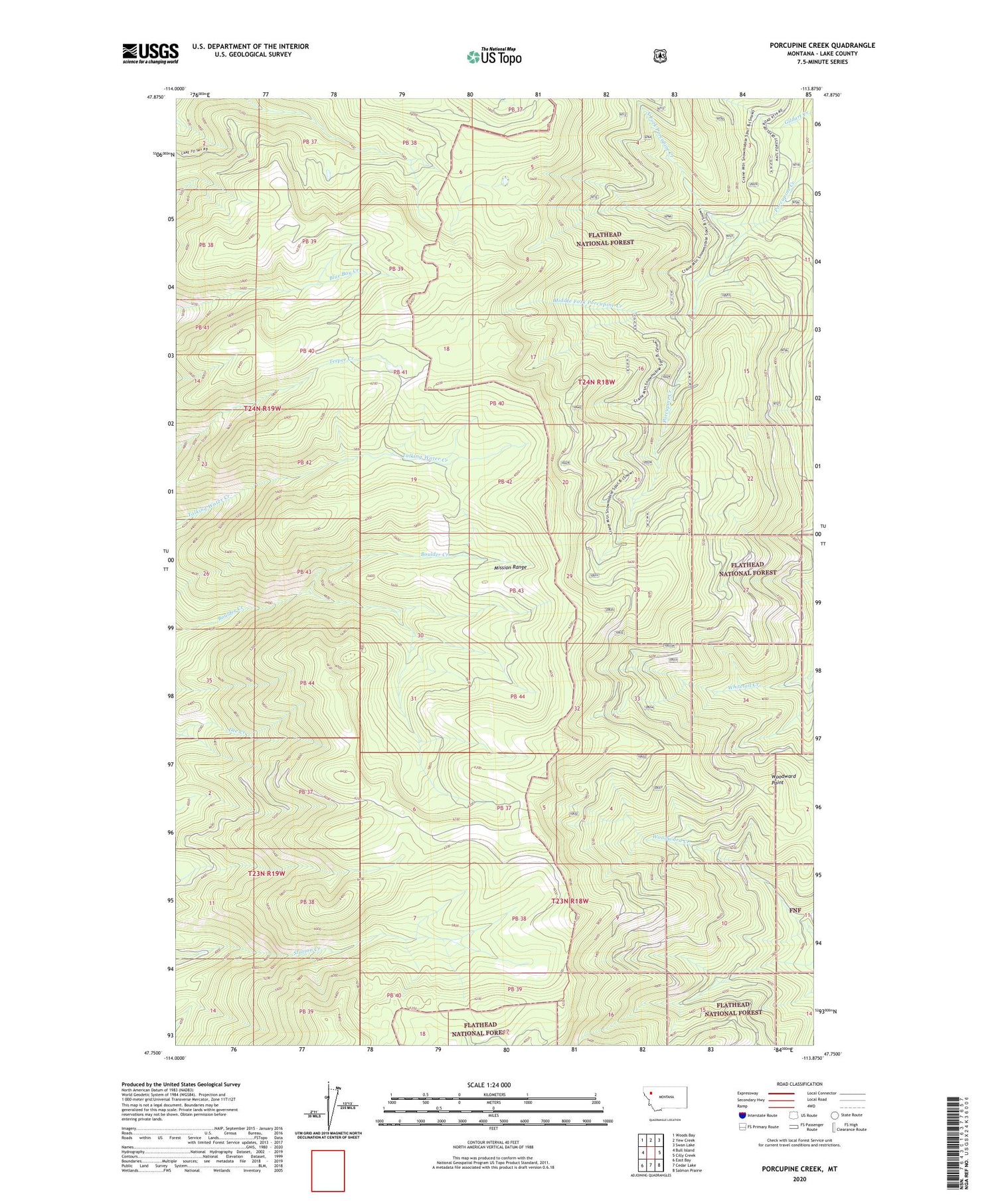
2020 topographic map quadrangle Porcupine Creek in the state of Montana. Scale: 1:24000. Based on the newly updated USGS 7.5' US Topo map series, this map is in the following counties: Lake. The map contains contour data, water features, and other items you are used to seeing on USGS maps, but also has updated roads and other features. This is the next generation of topographic maps. Printed on high-quality waterproof paper with UV fade-resistant inks.
Quads adjacent to this one:
West: Bull Island
Northwest: Woods Bay
North: Yew Creek
Northeast: Swan Lake
East: Cilly Creek
Southeast: Salmon Prairie
South: Cedar Lake
Southwest: East Bay
Contains the following named places: Middle Fork Porcupine Creek, North Fork Porcupine Creek, Swan River State Forest, Woods Bay-Rollins Division, Woodward Point