MyTopo
Red Lodge East Montana US Topo Map
Couldn't load pickup availability
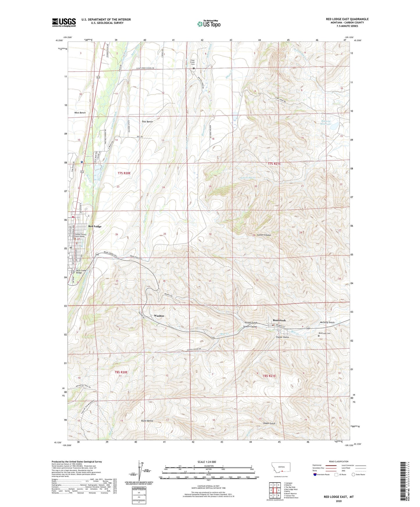
2020 topographic map quadrangle Red Lodge East in the state of Montana. Scale: 1:24000. Based on the newly updated USGS 7.5' US Topo map series, this map is in the following counties: Carbon. The map contains contour data, water features, and other items you are used to seeing on USGS maps, but also has updated roads and other features. This is the next generation of topographic maps. Printed on high-quality waterproof paper with UV fade-resistant inks.
Quads adjacent to this one:
West: Red Lodge West
Northwest: Castagne
North: Roberts
Northeast: The Big Slide
East: Belfry
Southeast: Hollenbeck Draw
South: Tolman Flat
Southwest: Mount Maurice
Contains the following named places: 07S20E02CCAD01 Well, 07S21E06CAAA01 Well, 07S21E15BACD01 Well, Adventist Church, Amalgamated, Bearcreek, Bearcreek Cemetery, Bearcreek Post Office, Bearcreek School, Bearcreek Volunteer Fire Department, Beartooth Billings Clinic, Beartooth Grain and Feed Elevator, Beartooth Nature Center, Becks Alpine Motel Campground, Bidstrip Reservoir, Big Engine Bridge, Brophy Mine, Burns Mine, Caledonia, Calvary Episcopal Church, Carbon County Court House, Carbon County Sheriff's Office, Cartwright Ditch, Cedar Wood Villa, Central School, Christian Life Assembly of God Church, Clear Creek Cemetery, Clear Creek School, Coal Miners Memorial Park, Depot Park, Dry Creek School, Eagle, Field School, Field School Park, Finnish Evangelical Lutheran Church, Finntown Park, Foster, Foster Gulch, Foster Mine, Gateway Baptist Church, Horsethief Recreation Site, Horsethief Sportsman Access, International, KAFM-FM (Red Lodge), Knowlton Creek, Lincoln School, Liver-Eating Johnston Park, McCarthy, McCarty Gulch, Mountain View School, Mountain View Trailer Court, North Fork Red Lodge Reservoir Dam, Pleasant Valley Canal, Pride Park, Red Lodge, Red Lodge Alliance Chapel, Red Lodge Ambulance, Red Lodge Baptist Church, Red Lodge Carnegie Library, Red Lodge Community Church, Red Lodge Country Historical Marker, Red Lodge High School, Red Lodge KOA Kampground, Red Lodge Police Department, Red Lodge Post Office, Red Lodge Rural Fire District 7 Red Lodge Fire Rescue, Robinsons Trailer Park, Rock Creek Bridge, Rock Creek Clear Creek Ditch, Rock Creek Park, Roosevelt Middle School, Rosetta Creek, Ruler Bench, Saint Agnes Catholic Church, Saint Lukes English Lutheran Church, Scotch Coulee, Smith, Smith Mine, Smith Mine Disaster Historical Marker, Snake Gulch, South Side Public School, Swimming Pool Park, Town of Bearcreek, Virtue Gulch, Visitors Center Park, Washoe, Washoe Post Office, Washoe School