MyTopo
Sloan Montana US Topo Map
Couldn't load pickup availability
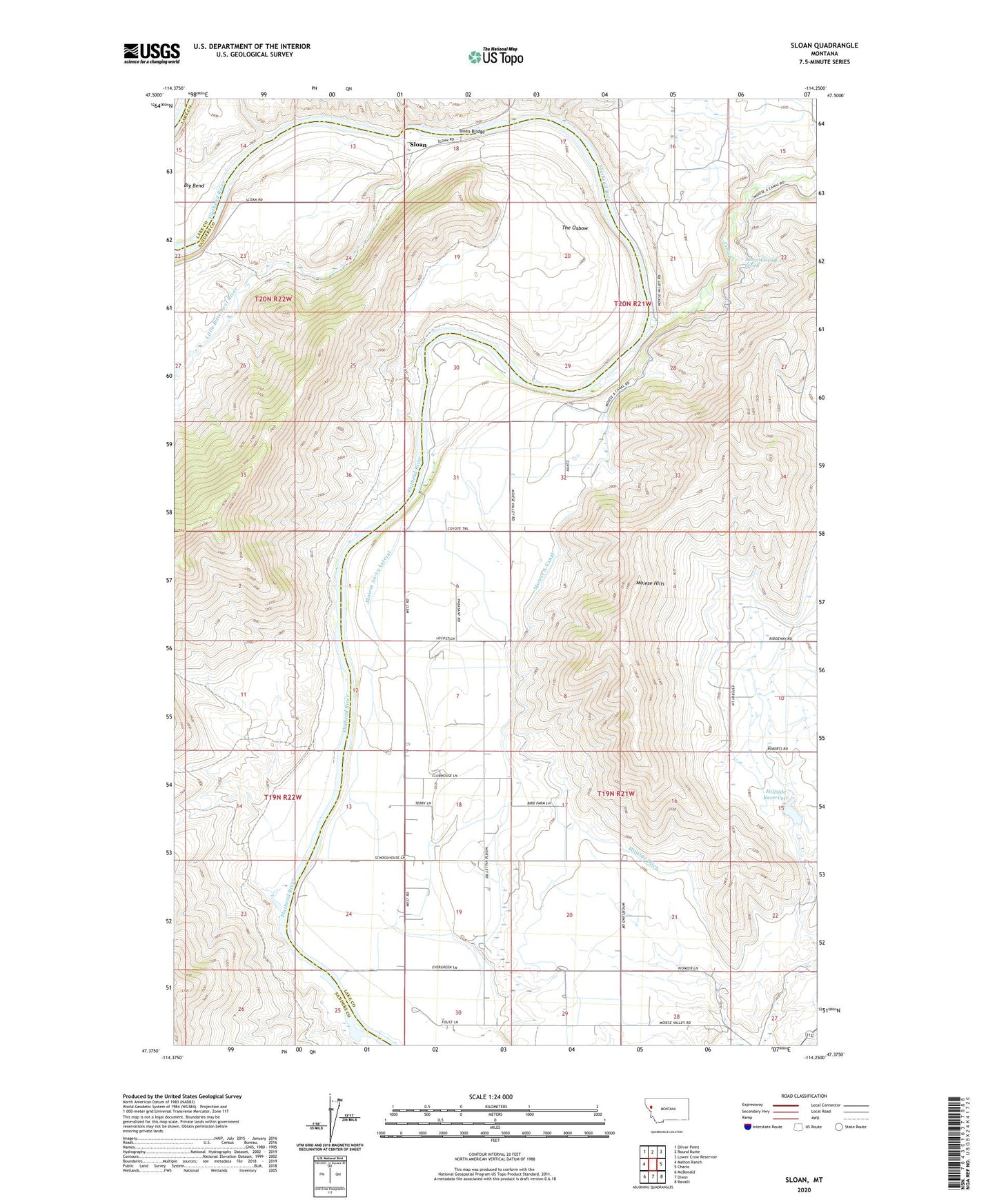
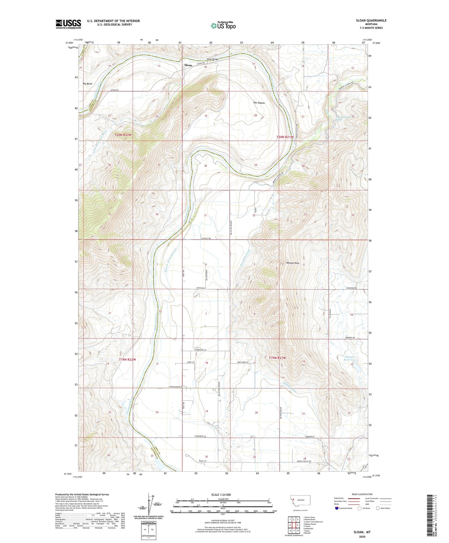
2020 topographic map quadrangle Sloan in the state of Montana. Scale: 1:24000. Based on the newly updated USGS 7.5' US Topo map series, this map is in the following counties: Lake, Sanders. The map contains contour data, water features, and other items you are used to seeing on USGS maps, but also has updated roads and other features. This is the next generation of topographic maps. Printed on high-quality waterproof paper with UV fade-resistant inks.
Quads adjacent to this one:
West: Melton Ranch
Northwest: Oliver Point
North: Round Butte
Northeast: Lower Crow Reservoir
East: Charlo
Southeast: Ravalli
South: Dixon
Southwest: McDonald
Contains the following named places: 19N21W06ADDB01 Well, 19N21W06BBB_01 Well, 19N21W06BDD_01 Well, 19N21W06CCBC01 Well, 19N21W06DBCC01 Well, 19N21W17BCBB01 Well, 19N21W18BBDA01 Well, 19N21W19ABA_01 Well, 19N21W30ADCD01 Well, 20N21W21CAB_01 Spring, Big Bend, Crow Creek, Hillside Dam, Hillside Ditch, Hillside Reservoir, Little Bitterroot River, Moiese 30-13 Lateral, Moiese A Canal, Moiese A-30 Lateral, Moiese Bible Church, Moiese Camp, Moiese Hills, Moiese School, Sloan, Sloan Bridge, Sloan Post Office, The Oxbow