MyTopo
Three Buttes Montana US Topo Map
Couldn't load pickup availability
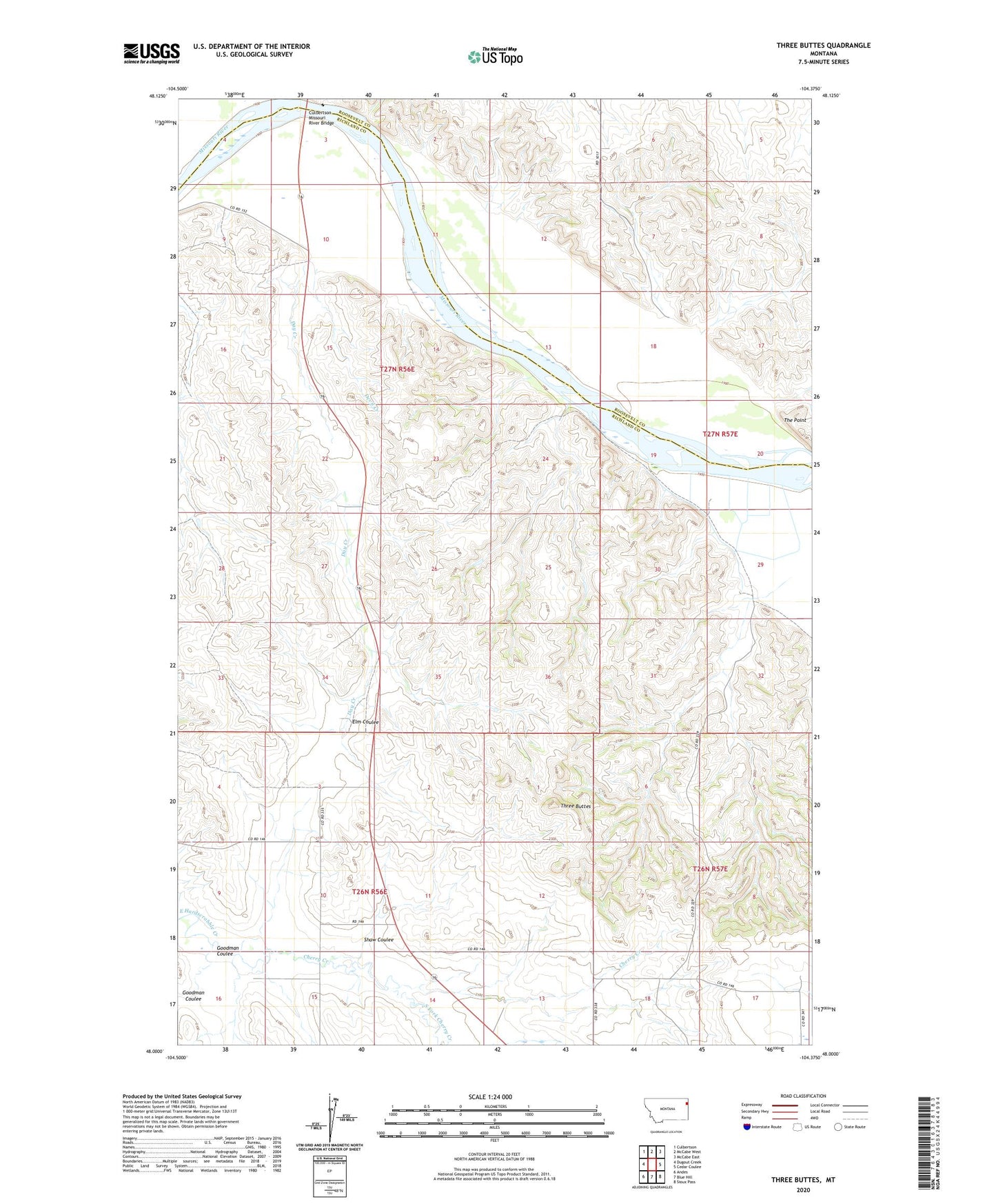
2020 topographic map quadrangle Three Buttes in the state of Montana. Scale: 1:24000. Based on the newly updated USGS 7.5' US Topo map series, this map is in the following counties: Richland, Roosevelt. The map contains contour data, water features, and other items you are used to seeing on USGS maps, but also has updated roads and other features. This is the next generation of topographic maps. Printed on high-quality waterproof paper with UV fade-resistant inks.
Quads adjacent to this one:
West: Dugout Creek
Northwest: Culbertson
North: McCabe West
Northeast: McCabe East
East: Cedar Coulee
Southeast: Sioux Pass
South: Blue Hill
Southwest: Andes
Contains the following named places: 26N56E16AADA01 Well, 26N57E17ADAA01 Well, 27N56E03CCA_01 Well, 27N56E10CC__01 Well, 27N56E15BB__01 Well, 27N56E22BB__01 Well, 27N56E22DC__01 Well, 27N56E22DC__02 Well, 27N56E22DCBD01 Well, 27N56E22DD__01 Well, 27N56E34AABC01 Well, 27N57E07BDCA01 Well, 27N57E18AB__01 Well, 27N57E19DC__01 Well, 27N57E19DCBD01 Well, 27N57E29AD__01 Well, 27N57E32BACD01 Well, 27N57E32BACD02 Well, 27N57E32BC__01 Well, 27N57E32BC__02 Well, Cherry Creek, Culbertson Bridge Fishing Access Site, Culbertson Missouri River Bridge, Day Creek, Devil Creek, Elm Coulee, Goodman Coulee, Shaw Coulee, South Fork Cherry Creek, The Point, Three Buttes