MyTopo
West Glacier Montana US Topo Map
Couldn't load pickup availability
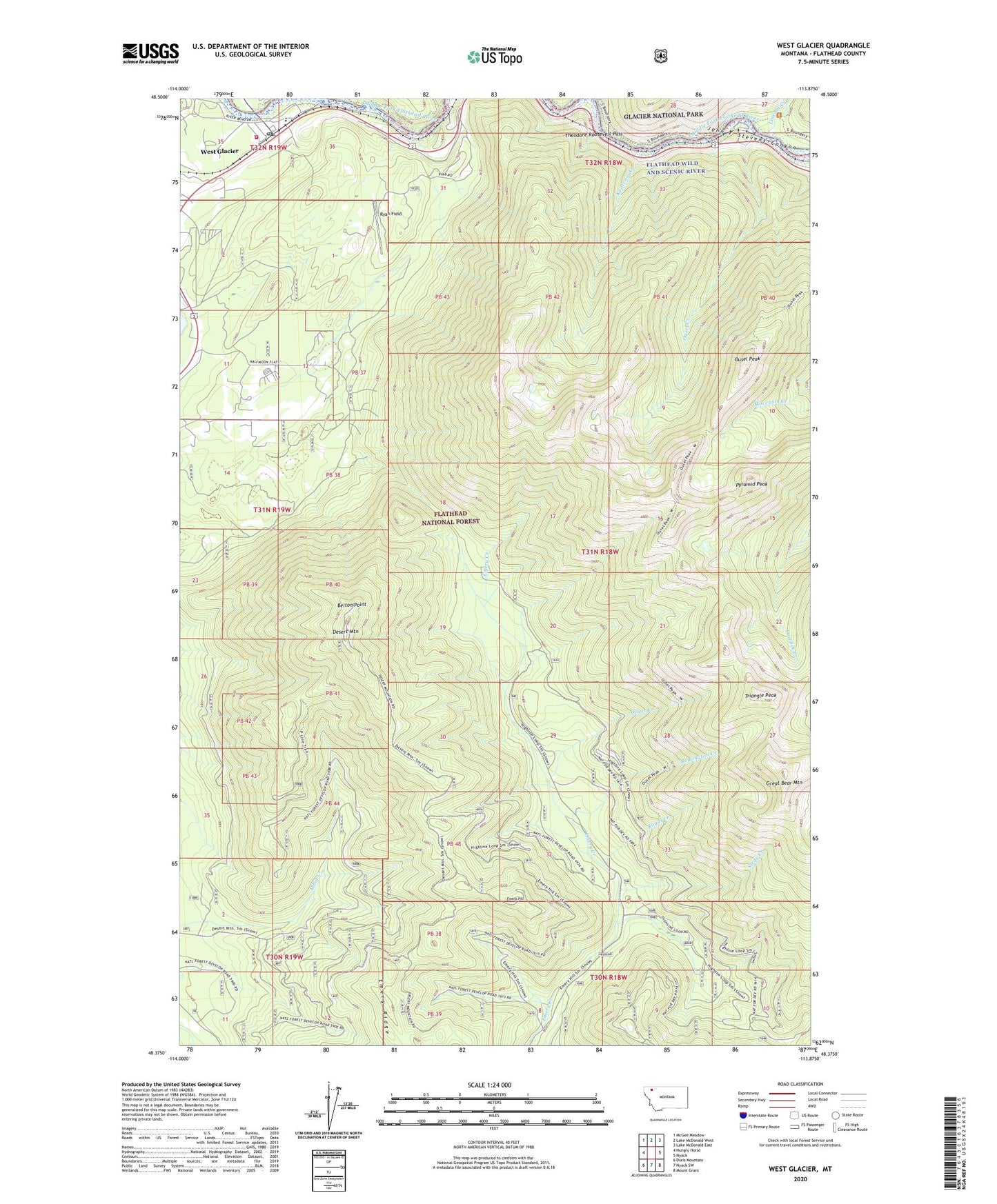
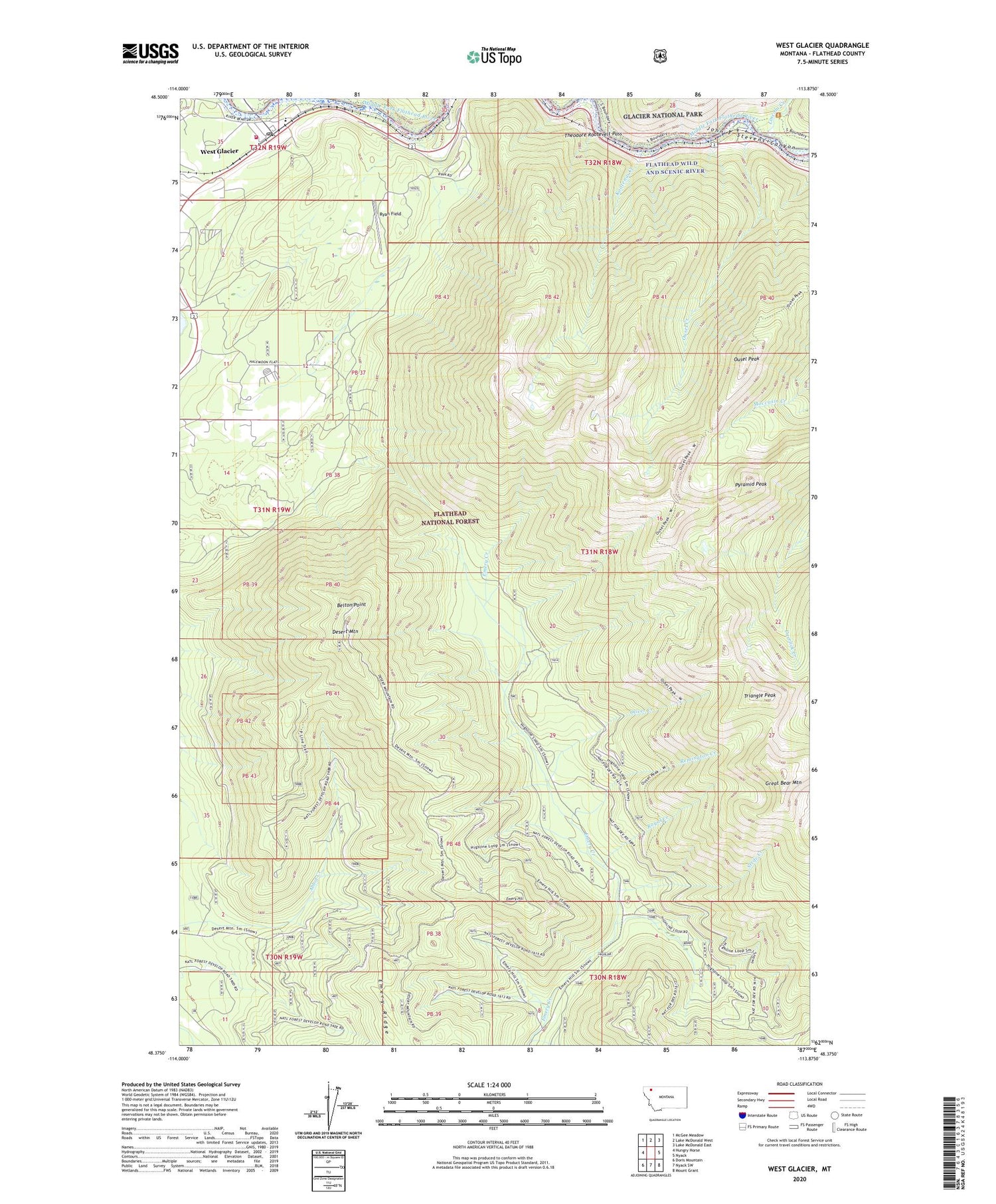
2020 topographic map quadrangle West Glacier in the state of Montana. Scale: 1:24000. Based on the newly updated USGS 7.5' US Topo map series, this map is in the following counties: Flathead. The map contains contour data, water features, and other items you are used to seeing on USGS maps, but also has updated roads and other features. This is the next generation of topographic maps. Printed on high-quality waterproof paper with UV fade-resistant inks.
Quads adjacent to this one:
West: Hungry Horse
Northwest: McGee Meadow
North: Lake McDonald West
Northeast: Lake McDonald East
East: Nyack
Southeast: Mount Grant
South: Nyack SW
Southwest: Doris Mountain
Contains the following named places: Belton, Belton Point, Coram - West Glacier Volunteer Fire Department, Coram Experimental Forest, Desert Mountain, Emery Hill, Emery Ridge, Great Bear Mountain, John F Stevens Canyon, Kootenai Creek, Lincoln Creek, Oliver Creek, Ousel Creek, Ousel Peak, Ousel Peak Trail, Pyramid Peak, Remington Creek, Royal Creek, Ryan Field, Silvertip, Strife Creek, Triangle Peak, West Glacier, West Glacier Census Designated Place, West Glacier Post Office, West Glacier School, ZIP Code: 59913