
MyTopo
Ainsworth NW Nebraska US Topo Map
Couldn't load pickup availability
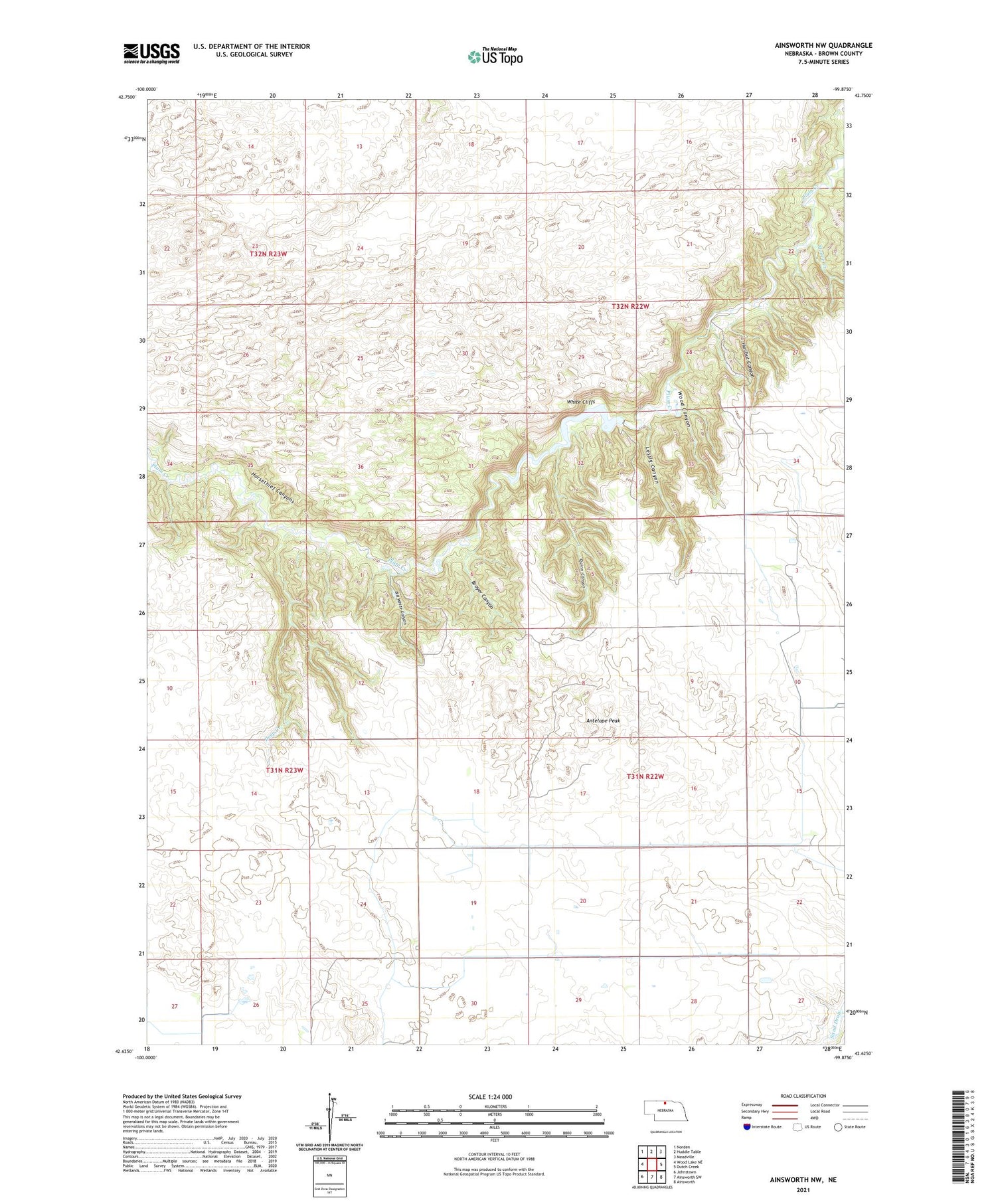
2021 topographic map quadrangle Ainsworth NW in the state of Nebraska. Scale: 1:24000. Based on the newly updated USGS 7.5' US Topo map series, this map is in the following counties: Brown. The map contains contour data, water features, and other items you are used to seeing on USGS maps, but also has updated roads and other features. This is the next generation of topographic maps. Printed on high-quality waterproof paper with UV fade-resistant inks.
Quads adjacent to this one:
West: Wood Lake NE
Northwest: Norden
North: Huddle Table
Northeast: Meadville
East: Dutch Creek
Southeast: Ainsworth
South: Ainsworth SW
Southwest: Johnstown
Contains the following named places: Antelope Peak, Bill White Canyon, Bobcat State Wildlife Management Area, Broyer Canyon, C Keim Ranch, Deep Creek, Horsethief Canyons, Hurlbut Canyon, Lessig Canyon, Moore Creek, Pine Canyon Dam, Pine Canyon Reservoir, Quinn Canyon, R Keim Ranch, School Number 18, School Number 23, School Number 24, White Cliffs, Wood Canyon


