MyTopo
Bridgeport NW Nebraska US Topo Map
Couldn't load pickup availability
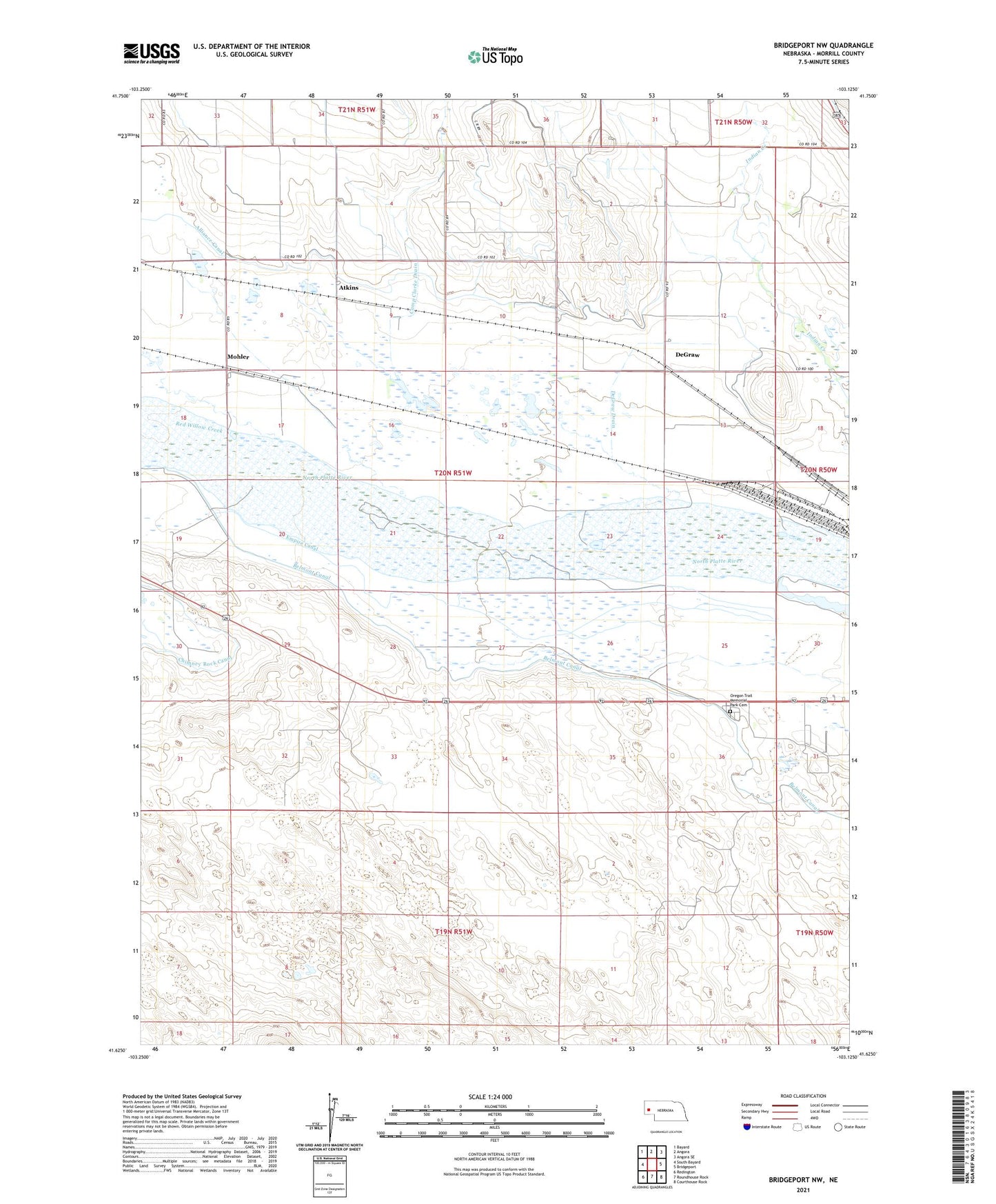
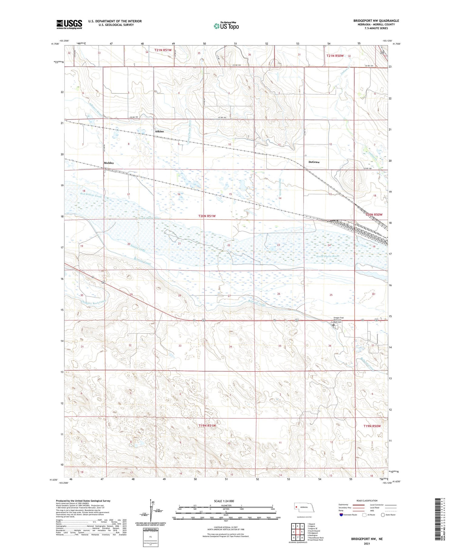
2021 topographic map quadrangle Bridgeport NW in the state of Nebraska. Scale: 1:24000. Based on the newly updated USGS 7.5' US Topo map series, this map is in the following counties: Morrill. The map contains contour data, water features, and other items you are used to seeing on USGS maps, but also has updated roads and other features. This is the next generation of topographic maps. Printed on high-quality waterproof paper with UV fade-resistant inks.
Quads adjacent to this one:
West: South Bayard
Northwest: Bayard
North: Angora
Northeast: Angora SE
East: Bridgeport
Southeast: Courthouse Rock
South: Roundhouse Rock
Southwest: Redington
Contains the following named places: Alliance Canal, Atkins, Belmont Canal, Belmont Dam, Belmont Diversion Dam, Belmont Diversion Reservoir, Camp Clarke Bridge and Sidney - Black Hills Trail Historical Marker, Camp Clarke Drain, DeGraw, DeGraw Drain, Dunlap Oil Field, Empire Canal, Hill School Number 44, Lapaseotes Feedyard, Mohler, Oregon Trail Memorial Park Cemetery, Red Willow Creek, West Camp Clarke Election Precinct, West School Number 44, ZIP Code: 69336