MyTopo
Bridgeport Nebraska US Topo Map
Couldn't load pickup availability
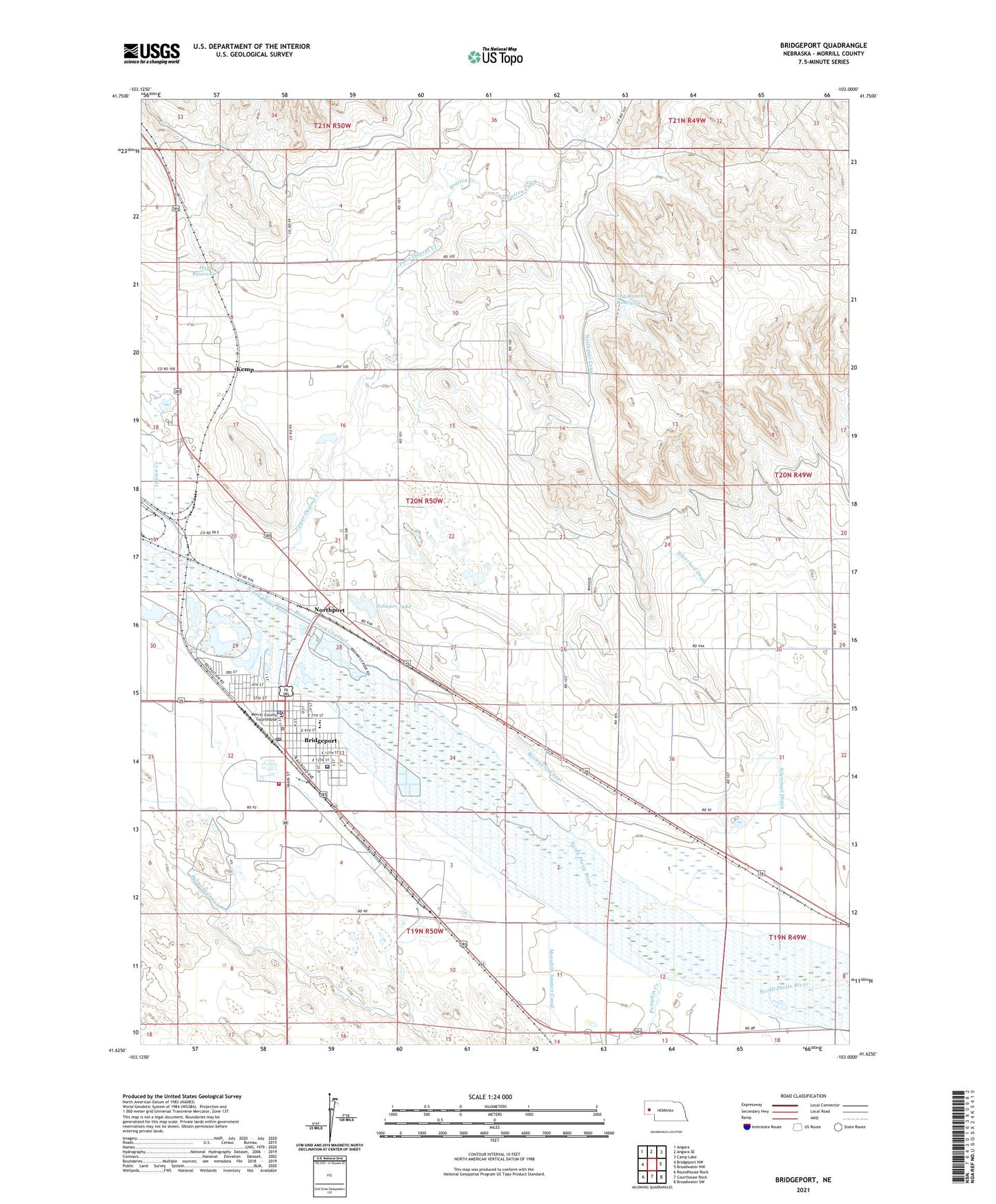
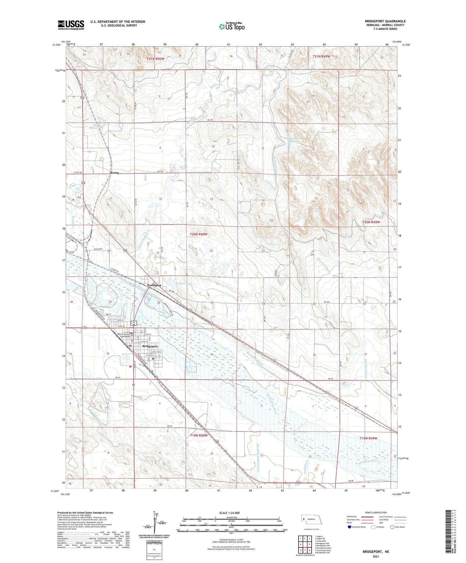
2021 topographic map quadrangle Bridgeport in the state of Nebraska. Scale: 1:24000. Based on the newly updated USGS 7.5' US Topo map series, this map is in the following counties: Morrill. The map contains contour data, water features, and other items you are used to seeing on USGS maps, but also has updated roads and other features. This is the next generation of topographic maps. Printed on high-quality waterproof paper with UV fade-resistant inks.
Quads adjacent to this one:
West: Bridgeport NW
Northwest: Angora
North: Angora SE
Northeast: Camp Lake
East: Broadwater NW
Southeast: Broadwater SW
South: Courthouse Rock
Southwest: Roundhouse Rock
Contains the following named places: All Souls Catholic Church, Bratten Creek, Bricker Lakes, Bridgeport, Bridgeport Camping Area, Bridgeport City Police Department, Bridgeport Elementary School, Bridgeport High School, Bridgeport Post Office, Bridgeport Public Library, Bridgeport Rural Fire District 1, Bridgeport State Recreational Area, Browns Creek Channel, Church of Christ, City of Bridgeport, Faith Baptist Church, First Baptist Church, First Presbyterian Church, Gebauer Lake, Golden Acres Motel and RV Park, Good Shepherd Episcopal Church, Hall Dam, Hall Reservoir, Heritage of Bridgeport, Indian Creek, Kemp, King Ranch Dam, King Ranch Reservoir, Kingdom Hall of Jehovahs Witnesses, Lakeview Mobile Park, Meredith Canal, Morrill County, Morrill County Community Hospital, Morrill County Courthouse, Morrill County Fairgrounds, Morrill County Medical Center, Morrill County Sheriff, Morrill County Sheriffs Office, New Life Assembly of God Church, North Camp Clarke Election Precinct, Northport, Northport Census Designated Place, Northport Post Office, Pioneer Trails Museum, Post Medical Clinic, Prairie Winds Community Center, Pumpkin Creek, Saint Pauls Lutheran Church, School Number 1, School Number 6, Towers, Trinidad Bean and Elevator Company Elevator, Upper Dugout Creek