MyTopo
Dalton Nebraska US Topo Map
Couldn't load pickup availability
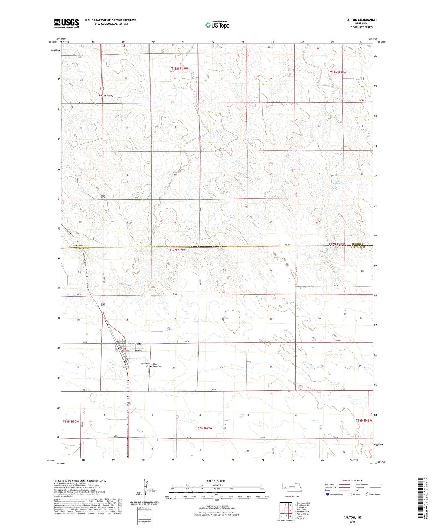
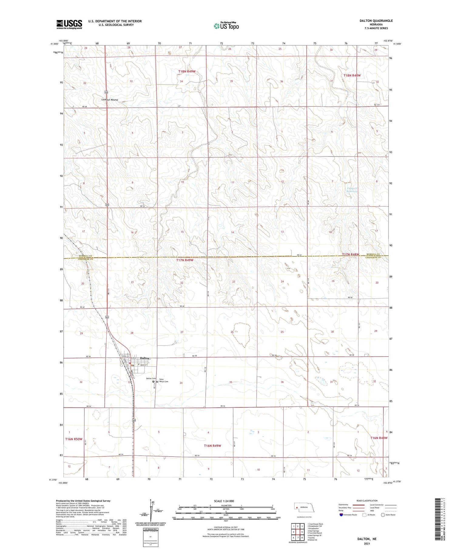
2021 topographic map quadrangle Dalton in the state of Nebraska. Scale: 1:24000. Based on the newly updated USGS 7.5' US Topo map series, this map is in the following counties: Morrill, Cheyenne. The map contains contour data, water features, and other items you are used to seeing on USGS maps, but also has updated roads and other features. This is the next generation of topographic maps. Printed on high-quality waterproof paper with UV fade-resistant inks.
Quads adjacent to this one:
West: Mud Springs
Northwest: Courthouse Rock
North: Broadwater SW
Northeast: Broadwater
East: Fairchild Ranch
Southeast: Dalton SE
South: Gurley
Southwest: Mud Springs SE
Contains the following named places: Assembly of God Church, Camp Creek Dam, Camp Creek Reservoir, Camp Lake, Crossroads Cooperative Association Elevator, Dalton, Dalton Cemetery, Dalton Medical Clinic, Dalton Post Office, Dalton Public Library, Dalton Volunteer Fire Department, Leyton High School, Lookout Mound, North School Number 28, Prairie Schooner Museum, Presbyterian Church, Saint Marys Catholic Church, Saint Marys Cemetery, Trinity Lutheran Church, Union Valley Election Precinct, Village of Dalton, ZIP Code: 69131