MyTopo
Grant Nebraska US Topo Map
Couldn't load pickup availability
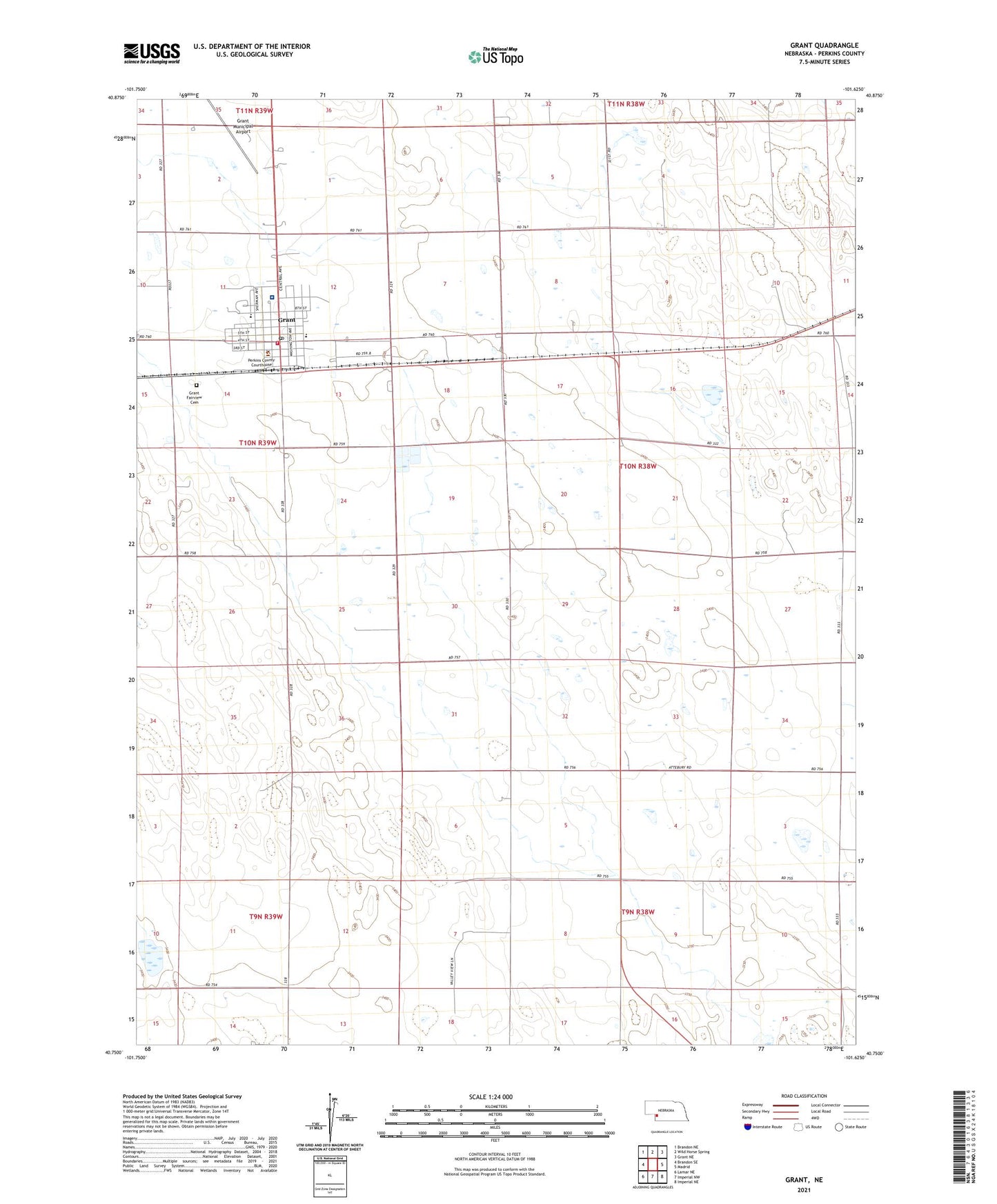
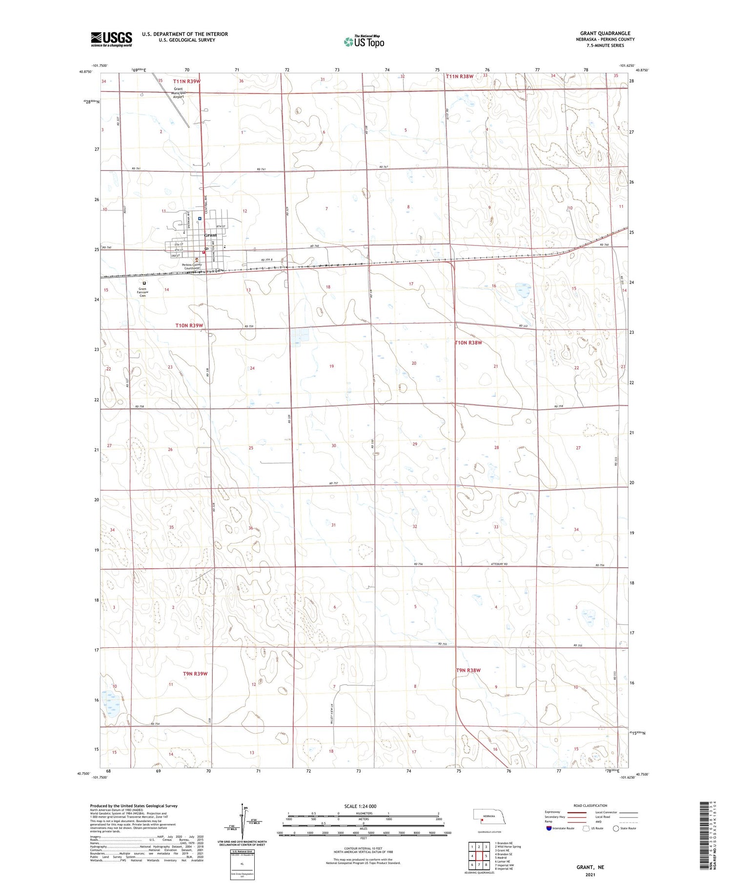
2021 topographic map quadrangle Grant in the state of Nebraska. Scale: 1:24000. Based on the newly updated USGS 7.5' US Topo map series, this map is in the following counties: Perkins. The map contains contour data, water features, and other items you are used to seeing on USGS maps, but also has updated roads and other features. This is the next generation of topographic maps. Printed on high-quality waterproof paper with UV fade-resistant inks.
Quads adjacent to this one:
West: Brandon SE
Northwest: Brandon NE
North: Wild Horse Spring
Northeast: Grant NE
East: Madrid
Southeast: Imperial NE
South: Imperial NW
Southwest: Lamar NE
Contains the following named places: City of Grant, Colglazier Medical Office, Congregational UCC Church, Eckery Election Precinct, Election District 2, Golden Ours Convalescent Home, Golden Plains Church, Golden Plains Church of God in Christ, Grant, Grant Co-op Exchange Elevator, Grant Elementary and Junior High School, Grant Evangelical Free Church, Grant Fairview Cemetery, Grant High School, Grant Medical Clinic, Grant Motel and RV Park, Grant Municipal Airport, Grant Post Office, Grant Volunteer Fire Department, Hastings Memorial Library, Mother of Sorrows Catholic Church, New Life Fellowship Church, Perkins County, Perkins County Ambulance Service, Perkins County Christian Elementary School, Perkins County Community Hospital, Perkins County Courthouse, Perkins County Sheriffs Office, Perkins County Sheriff's Office, Triple C Trailer Court, United Methodist Church, Zion Lutheran Church