MyTopo
McCook East Nebraska US Topo Map
Couldn't load pickup availability
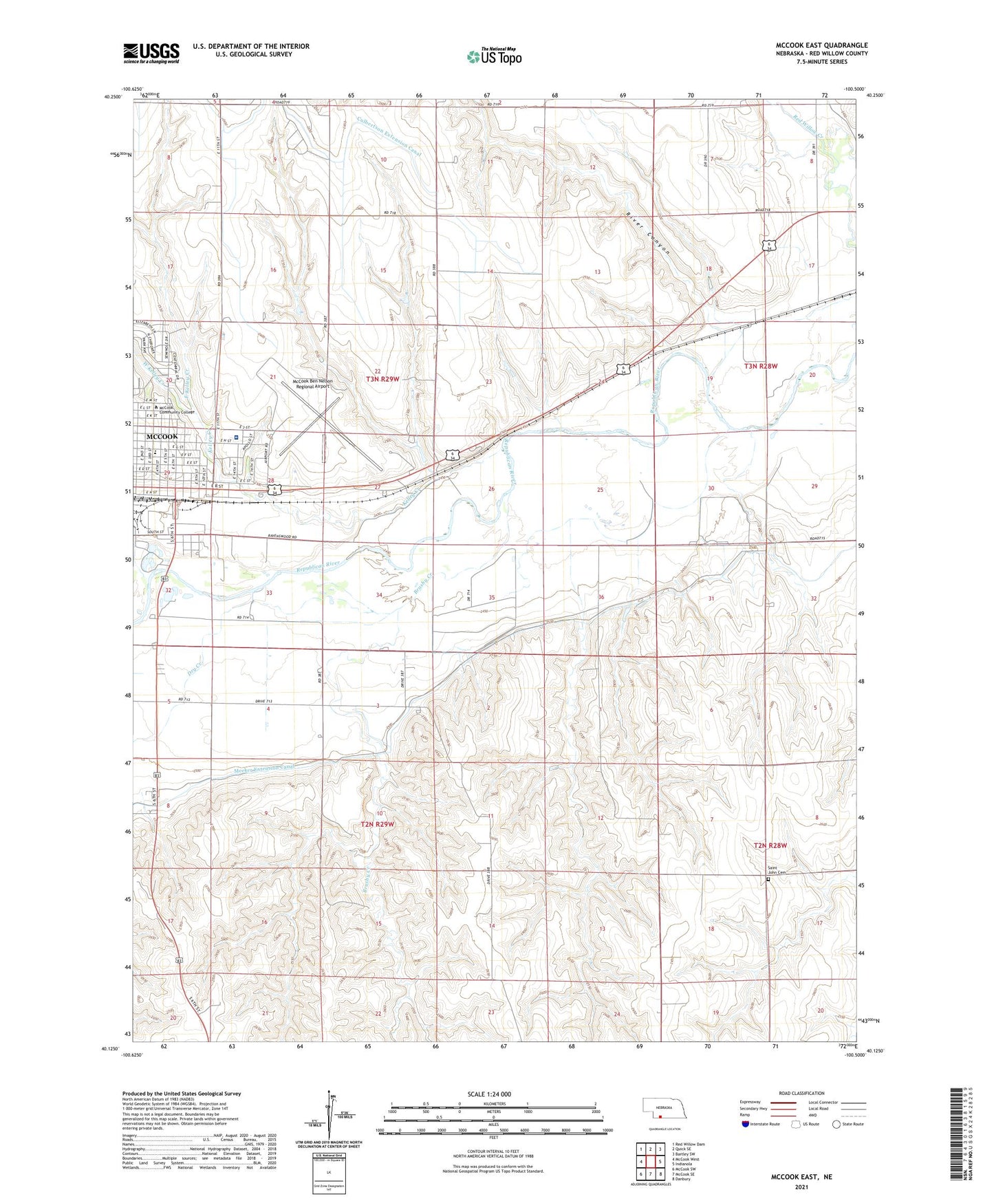
2021 topographic map quadrangle McCook East in the state of Nebraska. Scale: 1:24000. Based on the newly updated USGS 7.5' US Topo map series, this map is in the following counties: Red Willow. The map contains contour data, water features, and other items you are used to seeing on USGS maps, but also has updated roads and other features. This is the next generation of topographic maps. Printed on high-quality waterproof paper with UV fade-resistant inks.
Quads adjacent to this one:
West: McCook West
Northwest: Red Willow Dam
North: Quick SE
Northeast: Bartley SW
East: Indianola
Southeast: Danbury
South: McCook SE
Southwest: McCook SW
Contains the following named places: Assembly of God Church, Barnett Hall, Brooks Hall, Brushy Creek, Burnett Park, Church of Christ, City of McCook, Community Hospital, Dry Creek, East Kelley Creek, East Ward Elementary School, Elks Ball Park, Evangelical Free Church, Felling Field, First Baptist Church, First Congregational Church, Heritage Hills Golf Course, Kelley Creek, Kelley Park, McCook, McCook Beauty Academy, McCook Ben Nelson Regional Airport, McCook Christian Church, McCook Clinic, McCook Community College, McCook Eye Clinic, McMillen Hall, Meeker Extension Canal, Museum DAR, Our Saviors Lutheran Church, Peace Lutheran Church, Republican Valley School, River Canyon, Saint John Cemetery, Saint John Church, Saint Patricks Catholic Church, Saint Patricks Elementary School, School Number 31, The Church of Jesus Christ of Latter Day Saints, Tipton Building, Township of Valley Grange, Township of Willow Grove, True Hall, Valley Baptist Church, Valley Grange Election Precinct, Von Riesen Library, Walsh-Brady Hall, Weiland Field, West Kelley Creek, Wigwam Student Center, Willow Grove Election Precinct, Wrightstone Fine Arts Building