
MyTopo
Stratton Nebraska US Topo Map
Couldn't load pickup availability
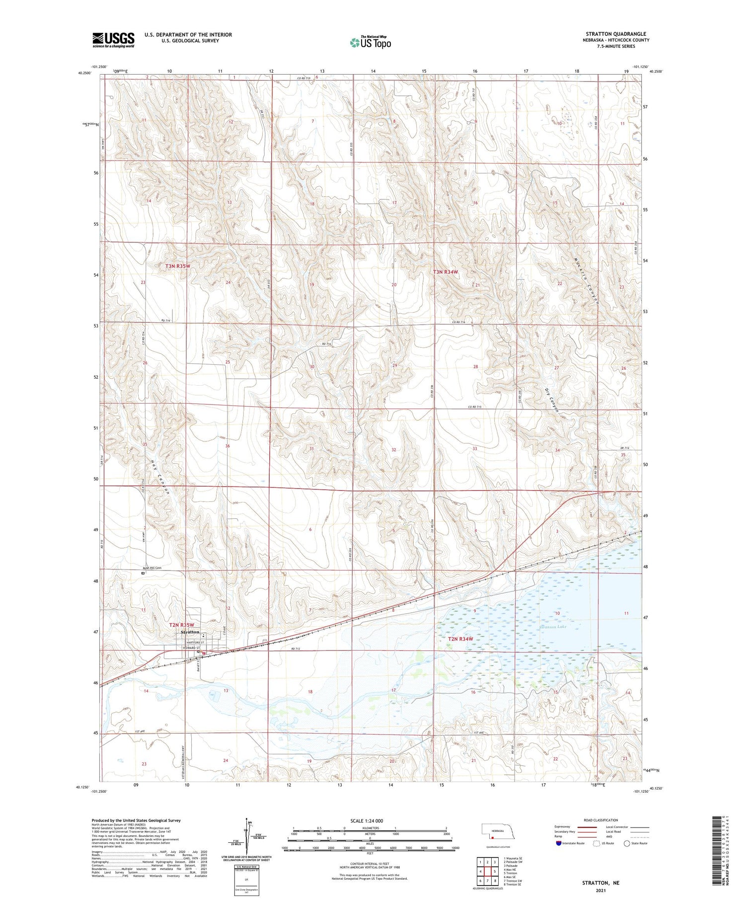
2021 topographic map quadrangle Stratton in the state of Nebraska. Scale: 1:24000. Based on the newly updated USGS 7.5' US Topo map series, this map is in the following counties: Hitchcock. The map contains contour data, water features, and other items you are used to seeing on USGS maps, but also has updated roads and other features. This is the next generation of topographic maps. Printed on high-quality waterproof paper with UV fade-resistant inks.
Quads adjacent to this one:
West: Max NE
Northwest: Wauneta SE
North: Palisade SW
Northeast: Palisade
East: Trenton
Southeast: Trenton SE
South: Trenton SW
Southwest: Max SE
Contains the following named places: Camp Creek, Church of Christ, Diehl Lake, Diehl Lake Dam, Dry Canyon, Farmers Cooperative Grain and Supply Company Elevator, Hay Canyon, Jesch Trailer Park, Leavenworth and Pikes Peak Express Historical Marker, Little House Museum, Muddy Creek, Pitner Park, Pleasant View Election Precinct, Rose Hill Cemetery, Saint Joseph Catholic Church, Starkey Election Precinct, Stratton, Stratton Fire Department, Stratton Medical Clinic, Stratton Post Office, Stratton Public Library, Stratton Public Schools, Township of Pleasant View, Township of Starkey, United Methodist Church, Village of Stratton


