
MyTopo
Trenton Nebraska US Topo Map
Couldn't load pickup availability
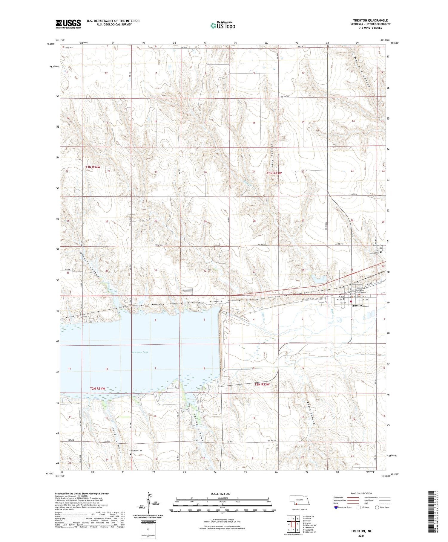
2021 topographic map quadrangle Trenton in the state of Nebraska. Scale: 1:24000. Based on the newly updated USGS 7.5' US Topo map series, this map is in the following counties: Hitchcock. The map contains contour data, water features, and other items you are used to seeing on USGS maps, but also has updated roads and other features. This is the next generation of topographic maps. Printed on high-quality waterproof paper with UV fade-resistant inks.
Quads adjacent to this one:
West: Stratton
Northwest: Palisade SW
North: Palisade
Northeast: Beverly
East: Culbertson NW
Southeast: Culbertson SW
South: Trenton SE
Southwest: Trenton SW
Contains the following named places: Bakers Acres Airport, Black Canyon, Bush Creek, Church of God Indiana, El Dorado Manor, Elm Creek, Farmers Cooperative Grain and Supply Company Elevator, Hidy Canyon, Hitchcock County, Hitchcock County Court House, Hitchcock County Museum, Hitchcock County Sheriff's Office, Jones Canyon, Macklin Bay Campground, Macklin Canyon, Poe, Ridnour Election Precinct, Rosefield Cemetery, Saint James Catholic Church, Saint James Cemetery, Spring Canyon, Spring Canyon Campground, Swanson Lake, Swanson Reservoir State Recreation Area, Township of Ridnour, Trenton, Trenton Cemetery, Trenton City Police, Trenton Dam, Trenton Election Precinct, Trenton Municipal Airport, Trenton Post Office, Trenton Public Library, Trenton Public Schools, Trenton Regional Medical Center, Trenton Rescue Squad, Trenton Volunteer Fire Department, United Church of Christ Congregational, United Methodist Church, Village of Trenton, ZIP Code: 69044


