MyTopo
Wakefield Nebraska US Topo Map
Couldn't load pickup availability
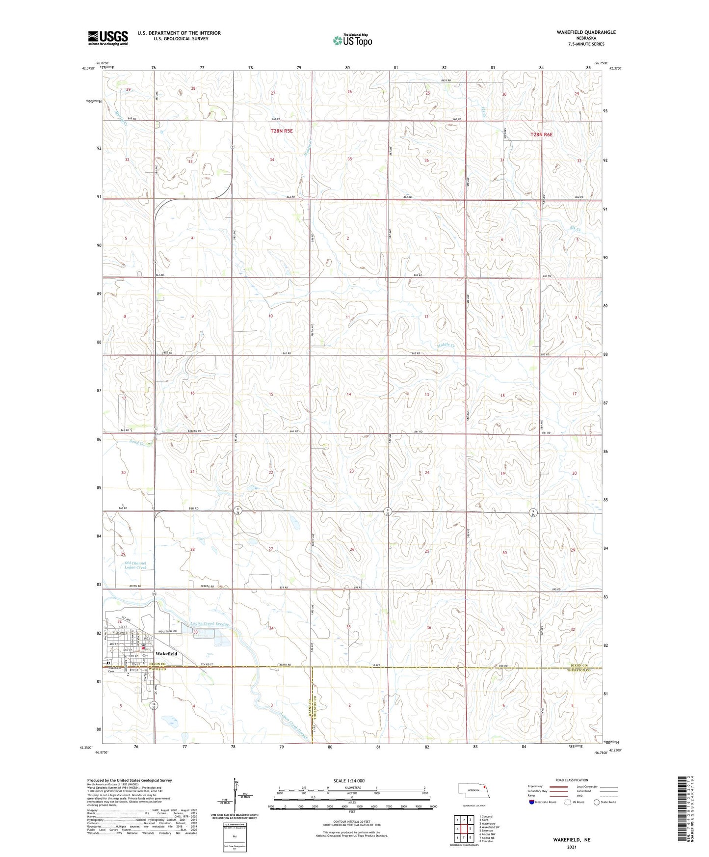
2021 topographic map quadrangle Wakefield in the state of Nebraska. Scale: 1:24000. Based on the newly updated USGS 7.5' US Topo map series, this map is in the following counties: Dixon, Thurston, Wayne. The map contains contour data, water features, and other items you are used to seeing on USGS maps, but also has updated roads and other features. This is the next generation of topographic maps. Printed on high-quality waterproof paper with UV fade-resistant inks.
Quads adjacent to this one:
West: Wakefield SW
Northwest: Concord
North: Allen
Northeast: Waterbury
East: Emerson
Southeast: Thurston
South: Altona NE
Southwest: Altona NW
Contains the following named places: Christian Church, City of Wakefield, Dixon County Sheriff's Office, Eaton Field, Evangelical Covenant Church, Graves Public Library, Logan Valley Golf Course, Northeast Cooperative Elevator, Presbyterian Church, Saint Johns Lutheran Church, Saint Johns Trailer Court, Salem Lutheran Church, South Logan Creek, Township of Emerson, Township of Wakefield, Wakefield, Wakefield Dental Practice Center, Wakefield Health Care Center, Wakefield Medical Clinic, Wakefield Post Office, Wakefield Public Schools, Wakefield Rescue Unit, Wakefield Volunteer Fire Department