
MyTopo
Duffer Peak Nevada US Topo Map
Couldn't load pickup availability
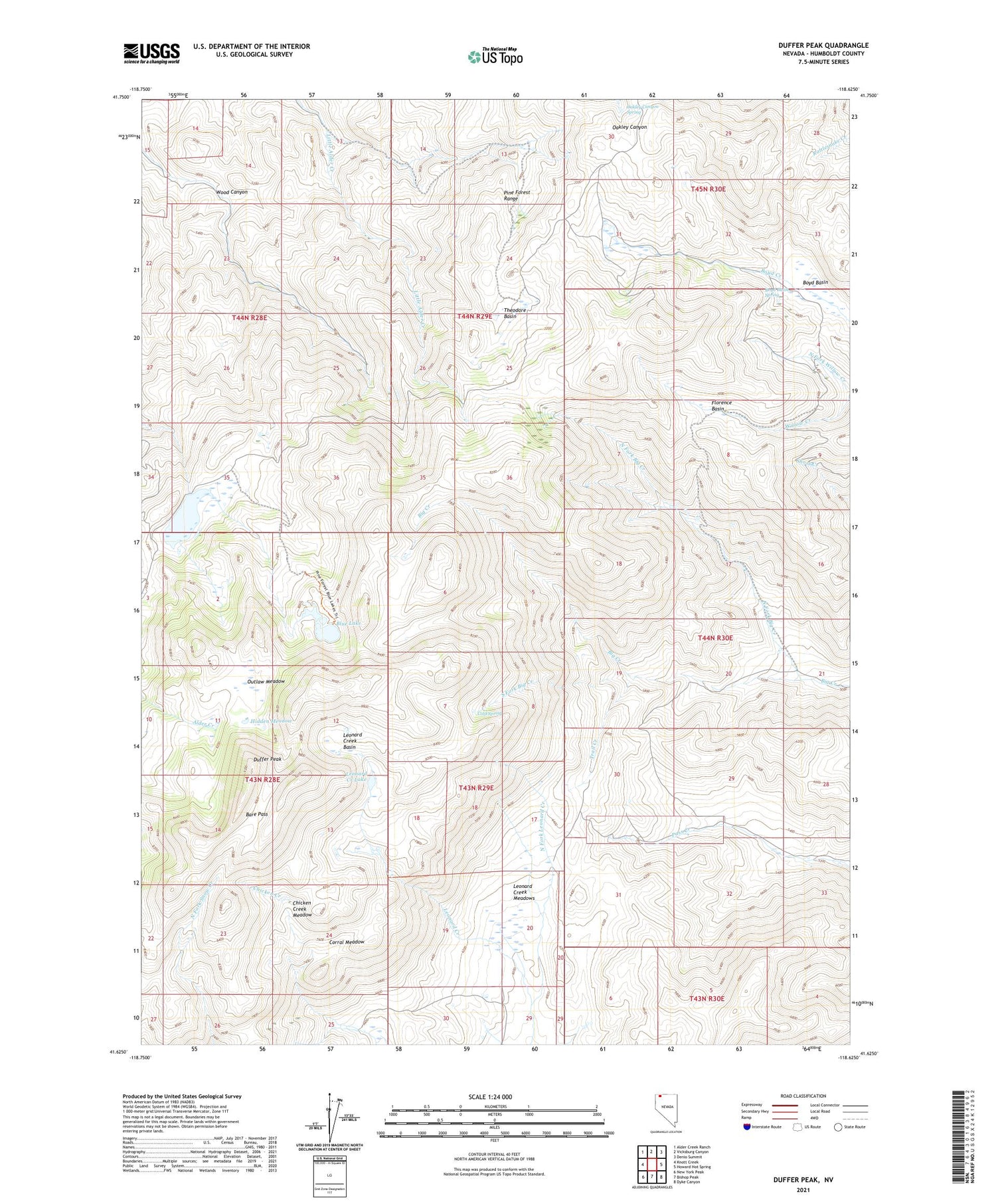
2021 topographic map quadrangle Duffer Peak in the state of Nevada. Scale: 1:24000. Based on the newly updated USGS 7.5' US Topo map series, this map is in the following counties: Humboldt. The map contains contour data, water features, and other items you are used to seeing on USGS maps, but also has updated roads and other features. This is the next generation of topographic maps. Printed on high-quality waterproof paper with UV fade-resistant inks.
Quads adjacent to this one:
West: Knott Creek
Northwest: Alder Creek Ranch
North: Vicksburg Canyon
Northeast: Denio Summit
East: Howard Hot Spring
Southeast: Dyke Canyon
South: Bishop Peak
Southwest: New York Peak
Contains the following named places: Adams Mine, Bare Pass, Blue Lake, Boyd Basin, Boyd Basin Spring, Chicken Creek Meadow, Cold Spring, Corral Meadow, Duffer Peak, Florence Basin, Hidden Meadow, Homer Verne Mine, Leonard Creek Basin, Leonard Creek Lake, Leonard Creek Meadows, North Fork Big Creek, North Fork Leonard Creek, Oakley Canyon Spring, Onion Valley Dam, Onion Valley Reservoir, Outlaw Meadow, Pine Forest Mining District, Pine Forest Range, Pine Forest Range Wilderness, South Fork Big Creek, Theodore Basin, Trail Creek, Wood Camp, Wood Canyon


