MyTopo
Eagle Valley Reservoir Nevada US Topo Map
Couldn't load pickup availability
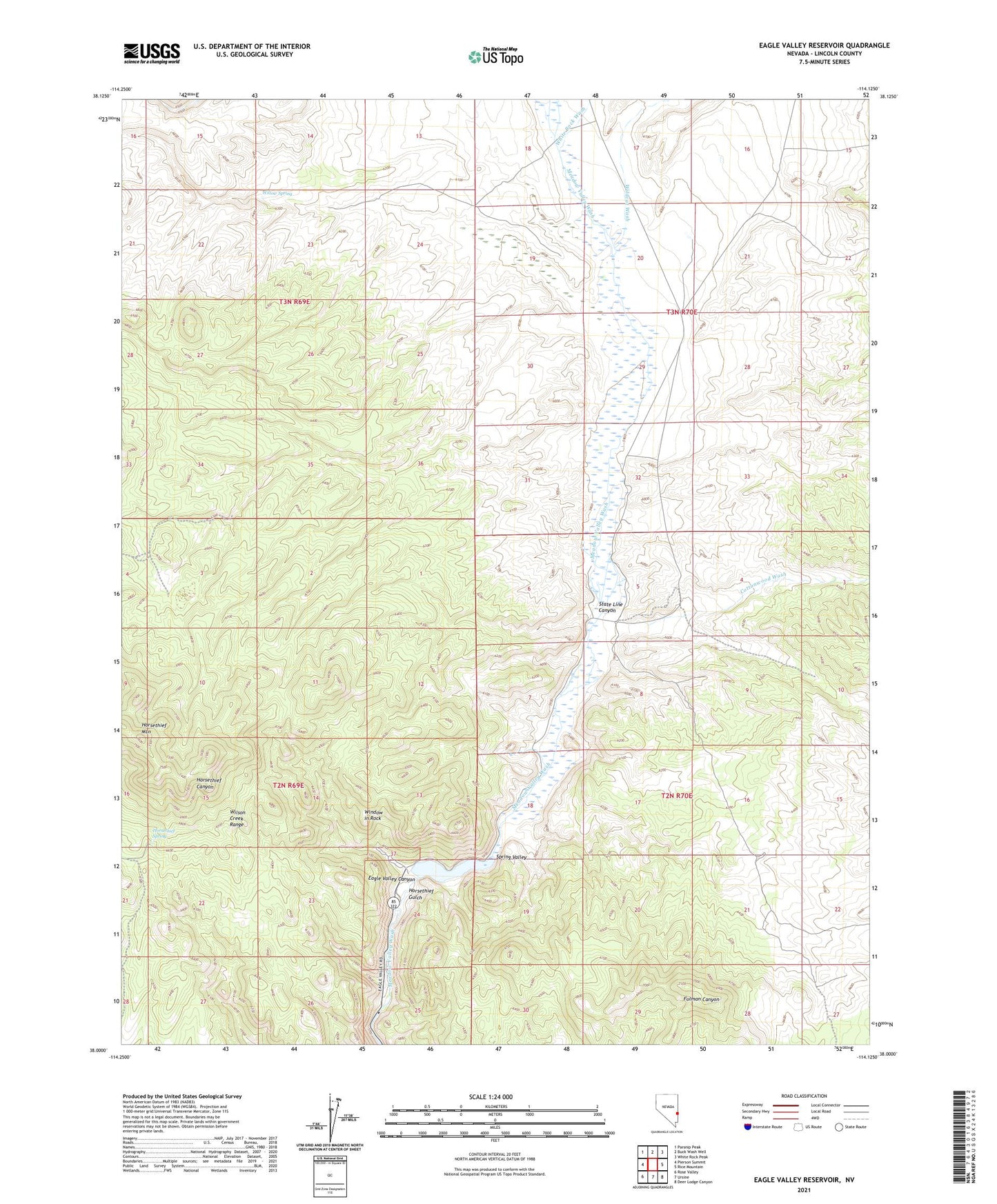
2021 topographic map quadrangle Eagle Valley Reservoir in the state of Nevada. Scale: 1:24000. Based on the newly updated USGS 7.5' US Topo map series, this map is in the following counties: Lincoln. The map contains contour data, water features, and other items you are used to seeing on USGS maps, but also has updated roads and other features. This is the next generation of topographic maps. Printed on high-quality waterproof paper with UV fade-resistant inks.
Quads adjacent to this one:
West: Pierson Summit
Northwest: Parsnip Peak
North: Buck Wash Well
Northeast: White Rock Peak
East: Rice Mountain
Southeast: Deer Lodge Canyon
South: Ursine
Southwest: Rose Valley
Contains the following named places: Cottonwood Wash, Eagle Valley Reservoir, Eagle Valley Reservoir Dam, Eagle Valley Reservoir State Recreation Area, Francis Ranch, Hollinger Debris Dam, Hollinger Debris Reservoir, Horsethief Gulch, Horsethief Mountain, Horsethief Spring, Meadow Valley Recreation Area, Millet Ranch, Newland, Newland Post Office, Rice Ranch, Seven L Ranch, Spring Valley, Spring Valley State Park, State Line Canyon, White Rock Wash, White Rock Well, Wildcat Wash, Willow Spring, Window in Rock